Geomaticians

20

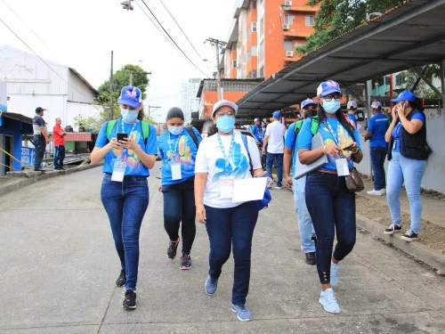
La Cartografía Satelital Georreferenciada Es La Columna Vertebral De Los Censos 2020

La Cartografía Satelital Georreferenciada Es La Columna Vertebral De Los Censos 2020

El departamento de cartografía del INEC levantó un total de 183,487 mapas para estos Censos de Población y Vivienda utilizando tecnología satelital georreferenciada, obtenida a través del Fondo de las Naciones Unidas para las Poblaciones (UNFPA), como base para la validación de elementos naturales (hidrografía, islas, cuerpos de aguas) y culturales (red vial, caminos y ...
ensegundos.com.pa
Te­le­spa­zio Und Dlr-gfr Be­kräf­ti­gen Ihr En­ga­ge­ment Im Ga­li­leo-pro­gramm Durch Ihr Er­folg­rei­ches Joint-ven­ture Spaceo­pal

Te­le­spa­zio Und Dlr-gfr Be­kräf­ti­gen Ihr En­ga­ge­ment Im Ga­li­leo-pro­gramm Durch Ihr Er­folg­rei­ches Joint-ven­ture Spaceo­pal

Telespazio und die DLR Gesellschaft für Raumfahrtanwendungen (DLR-GfR) mbH haben eine Vereinbarung zur Erneuerung ihrer Partnerschaft für Betrieb und Management des Galileo-Satellitensystems unterzeichnet. Die Vereinbarung gilt für kommende Jahre und Satellitengenerationen. spaceopal, ein Gemeinschaftsunternehmen, das zu gleichen Teilen von Telespazio und der DLR-GfR gehalten wird, soll laufende und zukünftige Aufgaben weiterführen. spaceopal ist seit 2016 ...
dlr.de

OGC Calls For Participation In Its Next Pilot To Improve Disaster Management And Response

The Open Geospatial Consortium (OGC) is Calling For Participants in the OGC Disaster Pilot 2023. Funding is available. Responses are due by February 17, 2023. The goal of the Disaster Pilot 2023 is to further improve the ability of key decision makers and responders to discover, manage, access, qualify, share, and exploit location-based information in ...
directionsmag.com

Leica Geosystems Launches New Locator Technology

Leica Geosystems, part of Hexagon, announced its latest solution for utility and excavation professionals. The new Leica DD175 utility locator and Leica DA175 signal transmitter complement the existing Leica DD100 series and help operators easily detect underground utilities to ensure site workers’ safety. Locating the position of underground cables and pipes before excavation is paramount ...
geospatialworld.net

Intermap Announces New Flood Modelling Initiative In Thailand

Intermap Technologies announced the development of a flood modelling initiative and enhanced Digital Elevation Model (DEM) datasets in Thailand. Using a combination of satellite imagery, radar data and ancillary inputs, Intermap will create an extensive, detailed flood map and precision elevation model for the greater Bangkok area. Bangkok itself is sinking due to urban development ...
geospatialworld.net
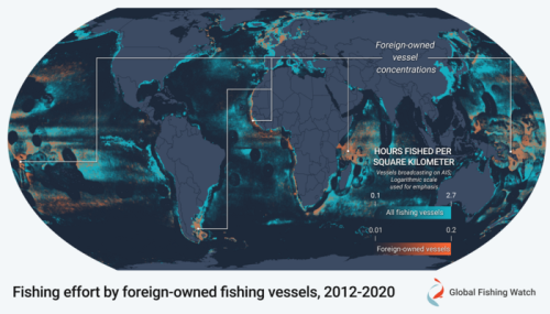
New Research Reveals Shifting Identities Of Global Fishing Fleet To Help Bolster Fisheries Management

New Research Reveals Shifting Identities Of Global Fishing Fleet To Help Bolster Fisheries Management

A new study published today in Science Advances combines a decade’s worth of satellite vessel tracking data with identification information from more than 40 public registries to determine where and when vessels responsible for most of the world’s industrial fishing change their country of registration, a practice known as “reflagging”, and identify hotspots of potential ...
eurekalert.org