Geomaticians

06

Tweets Provide Insights On How Invasive Insects Sprea

Tweets Provide Insights On How Invasive Insects Spread

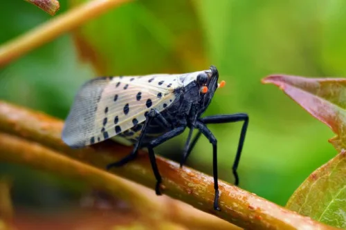
A new study led by North Carolina State University has found that Twitter and online new articles could be used effectively to track the timing and location of invasive insect spread in the United States and globally. These findings suggest that such sources are promising for filling gaps when official data are not widely available. ...
earth.com

Crean Un Mapa Para Que Los Ganaderos Registren Los Ataques De Lobos Al Ganado Sin Censuras Ni Filtros Ecologistas

Los ataques al ganado por parte de depredadores como en lobo son un problema que va en aumento en toda Europa. Hartos de sufrir el hostigamiento de estos animales y la censura de los medios que se niegan a hacerse eco de la problemática, un grupo de ganaderos franceses de la zona de los Vosgos, ...
revistajaraysedal.es
La NASA Se Interesa Por Una App Diseñada En Zaragoza Para Predecir Los Incendio

La NASA Se Interesa Por Una App Diseñada En Zaragoza Para Predecir Los Incendios

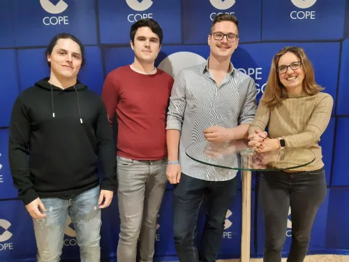
Un simulador de incendios forestales diseñado en Zaragoza por un grupo de jóvenes ingenieros e informáticos, se ha convertido en finalista en un concurso de ideas convocado por la NASA. Con esta aplicación han conseguido ser uno de los 35 equipos de todo el mundo que han llegado a la final del ‘NASA Space Apps ...
cope.es
UV Apoya Al Municipio De Jilotepec Con Estudios Cartográfico

UV Apoya Al Municipio De Jilotepec Con Estudios Cartográficos

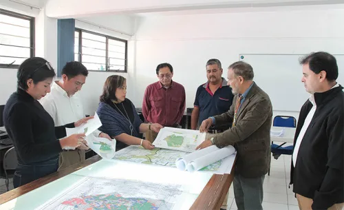
A solicitud de las autoridades del Ayuntamiento de Jilotepec, académicos y estudiantes de la Universidad Veracruzana (UV) desarrollan el proyecto “Estudio cartográfico de Jilotepec”, conformado por un sistema de información geográfica y un atlas municipal, en el que se analiza la principal problemática que lo afecta y se proponen, con base en la sustentabilidad, probables ...
uv.mx
اولین کامیونت هوشمند ایران با شتاب سیستم معرفی شد

اولین کامیونت هوشمند ایران با شتاب سیستم معرفی شد

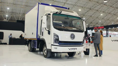
سیستم ioTrailer اولین سیستم هوشمند سازی خودروهای کار و تجاری است که توسط شرکت ” شتاب سیستم ” معرفی شده و امکانات منحصر بفردی را ارائه می دهد. این سیستم میزان وزن بار، کنترل محور عقب، سرویس های دوره ای، مسیریابی و تطبیق هواشناسی، موقعیت یابی جغرافیایی و حصار جغرافیایی، مانیتورینگ دما و رطوبت یخچالی، ...
asbe-bokhar.com

Ouster Launches Digital Lidar Perception Platform Ouster Gemini

Ouster announced the launch of Ouster Gemini, its cloud-backed digital lidar perception platform for crowd analytics, security, and intelligent transportation systems. Ouster Gemini offers the ability to detect, classify, and track moving objects in real-time using the 3D data from a single or multiple fused Ouster lidar sensors. Combined with a custom or third-party analytics ...
geospatialworld.net
Policy To Make Adoption Of Indian Standard Time Mandatory On Anvil: Government Official

The government is planning to come out with a comprehensive policy for mandatory adoption of Indian Standard Time (IST) nationwide, a senior consumer affairs ministry official said. The purpose is to ensure synchronization of all networks and computers to IST and adoption of IST by Telecom Service Providers, Internet Service Providers, power grids, banks, stock ...
outlookindia.com
Owl Autonomous Imaging Launches Monocular 3D Thermal Ranger Computer Vision

Owl Autonomous Imaging Launches Monocular 3D Thermal Ranger Computer Vision

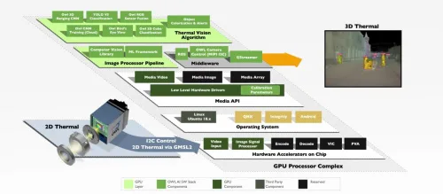
At CES 2023, Owl Autonomous Imaging announced the availability of an Evaluation Kit for their new Thermal Ranger™ ADAS & Autonomous Navigation Development Platform. This hardware and software kit enables Tier 1 and OEM automotive companies to easily evaluate Owl AI’s Thermal Ranger imaging solution for use in their Pedestrian Automatic Emergency Braking (PAEB) and ...
memuk.org

HERE Introduces UniMap To Revolutionize How Maps Are Created, Updated And Used

Digital maps just took a huge leap forward. At CES 2023, HERE Technologies, the world’s leading location platform, unveiled UniMap, a revolutionary, highly automated mapping technology that enables rapid creation of digital maps and location products. HERE has been developing the technology over the last three years in close collaboration with automotive groups including BMW ...
directionsmag.com
Scientists Use AI To Learn Extent Of Seagrass Scarring

Scientists Use AI To Learn Extent Of Seagrass Scarring

Scientists from the University of Florida, Auburn University and the Tampa Bay Estuary Program are using artificial intelligence technology to identify damaged seagrass beds in Tampa Bay — and so far, they’ve found almost 24,000 scars. “Seagrass is a critical habitat in Tampa Bay and is considered an indicator of a healthy estuary. It stabilizes ...
naples.floridaweekly.com
How Climate Change Is Impacting Galleries, Libraries, Archives And Museums

How Climate Change Is Impacting Galleries, Libraries, Archives And Museums

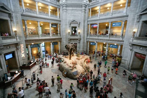
To further understand the impact of climate change on these cultural and information repositories, the Institute of Museum and Library Services based in Washington, D.C. has awarded a grant to LSU School of Library & Information Science Associate Professor Edward Benoit III and LSU Department of Geography & Anthropology Associate Professor Jill Trepanier with collaborator ...
lsu.edu