Geomaticians

03

إعادة تأهيل المراعي الطبيعية المتدهورة باستخدام طائرات الدرونز

وقع المركز الوطني لتنمية الغطاء النباتي ومكافحة التصحر، عقدا مع تحالف المكتب الإقليمي للاتحاد العالمي لحماية الطبيعة في الشرق الأوسط وشمال آسيا (IUCN) وشركة تلاد البيئة التجارية؛ لتنفيذ مشروعي دراسة مواقع إعادة تأهيل المراعي المتدهورة، وتحديد الحمولة الرعوية في عدد من المناطق المستهدفة. وأوضح المركز أن المشروع الأول يستهدف دراسة مواقع تنفيذ مشاريع إعادة تأهيل ...
ajil.news
Ecologistas En Acción De La Rioja Confecciona Un Mapa Topográfico Educativo Sobre Los Hábitats Naturales De Calahorra

Ecologistas En Acción De La Rioja Confecciona Un Mapa Topográfico Educativo Sobre Los Hábitats Naturales De Calahorra

Ecologistas en acción de La Rioja, ha presentado al Ayuntamiento de Calahorra un nuevo mapa sobre hábitats naturales del término municipal , un trabajo que bajo la dirección del biólogo Gabriel Furgiuele, se ha venido realizando en los últimos meses por el colectivo ambientalista , delimitando todos los hábitats naturales que se dan cita en ...
europapress.es
All Roads In Telangana To Be Mapped By Remote Sensing

All Roads In Telangana To Be Mapped By Remote Sensing

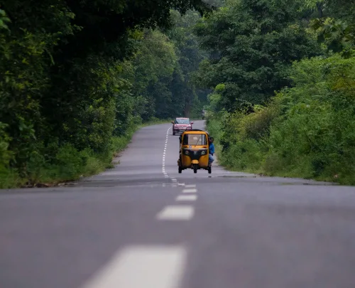
All roads in Telangana would be mapped with the help of satellite remote sensing systems to help in better planning and maintenance, Vice-Chairman of the State Planning Board B. Vinod Kumar said on Monday. The mapping would include length of the roads, width of roads at different locations, their conditions, existing culverts and bridges. The ...
thehindu.com

Mexico Seeks India’s Support In Building And Launching Remote Sensing Satellite

The chief of the Mexican space agency has sought the support of India in building and launching a remote sensing satellite. The Indian Space Research Organisation (ISRO) will work on this proposal with the support of India’s External Affairs Ministry. This request from Mexico is part of the ongoing cooperation activities between India and Mexico ...
wionews.com
Satellite Imagery Could Improve Fossil-hunting At Remote Sites

Satellite Imagery Could Improve Fossil-hunting At Remote Sites

Satellite imagery could help paleontologists spot promising fossil sites before trekking into remote places. New research from the lab of UO paleontologist Edward Davis in the Department of Earth Sciences shows that satellite data can reveal large individual fossils from the air, allowing field researchers to embark on more targeted searches on the ground. Their ...
around.uoregon.edu