Geomaticians

February

Geospatial Intelligence In Disaster Response The Turkey-Syria Earthquakes

Geospatial Intelligence In Disaster Response: The Turkey-Syria Earthquakes

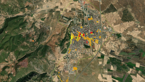
European Space Imaging has acquired high-resolution satellite imagery of affected areas in Turkey using GeoEye-1, including Islahiye, Nurdağı and Bahçe. The images reveal damaged residential areas, temporary tents set up on soccer fields, and heavy congestion on roads and highways, many of which have been closed due to earthquake damage. The United Nations Satellite Centre ...
gim-international.com

Ogólnopolska Konferencja Kartograficzna Uczci Jubileusz Polskiego Przeglądu Kartograficznego

Metody kartograficzne i geomatyczne w badaniach interdyscyplinarnych – pod takim hasłem odbędzie się tegoroczna XLV Ogólnopolska Konferencja Kartograficzna. Będzie to kolejna odsłona dorocznych spotkań środowiska kartografów i sympatyków map, które są organizowane od 1968 roku. Tym razem organizatorzy chcą skupić uwagę na związkach kartografii i geomatyki z innymi dziedzinami nauki. Problematyka konferencji ma obejmować takie ...
geoforum.pl

Neara Announces Revolutionary Automated Lidar Classification

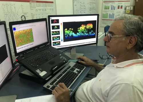
Neara, a leading climate tech software platform and provider of 3D interactive simulation models of critical infrastructure, today announced its revolutionary automated LiDAR (Light Detection & Ranging) classification solution will be available through a new self-service offering. Utility companies, and geospatial teams that capture and classify LiDAR for utilities, will now have easy access to ...
geospatialworld.net

Government Of Canada Launches Interactive Mapping Tool

The Honourable Joyce Murray, Minister of Fisheries, Oceans and the Canadian Coast Guard launched the new Canada Marine Planning Atlas (the Atlas). The Atlas is an interactive mapping tool that allows users to view and interact with data relevant to marine spatial planning. It includes data on economic, ecological and sociocultural activities that sometimes overlap ...
geospatialworld.net
Researchers Unveil Soybean Nutrients Distribution Map In China

Researchers Unveil Soybean Nutrients Distribution Map In China

Researchers from the Chinese Academy of Agricultural Sciences (CAAS) recently mapped the geographic distribution of soybean nutritional compositions in China. Researchers believe that the study, which was published in the journal Food Research International, provides scientific evidence for guiding the construction of high-quality soybean production bases in China. To clarify the spatial patterns of soybean ...
english.news.cn
Godoy Cruz Creó Un Sistema Que Ayuda A Elegir Los Mejores Recorridos Para Trasladarse Caminando

Godoy Cruz Creó Un Sistema Que Ayuda A Elegir Los Mejores Recorridos Para Trasladarse Caminando

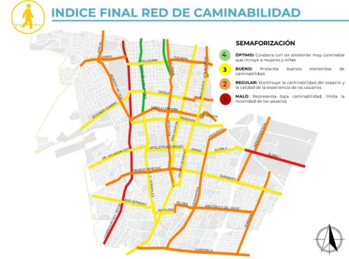
Durante un año y medio de trabajo, desarrollado junto a la Facultad de Ingeniería de la Uncuyo, se analizó y diagnosticó la situación de caminabilidad. Esto es, cuánto se demora una persona en llegar a sus actividades de forma peatonal. Y qué tan amigable es una zona. Para el desarrollo de dicho indicador, se tuvieron ...
losandes.com.ar

OGC To Form GeoDcat Standards Working Group; Public Comment Sought On Draft Charter

The Open Geospatial Consortium (OGC) is in the process of forming a new GeoDCAT Standards Working Group (SWG). Public comment is sought on its draft charter. Comments are due by February 22, 2023. The purpose of the SWG is to revise, publish, and maintain GeoDCAT – a spatio-temporal profile of the W3C DCAT Recommendation – ...
directionsmag.com

IBM, NASA Collaborate For Climate Change Research

IBM and NASA are collaborating for initiating improved climate change research. It was announced on February 1, that IBM is going to work together with NASA’s Marshall Space Flight Center to use artificial intelligence for climate change research in an effort to greatly improve research analysis of these large datasets. The aim is to make ...
geospatialworld.net
New Satellite-based Augmentation System For Australia And New Zealand

New Satellite-based Augmentation System For Australia And New Zealand

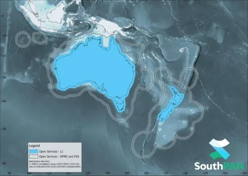
AMSA informed that vessels navigating in Australian and New Zealand waters can now access a Satellite-Based Augmentation System (SBAS) called SouthPAN. SouthPAN provides accurate, reliable and instant augmentation of PNT information across all of Australia and New Zealand. For example, the horizontal accuracy provided is several times better than the current unaugmented GNSS accuracy of ...
safety4sea.com

Esri Signs Space Act Agreement With NASA

The agreement focuses on extending access to the broader global community of NASA’s geospatial content for continued research and exploration—including new datasets from nearly 100 spaceborne sensors, measuring atmospheric health, land-based phenomena, and characteristics of the oceans. Partner efforts under this agreement will add to the existing NASA data in ArcGIS Living Atlas of the ...
geospatialworld.net

دومین نمایشگاه بین‌المللی ایران ژئو افتتاح و از 4 محصول دانش‌بنیان حوزه ژئوماتیک رونمایی شد

این نمایشگاه محلی برای حضور همه بازیگران این عرصه اعم از دستگاه‌های تولیدکننده اطلاعات مکانی، سازمان‌های بهره‌بردار، شرکت‌های خصوصی و دانش‌بنیان‌ها و دانشگاه‌ها است تا با ارائه توانمندی‌های خود و شبکه‌سازی ظرفیت‌های موجود؛ به نیازهای فناورانه کشور در این حوزه پاسخ دهند. نمایشگاه از از 9 تا 12 بهمن‌ماه 1401 میزبان علاقه‌مندان و فعالان حوزه ...
isti.ir

Transición Ecológica Incluye En Grafcan Nuevos Modelos Digitales Para Ortofotos

La Consejería de Transición Ecológica, Lucha contra el Cambio Climático y Planificación Territorial del Gobierno de Canarias, a través de la empresa pública Cartográfica de Canarias (Grafcan), ha incorporado nuevos servicios en el visor de Infraestructura de Datos Espaciales de Canarias (IDECanarias). Estas novedades tienen que ver con la incorporación de nuevos modelos digitales que ...
gobiernodecanarias.org
Modelo Digital É Utilizado Em 100% Dos Planos De Manejo Florestal No Acre

Modelo Digital É Utilizado Em 100% Dos Planos De Manejo Florestal No Acre

O Modelo Digital de Exploração Florestal (Modeflora), tecnologia lançada pela Embrapa Acre, completa 15 anos, com adoção em 100% dos planos de manejo do estado do Acre. A ferramenta confere maior eficiência ao planejamento e execução das operações de campo, proporciona economia no processo de produção e permite o monitoramento das etapas de manejo, além ...
mundogeo.com
Xfarm Technologies And FieldView Partner To Help Farmers Make Better Use Of Farm Data

Xfarm Technologies And FieldView Partner To Help Farmers Make Better Use Of Farm Data

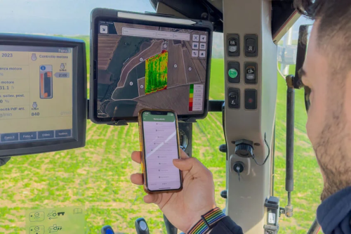
FieldView and xFarm Technologies announced a new partnership to connect their respective platforms. The goal of this partnership is to enable an easy data exchange for farmers and help to consolidate and simplify farming operations. The partnership focuses on connecting the two platforms allowing users to share farm data between their FieldView and xFarm accounts ...
futurefarming.com

Government To Present Application To Help Farmers Protect Crops Against Freezing Conditions

A new application developed by the rural development and foods ministry to give farmers early warning of oncoming frost is to be unveiled next week. Its aim is to restrict crop losses due to frost each year, as well as the amounts paid in compensation, which have reached an estimated 1.25 billion euros in the ...
hellenicnews.com
Indonesia Opens Its ‘Ocean Account’ For Sustainable Marine Management

Indonesia Opens Its ‘Ocean Account’ For Sustainable Marine Management

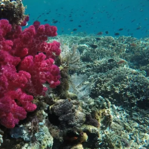
The Indonesian government is designing a new scheme to measure the long-term benefits provided by the country’s marine and coastal ecosystems. The ocean accounting system will serve as the standard indicator for the government in policymaking and zoning regarding Indonesia’s fisheries, conservation areas, and marine essential ecosystems. “We’ve been working on the ocean account with ...
news.mongabay.com
New Tool Reveals Best Places For Clean Energy Developments In The US

New Tool Reveals Best Places For Clean Energy Developments In The US

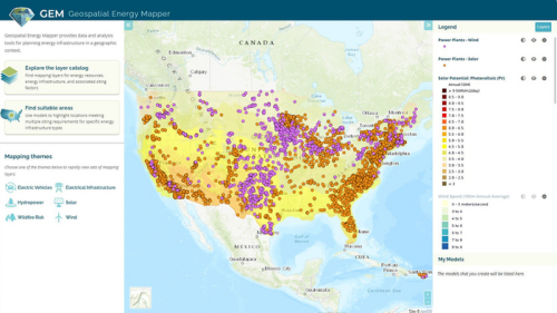
Researchers at the Argonne National Laboratory have developed an interactive online mapping tool that can help identify areas across the United States that are suitable for wind, solar, and other clean energy infrastructure projects. First publicly launched in 2013 as the Energy Zones Mapping Tool (EZMT), the solution has been redesigned, rebranded as Geospatial Energy ...
mining.com
DARPA Wants To Push The Boundaries Of Where Satellites Can Fly

DARPA Wants To Push The Boundaries Of Where Satellites Can Fly

DARPA defined Very Low Earth Orbit (VLEO) as orbits less than 450 km, or roughly 280 miles, in altitude. Low Earth Orbit, by contrast, is 2,000 km or 1,200 miles. The benefits of being in Very Low Earth Orbit include, according to DARPA, “improved spatial resolution for optical imaging, higher signal-to-noise ratios for radar and ...
popsci.com