Geomaticians

16

Rencontre Aérospatiale Au Sommet À Casablanca

Rencontre Aérospatiale Au Sommet À Casablanca

La première édition de l’Aerospace African Forum s’est ouvert ce matin à Casablanca, la capitale économique du Maroc et la plus grande ville du Maghreb. L’événement est organisé comme une plateforme continentale de réflexion sur le thème de la mobilité durable, est organisé par l’Africa Air Forum et le Gimas (Groupement des industries marocaines aéronautiques ...
air-cosmos.com

GPS 신호 안 닿는 실내서도 5m 오차 수준 위치 확인

국토부가 GPS가 단절된 실내에서도 활용할 수 있는 위치정보 기술을 개발했다. 오차는 5m 내외로 별도 장치나 애플리케이션 없이 스마트폰만으로 실내 경로와 피난 안내, 응급상황 신고 등 위치정보 서비스를 받아 볼 수 있다. 국토교통부 국토지리정보원은 15일 서울 상암동 스마트시티센터에서 GPS(위성항법시스템) 신호가 단절된 실내에서도 5m 오차로 위치를 결정하는 실내 위치결정 기술(측위기술)을 시연했다고 밝혔다.
shinailbo.co.kr

La Teledetección Con Drones En La Gestión Del Olivar, Un Avance En La Digitalización Del Cultivo

La digitalización de la olivicultura permitiría hacer frente a los desafíos a los que se enfrenta el sector, como una mayor producción, calidad y trazabilidad haciendo un uso sostenible de los recursos. En los procesos de digitalización se necesitan grandes cantidades de datos, siendo la teledetección con drones una herramienta ideal para recolectarlos. El uso ...
interempresas.net
TuneIn's Explorer Feature Puts The World's Radio Stations On An Interactive Map

TuneIn’s Explorer Feature Puts The World’s Radio Stations On An Interactive Map

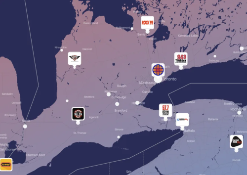
TuneIn is adding a new way for users to discover the more than 100,000 radio stations available to stream on its service. This week, the company – in honor of World Radio Day, which fell on February 13th – began rolling out TuneIn Explorer (via Android Police). The feature plots everything TuneIn offers on an ...
engadget.com
EPA Creates Water Quality Map Of Farm-related Pressure Areas

EPA Creates Water Quality Map Of Farm-related Pressure Areas

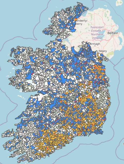
The Environmental Protection Agency (EPA) has developed a map which highlights how water quality is affected by farming activity in different areas of the country. The map, which was published this month, is divided into sub-basins, which are colour-coded to highlight different issues related to farming activity. A single sub-basin may be colour-coded with different ...
agriland.ie
New Technique Maps Large-scale Impacts Of Fire-induced Permafrost Thaw In Alaska

New Technique Maps Large-scale Impacts Of Fire-induced Permafrost Thaw In Alaska

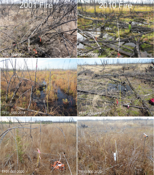
Researchers from Florida Atlantic University, in collaboration with the United States Army Corps of Engineers Cold Regions Research & Engineering Laboratory, and Alaska Ecoscience, systematically analyzed the effects of six large fires that have occurred since 2000 on the Tanana Flats lowland in interior Alaska on land cover change, vegetation dynamics, and terrain subsidence, or ...
eurekalert.org
Researchers Illuminate Gaps In Public Transportation Access, Equity

Researchers Illuminate Gaps In Public Transportation Access, Equity

Public transit systems offering broad coverage of stops and routes may still underserve the communities that rely on them the most, according to a new University of Illinois Urbana-Champaign study. The study applies contextual engineering to help determine lapses in equity in public bus transportation access using data from the Champaign-Urbana Mass Transit District as ...
news.illinois.edu
China To Employ Beidou Satellite-based Augmentation System In Railway Survey

China To Employ Beidou Satellite-based Augmentation System In Railway Survey

China will employ BeiDou satellite-based augmentation system (BDSBAS) to provide high-precision positioning service in railway survey and construction, according to the China Railway Siyuan Survey and Design Group Co., Ltd. Four satellite-based and 12 ground-based observation stations will be set up along the Wufeng-Enshi railway section in central China’s Hubei Province. This is the first ...
english.news.cn
Scientists Want Help Finding These ‘Jesus’ Lizards

Scientists Want Help Finding These ‘Jesus’ Lizards

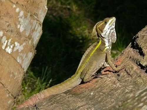
Wildlife specialists with the UF Institute of Food and Agricultural Sciences (UF/IFAS) depend on geographic information to determine this lizard’s potential impacts on the environment, wildlife, and human health. They need more information to stay ahead. “We receive anecdotal reports of brown basilisks in areas where the reported sightings are thin and sporadic, but we ...
futurity.org
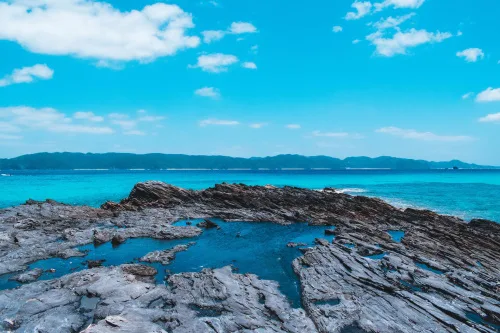
Japan Has More Than 14,000 Islands, Digital Mapping Reveals

Japan Has More Than 14,000 Islands, Digital Mapping Reveals

Thanks to digital mapping technology, Japanese geographers have identified more than 7,000 islands previously unrecognized in the country’s waters. The first such survey in 35 years revealed that the nation is made up of 14,125 islands rather than 6,852, as previously thought, according to a source familiar with the matter. The Geospatial Information Authority of ...
asahi.com