Geomaticians

09

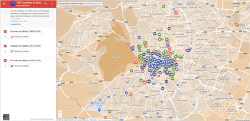
Un Mapa Virtual Con Postales Históricas Geolocalizadas Permite Ver La Evolución De La Ciudad De Madrid

Un Mapa Virtual Con Postales Históricas Geolocalizadas Permite Ver La Evolución De La Ciudad De Madrid

La Biblioteca Digital ‘memoriademadrid’ ha publicado un mapa virtual en el que se pueden visualizar 1.087 tarjetas postales históricas de Madrid, geolocalizadas y referenciadas, procedentes de la colección del Museo de Historia y de las aportadas por la ciudadanía en el marco del proyecto Memoria de los Barrios. Esta herramienta permite observar la evolución de ...
esmartcity.es

Progetto C-farms: Parte La Fase Di Test Delle Pratiche Di Carbon Farming Nelle Aziende

Il progetto europeo Life C-FARMs è giunto alla fase di sperimentazione nelle aziende. Obiettivi di questo programma europeo, di cui Confagricoltura è partner, sono la realizzazione del Sistema Informativo Geospaziale Dimostrativo ad alta risoluzione (GIS-FARMs), che farà identificare il potenziale di mitigazione del settore agricolo della Regione selezionata, la Lombardia; lo sviluppo di un quadro ...
confagricoltura.it
Mit Satelliten-daten Maßnahmen Gegen Waldschäden Planen

Mit Satelliten-daten Maßnahmen Gegen Waldschäden Planen

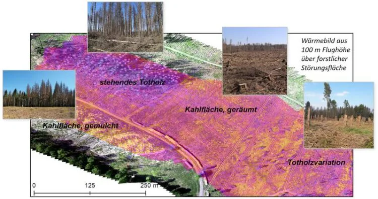
Ein Forschungsteam am Geographischen Institut der Universität Göttingen ist mit dem Teilprojekt „Fernerkundung“ an dem Verbundvorhaben „ResEt-Fi – Wegbereiter Wiederbewaldung: Regionales Flächenmanagement“ beteiligt. Dieser Verbund will Werkzeuge und Konzepte entwickeln, um die Planung und Umsetzung der Wiederbewaldung zu unterstützen. In dem Göttinger Teilprojekt werden in den kommenden drei Jahren Datensätze zur Beschreibung des Mikroklimas und ...
innovations-report.de

Cerca De 28% Das Pistas De Pouso Na Amazônia Está Em Área Protegida

Um levantamento inédito do MapBiomas identificou 2.869 pistas de pouso na Amazônia, segundo a entidade, mais do que o dobro das pistas contidas nos registros da Agência Nacional de Aviação Civil (Anac). Pelas coordenadas geográficas, 804 pistas de pouso, ou 28% do total, estão dentro de alguma área protegida: 320 (11%) ficam no interior de ...
nativanews.com.br
İhtiyaç Haritası'nın Afet Koordinasyon Platformu Afet Haritası

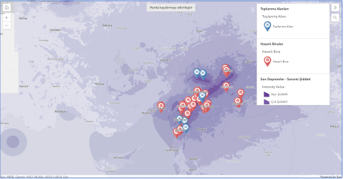
İhtiyaç Haritası’nın Afet Koordinasyon Platformu: Afet Haritası

Afet Haritası, destek ve kurtarma çalışmaları için yerel yetkililer, STK’lar, şirketler ve gönüllüler gibi çeşitli aktörler arasında etkili iletişim ve koordinasyon sorunlarını çözmeye odaklanıyor. Destek sağlayan tüm aktörleri gerçek zamanlı olarak takip edebilen Afet Haritası, aynı zamanda Türkiye’nin afet bölgelerindeki ihtiyaçları belirlemek ve tedarik etmek için kullanıcıları hızlı bir şekilde harekete geçiriyor. Kısacası Afet Haritası, ...
webrazzi.com
Alphartk Announces Free Educational RTK Access

Alphartk Announces Free Educational RTK Access

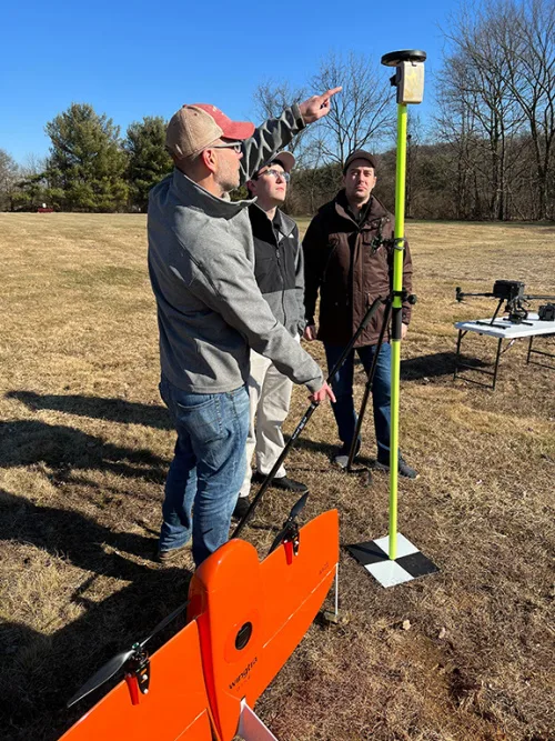
AlphaRTK, a real-time kinematic (RTK) service provider, announced today it will provide students and faculty of Rutgers University, West Chester University, and Warren County Community College free access to its global navigation satellite system (GNSS) correction network. AlphaRTK is the most affordable, privately held, RTK subscription network to fully support four-constellation GNSS corrections. The service ...
geospatialworld.net
Google Maps Delivers Stunning And Immersive Experience With Its Latest Update

Over the past year, Google Maps has really evolved, offering impressive features, that provide more immersive experiences. Now the firm is taking things to another level, leveraging AI and computer vision to take you places that you never thought possible within Google Maps. While you could previously take an aerial tour of locations, you’ll now ...
xda-developers.com

IITTNIF And AGI Sign MoU For Geospatial Advocacy, Innovation, And Research

India’s Geospatial industry body – the Association of Geospatial Industries (AGI), and the Indian Institute of Technology (IIT) Tirupati’s technology innovation hub – the Navavishkar I-Hub Foundation – have signed a Memorandums of Understanding for collectively elevating the adoption of Geospatial technologies and applications in the country. Under their MoU for innovation-centric cooperation, AGI and ...
geospatialworld.net

Revisions To The ASPRS Positional Accuracy Standards For Geospatial Data (2014) Seeking Public Comments

The American Society of Photogrammetry and Remote Sensing is revising the ASPRS Positional Accuracy Standards for Digital Geospatial Data for publication as a 2nd Edition and we are seeking public opinion on the proposed changes. Revising the standard is an important and necessary process, as technologies and practices are evolving. The updating of these standards ...
directionsmag.com
Open Data Challenge Hackathon Supports Implementation Of Geodata In Central Asia

Open Data Challenge Hackathon Supports Implementation Of Geodata In Central Asia

During the Open Data Challenge hackathon held in Tashkent, the capital of Uzbekistan, more than 200 students, divided into 50 teams, spent three days using geodata to tackle the country’s most relevant issues. The event was organized from 27-29 January 2023 by Uzbekistan IT-Park, Akfa University, the Organization for Security and Co-operation in Europe, the ...
gim-international.com
Geospatial Intelligence In Disaster Response The Turkey-Syria Earthquakes

Geospatial Intelligence In Disaster Response: The Turkey-Syria Earthquakes

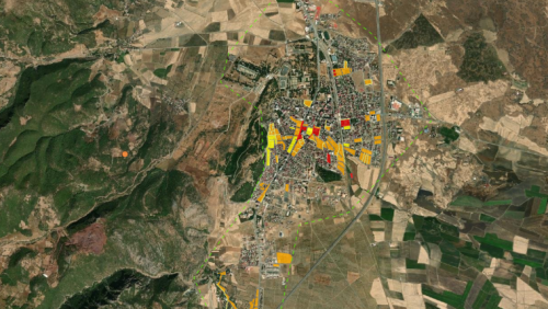
European Space Imaging has acquired high-resolution satellite imagery of affected areas in Turkey using GeoEye-1, including Islahiye, Nurdağı and Bahçe. The images reveal damaged residential areas, temporary tents set up on soccer fields, and heavy congestion on roads and highways, many of which have been closed due to earthquake damage. The United Nations Satellite Centre ...
gim-international.com