Geomaticians

22

Esri Releases 2023 Update Of Ready-To-Use US Census Bureau Data For ArcGIS Users

The United States Census Bureau recently released its annual update to its American Community Survey (ACS) data. Many federal agencies are required to use this ACS data, and many non-profits rely on it when applying for grants for their operations and decision-making. To help meet this need, Esri, the global leader in location intelligence, has ...
businesswire.com

Portal To Map Health Facilities Launched

The Department of Health Services (DoHS), on Wednesday launched the Geo Web Portal for Health Centres. Dr. HC Lyndem, the Director of DHS(MI), inaugurated the portal at the DHS headquarters in Shillong. The portal provides rich information through space technology mapping. It plays a crucial role in assessing existing health resources by considering factors such ...
themeghalayan.com
La Xunta Participa En Un Proyecto Europeo Para La Alerta Temprana De Incendios Forestales Mediante La Gestión De Datos Vía Satélite Por Inteligencia Artificial

La Xunta Participa En Un Proyecto Europeo Para La Alerta Temprana De Incendios Forestales Mediante La Gestión De Datos Vía Satélite Por Inteligencia Artificial

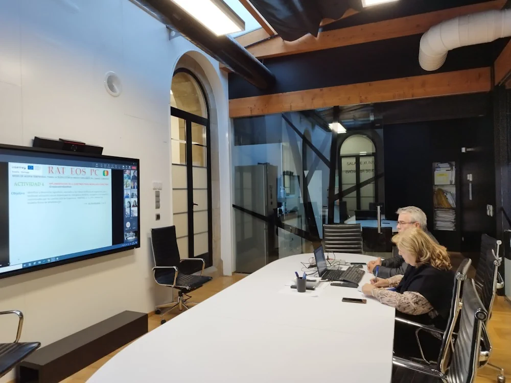
La Xunta, a través de la Dirección General de Defensa del Monte de la Consellería de Medio Rural, participa en un proyecto europeo Interreg centrado en la gestión conjunta de servicios relacionados con las nuevas tecnologías para la prevención, preparación y respuesta frente catástrofes naturales e incendios forestales. El proyecto, que se financia en un ...
xunta.gal
Advocates Hope To Use Map, Grant To Reduce Conflict Over Solar, Wind Siting

Advocates Hope To Use Map, Grant To Reduce Conflict Over Solar, Wind Siting

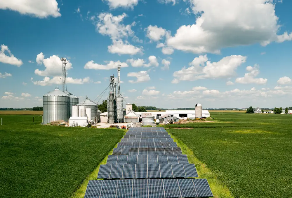
As Indiana prepares to bring thousands of megawatts of utility-scale wind and solar energy online, environmentalists and educators hope to use new tools — mapping and grant-boosted education — to manage strife over where future projects go. “There is this (not-in-my-backyard)-ism out there. But it’s not necessarily because of wind and solar energy; it’s because ...
indianacapitalchronicle.com
Computer Vision And Neural Networks To Help Detect Crop Diseases

Computer Vision And Neural Networks To Help Detect Crop Diseases

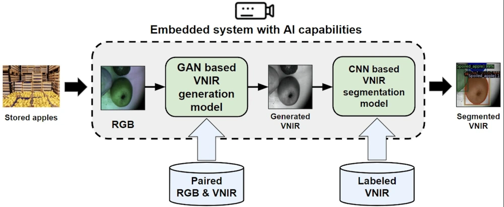
A research team from Skoltech and Saint-Petersburg State University of Aerospace Instrumentation have presented a paper in which they pioneered an alternative method for detecting decayed and moldy apples at the post-harvest stage, when fruits are stored and then delivered to the customer. A computer vision system will determine different defects at the early stage, ...
phys.org
Ecopia AI Maps Toronto, But The City Won’t Comment On Its AV Readiness

Ecopia AI Maps Toronto, But The City Won’t Comment On Its AV Readiness

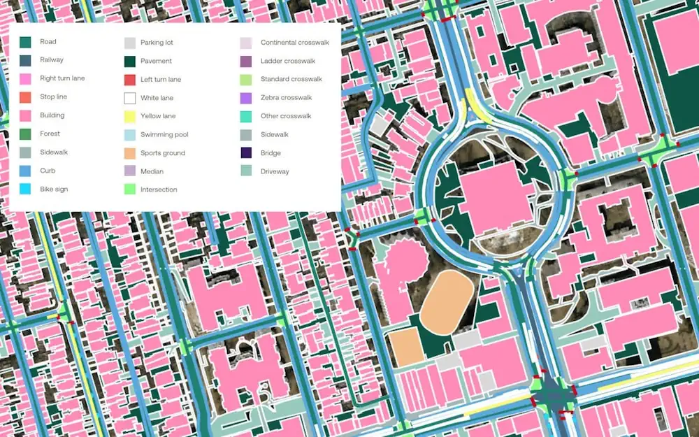
Two years ago, Ecopia received almost $1 million from the Ontario Vehicle Innovation Network (OVIN) to fund this map’s development. The work was done using artificial intelligence technology to plot crucial information about Toronto’s land cover and transportation features. The data is essential to supporting safe and effective AV transportation and navigation. Ecopia also invested ...
electricautonomy.ca