Geomaticians

21

Launch Of The Geospatial Innovation Awards 2024

Geovation, Ordnance Survey’s (OS) award-winning open innovation hub, has opened nominations for round two of its Geospatial Innovation Awards to showcase the best in geospatial innovation and the impact it has on people, places and planet. The 2024 awards, which are open to international entries, build on the success of the inaugural awards earlier this ...
directionsmag.com
Trimble To Provide Advanced Positioning Systems To Sabanto For Enhanced Autonomous Tractor Performance

Trimble and Sabanto have announced the integration of Trimble BX992 Dual Antenna GNSS receivers with Trimble CenterPoint® RTX into Sabanto’s autonomy solutions. Trimble will act as Sabanto’s key autonomous technology provider, delivering high-accuracy positioning to its fleet. Farmers need the highest level of uptime and reliability to avoid service disruption. Leveraging Trimble’s BX992 GNSS receiver ...
insidegnss.com

A Mission To Add Guernsey To Google Street View

Aman who received a 360-degree camera as a gift has taken it upon himself to incorporate his neighbourhood in Guernsey into the Google Street View online map, according to a BBC report. According to Guernsey’s Office of the Data Protection Authority (ODPA), Google deployed cars on the island for the Street View service in 2010. ...
gim-international.com
GIS Maps Show The Extent Of Chula Vista’s Parkland Divide

GIS Maps Show The Extent Of Chula Vista’s Parkland Divide

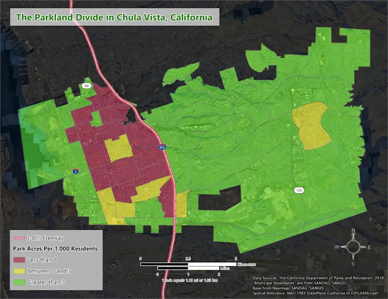
A new analysis shows how much Chula Vista residents’ access to parkland depends on where they live. The analysis, conducted by geographic information systems (GIS) researcher and Chula Vista resident Jacob Helfman, visualizes how areas east of Interstate 805 have over three times more parkland per person than those west of the freeway. Helfman’s analysis ...
kpbs.org
Drones Help Solve The Forest Carbon Capture Riddle In Thailand

Drones Help Solve The Forest Carbon Capture Riddle In Thailand

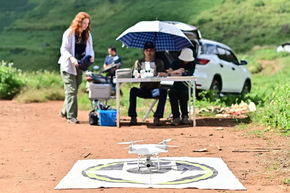
On a hillside overlooking cabbage fields outside the northern Thai city of Chiang Mai, a drone’s rotors begin to whir, lifting it over a patch of forest. It moves back and forth atop the rich canopy, transmitting photos to be knitted into a 3D model that reveals the woodland’s health and helps estimate how much ...
aljazeera.com
A New Map Showing All Above-Ground Biomass In The Brazilian Amazon

A New Map Showing All Above-Ground Biomass In The Brazilian Amazon

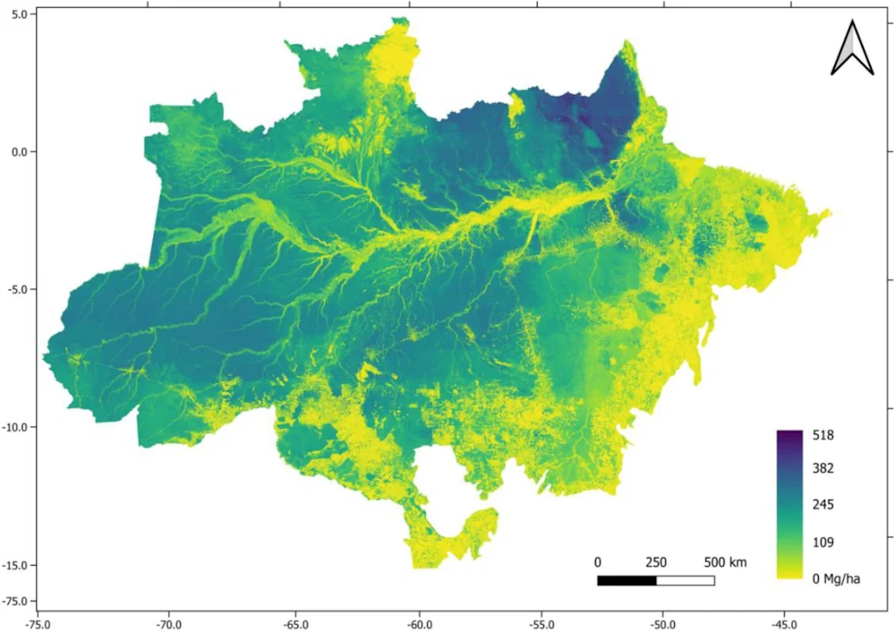
Publication of a new map showing all the above-ground biomass in the Brazilian Amazon is good news in the context of the severe crisis afflicting the world’s largest contiguous tropical rain forest. Using airborne laser scanning and satellite imagery calibrated by field forest inventories and integrated by heavy-duty computer processing and machine learning, the map ...
labmanager.com