Geomaticians

20

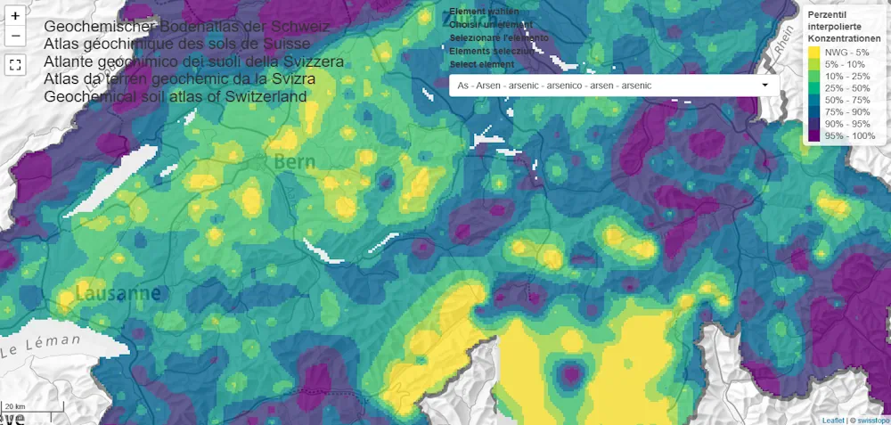
Soil Atlas Depicts The Distribution Of Chemical Elements In Swiss Soils

Soil Atlas Depicts The Distribution Of Chemical Elements In Swiss Soils

Agroscope and the Federal Office for the Environment have published the first Geochemical Soil Atlas of Switzerland. It provides an overview of the large-scale distribution of 20 naturally occurring chemical elements in Swiss soils. The soil atlas will help the cantonal environmental protection agencies assess soil pollution levels and take action where necessary. The Geochemical ...
admin.ch

Abu Dhabi’s Bayanat And Yahsat Merge To Create $4 Billion Space Tech Company

Bayanat, a provider of geospatial data products and services, and Al Yah Satellite Communications, known as Yahsat, are set to merge in a deal that will establish one of the world’s most valuable listed space companies. The combined entity, with a market capitalisation of Dh15 billion ($4.08 billion) based on closing share prices as of ...
edgemiddleeast.com
Gençler Yeni Projelerini İbb Desteği İle Geliştiriyor

Gençler Yeni Projelerini İbb Desteği İle Geliştiriyor

İstanbul Büyükşehir Belediyesi (İBB) Bilgi İşlem Dairesi Başkanlığı Coğrafi Bilgi Sistemi (CBS) Şube Müdürlüğü ve Akıllı Şehir Şube Müdürlüğünün iş birliği ile hayata geçirilen GIS Hackathon 16-17 Aralık tarihlerinde Tech Istanbul Başakşehir’de gerçekleştirildi. İstanbul gibi tarihi ve kültürel bir şehir için yeni fikirlerin geliştirilmesi amacıyla hayata geçirilen GIS Hackatona; CBS teknolojilerine ilgi duyan üniversite mezunları ...
filashaber.com

نحوه دسترسی دانشجویان به تصاویر ماهواره «خیام» اعلام شد

حسین دلیریان با انتشار متنی در شبکه X اعلام کرد: دسترسی به خدمات تجاری ماهواره «خیام» برای تمام دانشجویان جهت استفاده در پژوهش‌ها و اشخاص حقیقی و شرکت‌های خصوصی فراهم شد. وی تاکید کرد: این افراد می‌توانند از طریق لینک www.isrc.ac.ir/vavnu تصاویر ماهواره «خیام» با دقت ۱ متر را سفارش‌گذاری کنند. به گفته سخنگوی سازمان ...
isna.ir

Kazakhstan To Launch Earth Observation Satellite Production

Kazakhstan is set to produce Earth remote sensing satellites at its assembly and testing complex for spacecraft. The plan is to produce 60 percent of KazEOSat-MR medium-resolution satellites, replacing the current KazEOSat-2. According to the Kazakh Ministry of Digital Development, Innovation and Aerospace Industry, design work is currently underway, with production scheduled to commence next ...
jjtv.kz
Neue Karte Zeigt Radon-situation In Wohnungen

Neue Karte Zeigt Radon-situation In Wohnungen

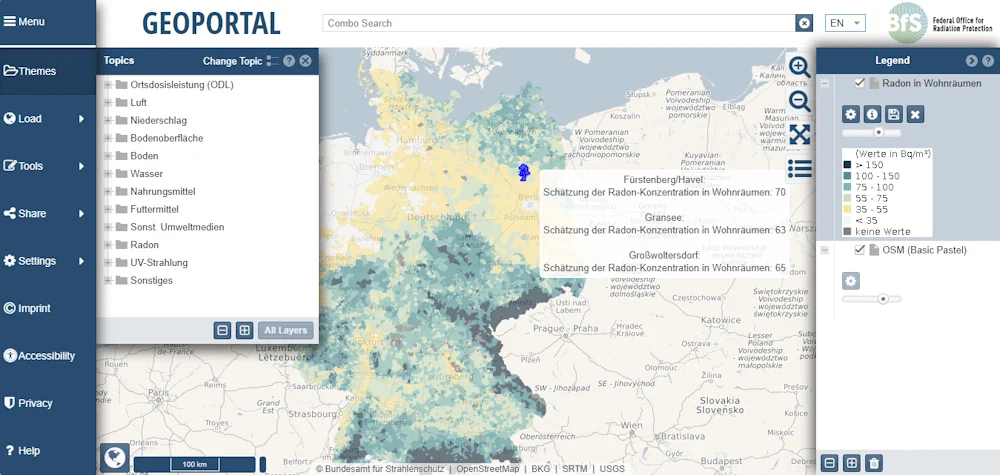
Man kann es weder sehen noch riechen oder schmecken: das radioaktive Gas Radon. In geringen Mengen ist es in jedem Gebäude vorhanden. Erhöhte Radon-Werte stellen ein ernst zu nehmendes Gesundheitsrisiko dar, denn dieser Innenraumschadstoff gehört – nach dem Rauchen – zu den häufigsten Ursachen von Lungenkrebs. Eine neue Karte des Bundesamtes für Strahlenschutz zeigt die ...
pro-physik.de
Presentan Mapas De Siete Cultivos Con Información Georreferenciada De Superficie Sembrada En Córdoba

Presentan Mapas De Siete Cultivos Con Información Georreferenciada De Superficie Sembrada En Córdoba

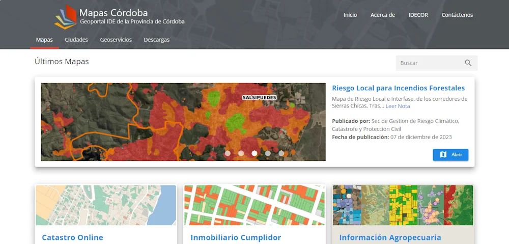
La Bolsa de Cereales de Córdoba (BCCBA), con el apoyo e infraestructura de IDECOR, presentó sus mapas de siete cultivos en la provincia de Córdoba. Concretamente, se trata de información georreferenciada de la superficie sembrada de los cultivos de alfalfa, garbanzo, girasol, maíz, maní, soja y sorgo en territorio cordobés. La producción y publicación de ...
agroverdad.com.ar
NOAA Seeks Applications For 2024 Urban Heat Island Initiative

NOAA Seeks Applications For 2024 Urban Heat Island Initiative

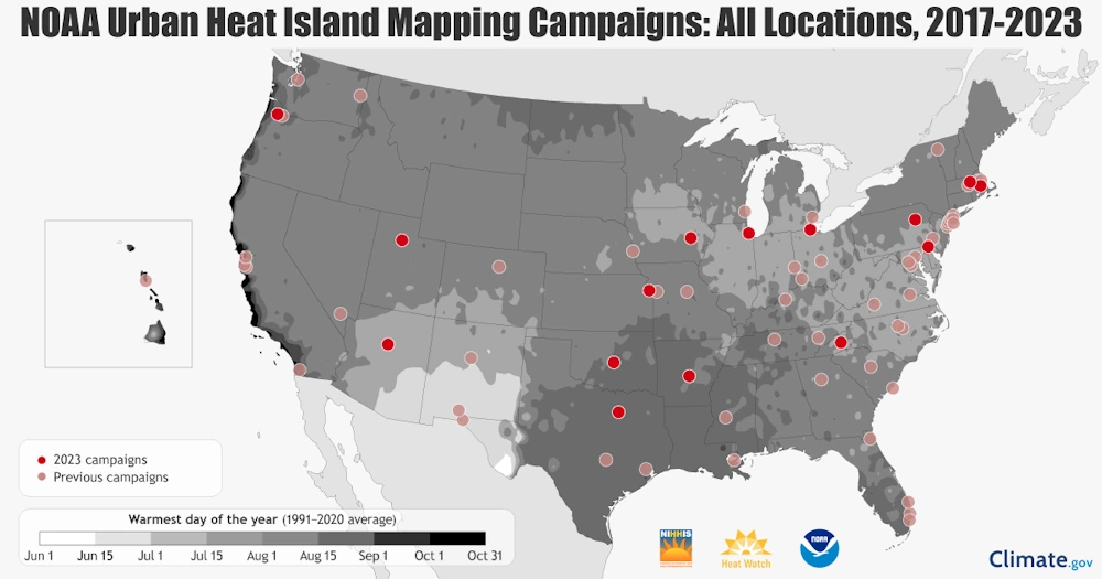
NOAA’s National Integrated Heat Health Information System (NIHHIS), in partnership with CAPA Strategies LLCoffsite link, is now accepting applications from organizations interested in participating in the 2024 Urban Heat Island (UHI) mapping campaign program. In the eighth year of the program, NIHHIS and CAPA Strategies will support community science campaigns in cities and counties across ...
noaa.gov

Joshi Launches India’s National Geoscience Data Repository (NGDR) Portal

Minister for Mines Pralhad Joshi launched India’s National Geoscience Data Repository (NGDR) portal on Tuesday. NGDR is a comprehensive online platform that will host the geospatial data for the entire country. Terming the NGDR portal the culmination of the work of several years, Mines Secretary VL Kantha Rao said that out of the total 32 ...
psuwatch.com
Brown Anthropologist’s Mapping Project Shows How Peru Transformed After Colonization

Brown Anthropologist’s Mapping Project Shows How Peru Transformed After Colonization

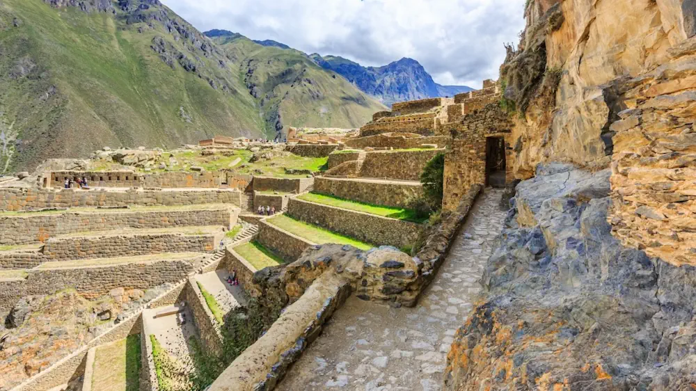
Parker VanValkenburgh has dedicated more than a decade of research to understanding how colonialism impacted Peru’s Indigenous people in the 16th century. That time marked a turning point in the region: Spanish forces conquered the Inca Empire, initiating a period of social violence and upheaval that included the forced resettlement of more than 2 million ...
brown.edu