Geomaticians

31

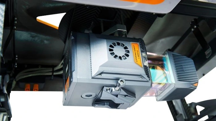
CHCNav Introduces Alphauni 20 Lidar System

CHCNav Introduces Alphauni 20 Lidar System

The AlphaUni 20 (AU20) Lidar system represents a new era in cost-effective, multi-platform mobile mapping solutions, according to CHC Navigation (CHCNav), a global leader in precision mapping, positioning and navigation technologies. Harnessing the power of six years of innovation and product development fuelled by CHCNAV’s Lidar technology, the AU20 is aimed at redefining mobile mapping ...
gim-international.com
PCSDS Upgrades Coastal Mapping Through Google Earth Engine

PCSDS Upgrades Coastal Mapping Through Google Earth Engine

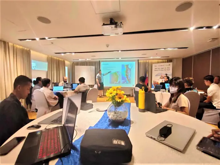
The Palawan Council for Sustainable Development, along with representatives of different government and public organizations dedicated to environmental conservation in Palawan, attended a training-workshop organized by the United States Agency for International Development (USAID) Fish Right program on August 21-23. The workshop consisted of using the features of Google Earth Engine, integrating it with the ...
palawan-news.com
Governo Lança Painel Que Detalha Ocorrências De Desastres Naturais No Rio Grande Do Sul

Governo Lança Painel Que Detalha Ocorrências De Desastres Naturais No Rio Grande Do Sul

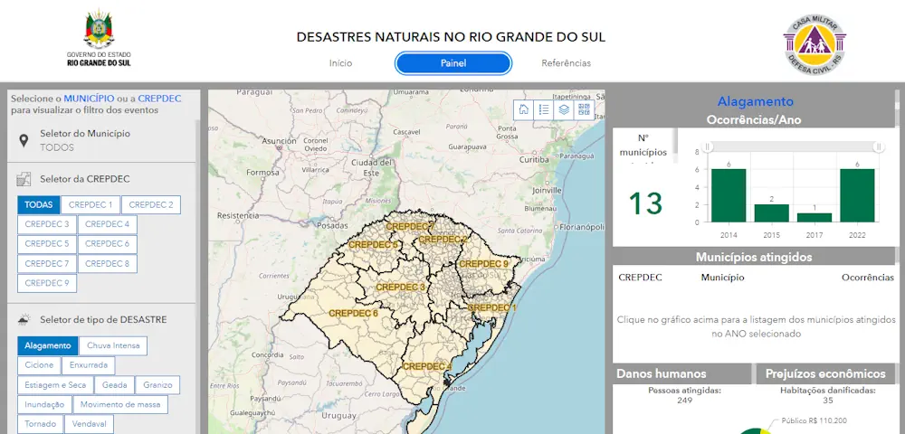
As informações sobre ocorrências de desastres naturais no Rio Grande do Sul entre os anos de 2003 e 2022 foram disponibilizadas pelo governo do Estado em um novo painel, apresentado nesta terça-feira (29/8) durante a 46ª Expointer, em Esteio. No portal, elaborado pela Secretaria de Planejamento, Governança e Gestão (SPGG) em parceria com a Defesa ...
estado.rs.gov.br

Queensland’s Spatial Cadastre Updated For Inland Rail

A two-year project to survey and model nearly 233,000 hectares of land — equivalent to the size of the Australian Capital Territory — to upgrade Queensland’s spatial cadastre, has been completed as a vital part of delivering the Inland Rail project. The spatial cadastre is used to accurately identify the location of the new rail ...
spatialsource.com.au

España Cederá A La UE Imágenes De Su Satélite ‘Espía’

La inteligencia militar española se nutre en buena parte gracias a las imágenes de alta resolución que obtiene a través del Sistema de Observación de la Tierra por Satélite gubernamental con tecnología Radar, más conocido como ‘Satélite PAZ’. España ha decidido ceder gratuitamente a la Unión Europea parte de las imágenes que capten con este ...
cadenaser.com
Esri Canada Launches Assessment Analyst Valueit For Accurate Property Assessment Values

Esri Canada Launches Assessment Analyst Valueit For Accurate Property Assessment Values

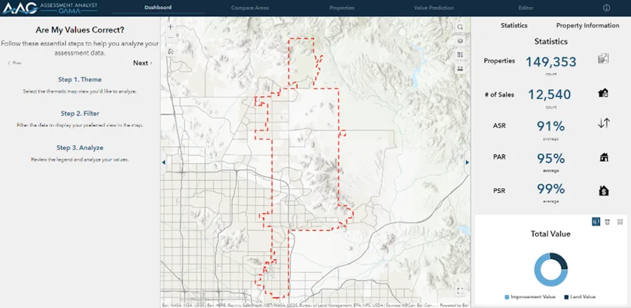
Esri Canada today announced the launch of Assessment Analyst ValueIT, a powerful visualization and analytic application that revolutionizes property assessment by providing clarity and control over the accuracy of assessment values. With AA ValueIT, assessors can confidently determine if assessments meet local or state standards by leveraging the full potential of computer-assisted mass appraisal (CAMA) ...
directionsmag.com

Location Data Can Help Build The EV Chargepoint Network Of Tomorrow

The Geospatial Commission has today (30 August 2023) published a report to support local authorities to make decisions about where to install electric vehicle (EV) chargepoints in their areas. Location data can arm local authorities with evidence to rollout a public charging network that gives current and prospective EV owners the confidence to make their ...
gov.uk
Google Expands Environmental Mapping Tools

Google Expands Environmental Mapping Tools

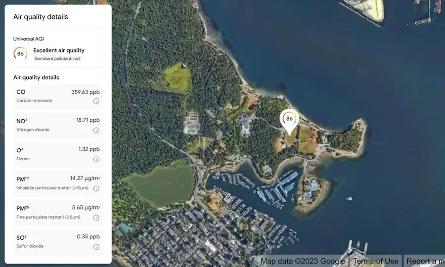
Google is expanding its sustainability offerings with new products from its Google Maps platform, including mapping technologies for solar energy, air quality, and pollen distribution. The mapping tools use AI and machine learning paired with aerial imagery and environmental data to provide valuable information for developers, businesses, and organizations to track and mitigate their environmental ...
environmentalleader.com