Geomaticians

25

Interactive Map Helps People Find Food And Resources In Illinois

Interactive Map Helps People Find Food And Resources In Illinois

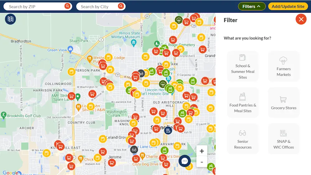
Technology is helping folks with their daily lives find their basic needs. The Find Food IL Map is a digital tool created in response to the COVID-19 pandemic, but it will likely stick around as food insecurity becomes more prevalent. When the pandemic hit, many families found themselves grappling with a new reality – a ...
ksdk.com
ENEA Un Servizio Per Mappare Aree A Rischio Inondazione

ENEA: Un Servizio Per Mappare Aree A Rischio Inondazione

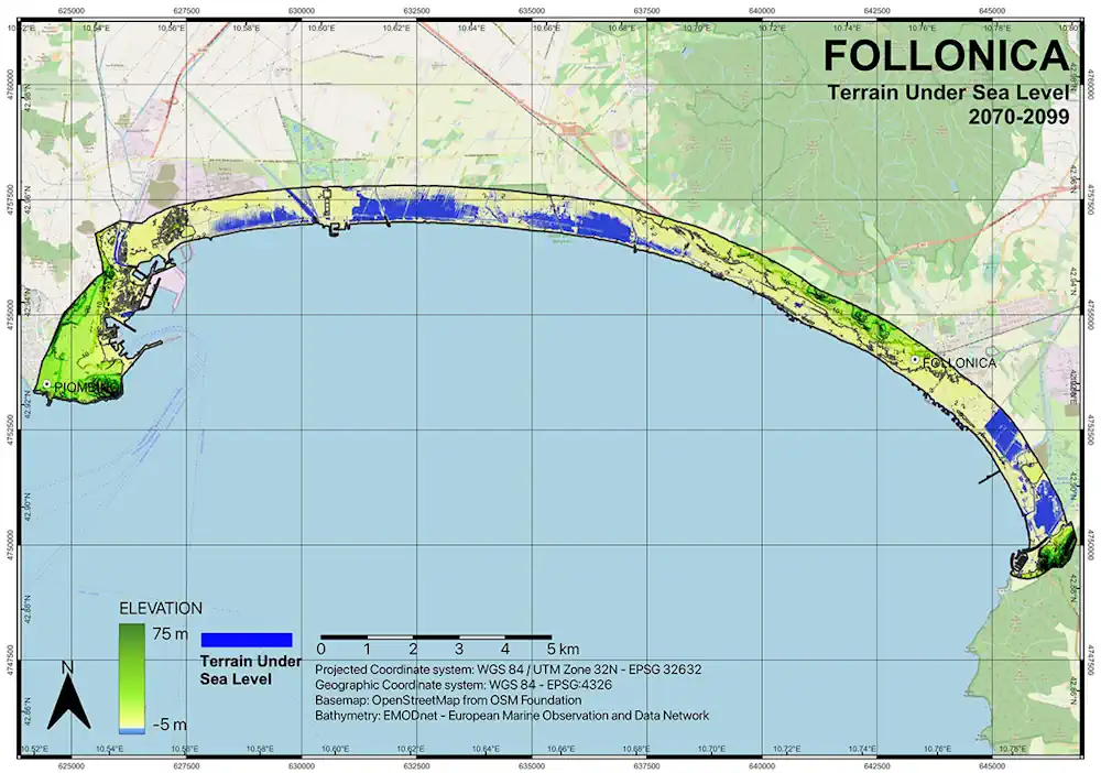
ENEA ha sviluppato un nuovo servizio in grado di mappare le aree costiere a rischio inondazione per il cambiamento climatico che abbina modelli ad alta risoluzione, tecnologie satellitari e rilievi sul campo. Il nuovo servizio climatico è stato messo a punto da un team di ricercatori composto da climatologi, esperti GIS, oceanografi e geologi ed ...
ecquologia.com
Oklahoma Latest State To Launch Interactive Broadband Map

Oklahoma Latest State To Launch Interactive Broadband Map

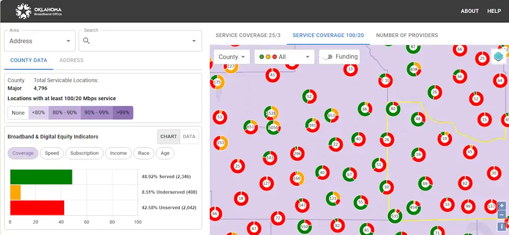
The Oklahoma Broadband Office launched a new, interactive broadband map on Tuesday that details the availability, speed and equity of internet service across the state. The map shows locations in Oklahoma that either have slow internet speeds or don’t have access to internet at all. It aims to aid the state in planning how to ...
statescoop.com
Minagri Utilizará Imágenes Satelitales Para Identificar Zonas Agrícolas Inundadas

Minagri Utilizará Imágenes Satelitales Para Identificar Zonas Agrícolas Inundadas

Con el objetivo de conocer a la brevedad cuáles son las zonas agrícolas del centro-sur del país que están inundadas a causa del sistema frontal, la subsecretaria de Agricultura, Ignacia Fernández, instruyó al Centro de Información de Recursos Naturales (CIREN), coordinar el procesamiento de imágenes satelitales y la entrega de información geoespacial, a través del ...
minagri.gob.cl

Khanan Prahari App Helping To Curb Illegal Coal Mining Activities Through Public Participation

The mobile app Khanan Prahari, which allows citizens to report incidents of illegal coal mining through geo-tagged photographs and textual information, is a significant step taken by the Ministry of Coal towards curbing illegal coal mining activities. The corresponding web portal called as Coal Mine Surveillance & Management System (CMSMS) has been developed in association ...
indiaeducationdiary.in

Sask. Project Aims To Reduce Drug Overdose Deaths

Ninety-two confirmed overdose deaths and 199 more suspected deaths have occurred in the province this year as of Aug. 1, according to a report from Saskatchewan’s Coroner. Now, a new project between the University of Regina and AIDS Programs South Saskatchewan (APSS), called Project Reportneedles.ca, was launched on Wednesday, which will aim to change those ...
regina.ctvnews.ca
Anglian Water Uses Satellites To Detect Hard-to-find Water Leaks

Anglian Water reports saving millions of litres of water with space-based detection of water leaks that are otherwise invisible. The company, which supplies water to almost 7 million people mainly in the east of England, launched the programme in December 2022. Based on two complete scans of its service area has reported saving over 2Ml/d ...
smart-energy.com

Space Intelligence To Map Kenya And Tanzania To Support Integrity And Transparency In The Carbon Markets

According to reports by Space Intelligence, a NatureTech company specialising in Digital MRV (Measurement, Reporting, and Verification) across the tropics to support nature-based solutions to climate change, it has been selected to map Kenya and Tanzania to support integrity and transparency in the carbon markets. The maps, expected to be verified by Verra, will help ...
africanews.space
OGC And Partners Release Marine SDI Roadmap

OGC And Partners Release Marine SDI Roadmap

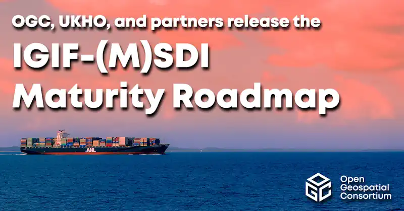
The Open Geospatial Consortium (OGC) has released the first iteration the Integrated Geospatial Information Framework (IGIF)-M (Marine) Spatial Data Infrastructure (SDI) Maturity Roadmap for both marine and terrestrial domains. Developed as part of OGC’s ongoing Federated Marine Spatial Data Infrastructure (FMSDI) Initiative, the IGIF-(M)SDI Maturity Roadmap is a quick-start guide for nations and marine organizations ...
gpsworld.com