Geomaticians

04

Buenos Aires Albergará Las Jornadas De Geociencias Para Ingeniería

Durante los días 1 y 2 de noviembre de este año, tendrá lugar la cuarta edición de las Jornadas de Geociencias para la Ingeniería. El evento es organizado por el Instituto de Geodesia y Geofísica Aplicadas y el Departamento de Agrimensura de la Facultad de Ingeniería de la Universidad de Buenos Aires y tendrá lugar ...
comercioyjusticia.info
Drone Lidar In Poland TPI Joins Global Distribution Network Of GeoCue

Drone Lidar In Poland: TPI Joins Global Distribution Network Of GeoCue

GeoCue is delighted to announce the inclusion of TPI, the largest supplier of geospatial equipment in Poland, into its global distribution network. This strategic partnership will create new opportunities for GeoCue and TPI to expand their reach and provide cutting-edge geospatial solutions to customers in Poland and beyond. As part of this collaboration, TPI now ...
uasweekly.com
Transport For Wales Launches New Live Map That Shows Passengers Where Their Train Is

Transport For Wales Launches New Live Map That Shows Passengers Where Their Train Is

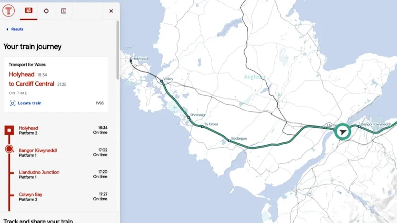
A brand new live digital map has been launched showing customers exactly where their train is. Launched by Transport for Wales, the map has been described as “fantastic” by rail bosses. It shows the location of every TfW train and allows customers to view a train’s journey in real time and see the expected arrival ...
itv.com
Use Berkeley’s Emergency Map To Find Critical, Real-time Information By Location

Use Berkeley’s Emergency Map To Find Critical, Real-time Information By Location

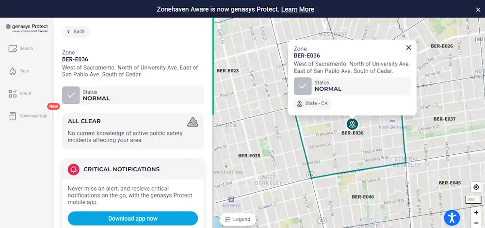
Learn how to use the City’s Emergency Map to quickly see how neighborhoods, including your own, may be directed to evacuate, shelter in place, or take other protective action during a major emergency. When possible, the City would use the map to also identify evacuation routes, road closures, shelters, or other critical information to guide ...
berkeleyca.gov
We Wrocławiu Powstaje Mapa Koron Drzew. Czemu Ma Służyć

We Wrocławiu Powstaje Mapa Koron Drzew. Czemu Ma Służyć?

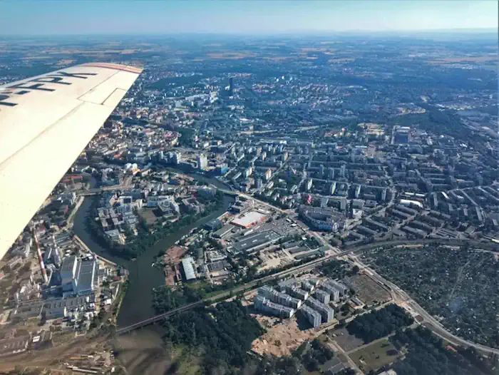
Wrocław jako drugie (po Warszawie) miasto w Polsce będzie korzystał z tworzonej właśnie mapy koron drzew, która powinna być gotowa jeszcze w tym roku. Mapa powstaje w ramach nowego, europejskiego projektu LIFECOOLCITY. Jak się ją przygotowuje i w jaki sposób przyczyni się do niwelowania zjawiska miejskich wysp ciepła? Realizacja projektu LIFECOOLCITY pomoże w określeniu „zielonych” ...
wroclaw.pl

Govt To Undertake GIS Mapping Of Urban Areas

In order to plug revenue leakages, the state government will conduct a geographic information system (GIS) mapping of all properties in municipal areas in the state, Urban Development Minister Vishwajit Rane informed the Goa legislative assembly on Thursday. Rane said the work of GIS mapping has already started in North Goa and the tender process ...
navhindtimes.in

Burned Area Emergency Response (BAER) Team To Assess Grapevine Fire

A Burned Area Emergency Response (BAER) Team is being established to begin a burned area assessment of the Grapevine wildfire on the Verde Ranger District. Preliminary evaluation has found no immediate or downstream values at risk, including the community of Whitehorse. BAER teams consist of scientists and specialists including hydrologists, geologists, soil scientists, engineers, botanists, ...
ein.az.gov

IBM And NASA Open Source Largest Geospatial AI Foundation Model On Hugging Face

IBM and open-source AI platform Hugging Face today announced that IBM’s watsonx.ai geospatial foundation model – built from NASA’s satellite data – will now be openly available on Hugging Face. It will be the largest geospatial foundation model on Hugging Face and the first-ever open-source AI foundation model built in collaboration with NASA. The model ...
newsroom.ibm.com