Geomaticians

April

This UC Doctoral Student Is Helping Pileated Woodpeckers Find Space In Hamilton County

This UC Doctoral Student Is Helping Pileated Woodpeckers Find Space In Hamilton County

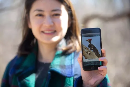
As cities continue expanding, forested areas are becoming scarcer, and less dense. That’s bad news for the wildlife that call those areas home. A University of Cincinnati doctoral student is studying what local areas are important to North America’s largest woodpecker. “The pileated woodpecker is not considered as a vulnerable species, but it is an ...
wvxu.org

Seoul Robotics Partners With Temple For Street-level 3D Solutions

Seoul Robotics, the company powering smart 3D infrastructure solutions, announced a distribution partnership with Temple, a provider of intelligent transportation systems, to bring its proprietary software, SENSR™, to customers in the Southeast. This is Seoul Robotics’ first partnership with a transportation technology distributor in the U.S. and will expand the company’s deployment of smart infrastructure ...
geospatialworld.net

Drones To Tally Canines

The Bruhat Bengaluru Mahanagara Palike (BBMP) is contemplating using drones to aid the upcoming dog census in the city. According to the officials, the technology is being actively considered as it will help cover a larger area in a short period and will give a better understanding of the stray population. “Property surveys in the ...
bangaloremirror.indiatimes.com

Signing Ceremony Of New Documents Of Cooperation Between Tajikistan And Azerbaijan

Following the meeting and negotiations at the highest level between Tajikistan and Azerbaijan, a ceremony of signing of new documents of cooperation took place. Agreement between the Government of the Republic of Tajikistan and the Government of the Republic of Azerbaijan on cooperation in the field of geodesy, cartography, land surveying, cadastre and remote land ...
einnews.com
Desarrollan Mapas Temáticos Que Reflejan Cambios Ambientales Producidos Por La Actividad Agropecuaria

Desarrollan Mapas Temáticos Que Reflejan Cambios Ambientales Producidos Por La Actividad Agropecuaria

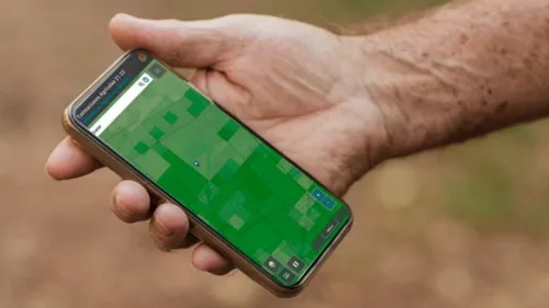
Investigadores que trabajan en el Laboratorio de Investigación y Reflexión en Agroecología (LIRA), de la Facultad de Ciencias Agrarias y Forestales de la UNLP diseñan, a partir de diferentes índices calculados, mapas temáticos que permiten visualizar el riesgo ambiental de las actividades agropecuarias en la provincia de Buenos Aires. Cuando se habla de riesgo, entran ...
unlp.edu.ar
Scientists Use NASA Satellite Data To Determine Belize Coral Reef Risk

Scientists Use NASA Satellite Data To Determine Belize Coral Reef Risk

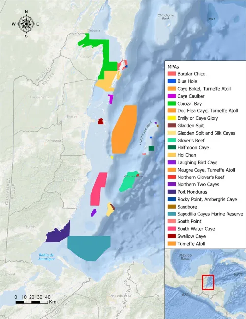
Using two decades of NASA satellite measurements stored in the cloud, scientists recently assessed the vulnerability of Belize’s renowned coral reefs to bleaching and collapse. The findings could help management authorities protect the reefs from human impacts such as development, overfishing, pollution, and climate change. In a study published in Frontiers in Remote Sensing, the ...
climate.nasa.gov

Civil Engineers Use Public Satellite Images To Study Why The Jagersfontein Dam Failed

On 11 September 2022, a diamond mine waste storage facility, known as a tailings dam, failed in the town of Jagersfontein in the Free State province of South Africa. In the failure, one person was killed and multiple homes destroyed. Tailings are the finely ground leftovers that remain after valuable metals are removed from rock ...
sciencedaily.com

Calgary Researcher Hoping To Drive Change For People With Dementia

“Physicians usually use a cognitive assessment, with pen and paper usually, to determine whether a driver is fit to drive. But these assessments are very limited,” said Dr. Sayeh Bayat, an assistant professor in both the University of Calgary’s department of biomedical engineering and geomatics engineering at the Schulich School of Engineering. Bayat recently received ...
globalnews.ca

Geoportal.Gov.Pl: Aktualizacja Modeli Budynków 3D Dla Kolejnych 3 Województw

W krajowym Geoportalu udostępniono nowe modele budynków w standardzie LoD1 dla obszaru kolejnych województw: dolnośląskiego, opolskiego oraz wielkopolskiego. Aktualne modele 3D budynków w standardzie LoD1 są dostępne w paczkach powiatowych i zostały wygenerowane w sposób automatyczny na podstawie zaktualizowanych w 2022 r. danych BDOT10k oraz chmury punktów ALS i numerycznego modelu terenu dostępnych w Państwowym ...
Konya'dan Hatay'da Arızalara Robotik Tespit

Konya’dan Hatay’da Arızalara Robotik Tespit

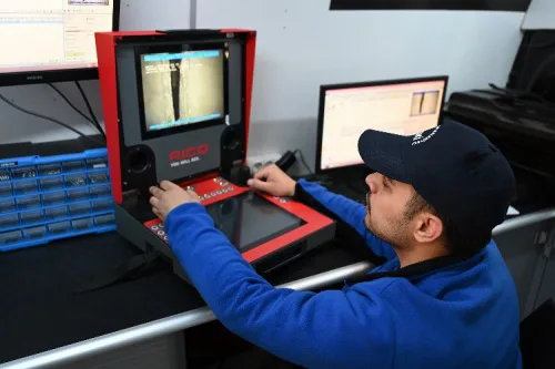
Konya Büyükşehir Belediyesi KOSKİ Genel Müdürlüğü’nün Akıllı Şebeke Uygulamaları arasında bulunan Robotik Kanal Görüntüleme Aracı, Hatay’daki altyapı onarım faaliyetlerinde büyük çaplı kazı yapmadan arızalarını hızlı tespit etmeye olanak sağlıyor. Konya Büyükşehir Belediye Başkanı Uğur İbrahim Altay, Konya Büyükşehir Belediyesi KOSKİ Genel Müdürlüğü’nün Akıllı Şebeke Uygulamalarından biri olan Robotik Kanal Görüntüleme Aracıyla kanalizasyon arızalarına müdahale ettiklerini ...
yeniufuk.com.tr

Dynamische 3D-visualisierung Der Wasserspiegellagen

Das Tiefbau- und Vermessungsamt der Landeshauptstadt Wiesbaden, Abteilung Stadtvermessung, hat in enger Abstimmung mit der Bundesanstalt für Gewässerkunde (BfG) realisieren können, dass die Wasserspiegellagen für den Rhein und der Mainmündung für den Bereich Wiesbaden dreidimensional (3D) visualisiert werden. Diese waren beim BfG nur zweidimensional für Jedermann abrufbar. Mithilfe dieser Anwendung ist eine Ersteinschätzung bei verschiedenen ...
wiesbadenaktuell.de
Deutschland Verlor In Den Letzten Zwei Jahrzehnten Durchschnittlich 760 Millionen Tonnen Wasser Pro Jahr

Deutschland Verlor In Den Letzten Zwei Jahrzehnten Durchschnittlich 760 Millionen Tonnen Wasser Pro Jahr

Die letzten fünf Jahre in Deutschland waren von massiven Sommerdürren geprägt. Sehr viel Wasser ging verloren. Nur: Wie hoch die Verluste genau waren und ob sich daraus ein Trend für die Zukunft ableiten lässt, sind nach wie vor offene Fragen. Ein Team des Deutschen GeoForschungsZentrums (GFZ) hat nun mit Kolleg:innen die Jahre 2002-2022 genauer untersucht. ...
idw-online.de
Córdoba Suma Tecnología A La Producción Agrícola

Córdoba Suma Tecnología A La Producción Agrícola

Con datos de la campaña 2021/22 que se suman a los existentes de 2020/21 y el relevamiento en marcha de la vigente campaña 2022/23, Córdoba consolida una nueva metodología de estimaciones agrícolas que incluye el mapeo de cultivos y estimación de rindes y producción a escala semi-predial. El nuevo modelo, desarrollado por el Ministerio de ...

China’s Hyperspectral Earth Observation Satellite Put Into Use

China’s hyperspectral satellite for Earth observation has gone into use after completing in-orbit tests, the Ministry of Ecology and Environment, the primary developer of the spacecraft, announced on Tuesday. The satellite, Gaofen-5 02, was launched into space on Sept. 7, 2021. Designers mounted seven payloads on it, including short-wave infrared hyperspectral cameras. The onboard devices ...
english.news.cn
Este Mapa Interactivo Mostra-te A “Cidade De 15 Minutos” Que Existe Em Lisboa

Este Mapa Interactivo Mostra-te A “Cidade De 15 Minutos” Que Existe Em Lisboa

Uma pequena ferramenta desenvolvida no contexto do último Conselho de Cidadãos, dedicado à “cidade dos 15 minutos”, permite a qualquer pessoa perceber o que tem próximo da sua residência, local de trabalho ou no seu bairro. O mapa foi desenvolvido por Manuel Banza, cientista de dados e entusiasta de cidades, para ajudar os participantes a ...
lisboaparapessoas.pt

Da e-Geos La Piattaforma D’accesso Ai Dati Dei Satelliti Iride

La società e-Geos (80% Telespazio – 20% Agenzia spaziale italiana) si è aggiudicata una gara dell’Agenzia spaziale europea (Esa) per realizzare l’infrastruttura per l’accesso ai dati e ai servizi di Iride, l’innovativa costellazione satellitare italiana per l’osservazione della Terra promossa dal Governo italiano, grazie alle risorse del Pnrr, e gestita da Esa e Agenzia spaziale ...

IOGP Releases Land Survey Data Model

The International Association of Oil and Gas Producers has released its Land Survey Data Model (LSDM), continuing the practice of its Geomatics Committee of maintaining an “out-of-the-box” data model template to manage survey data within a geodatabase. The LSDM is an industry standard template for operators to maintain land survey data, mainly acquired for the ...
jpt.spe.org
Mapping Hidden Meltwater Paths In Glaciers

Mapping Hidden Meltwater Paths In Glaciers

Norwegian and Estonian researchers have developed a method to map hidden meltwater paths in glaciers. Having a better understanding of how water moves inside and under the glaciers helps to better predict the motion, melting rates, and possible sudden collapses of glaciers. The small floating drifters, about the shape, size, and weight of an average ...
phys.org

Developers Invited To The 2023 Open Standards And Open Source Software Code Sprint

The Open Geospatial Consortium (OGC), the Apache Software Foundation (ASF), and the Open Source Geospatial Foundation (OSGeo) invite software developers to attend the annual Open Standards and Open Source Software Code Sprint. The hybrid virtual and in-person event will be hosted by Open Source service company Camptocamp SA in Bussigny, Switzerland (near Lausanne). The event ...
directionsmag.com

Côte d’Ivoire : Salon international de la Géomatique

L’édition 2023 du Salon international de la Géomatique se tiendra les 27 et 28 avril à Abidjan, précisant que 5.000 visiteurs sont attendus à cet événement. Selon le service de communication du Comité national de télédétection et d’information géographique (CNTIG), 50 pays prendront part à ce salon. Pendant deux jours, ceux-ci auront à visiter 52 ...
sahel-intelligence.com