Geomaticians

April

Brasil E China Vão Fabricar E Lançar Satélite Para Monitorar A Amazônia

Brasil E China Vão Fabricar E Lançar Satélite Para Monitorar A Amazônia

Os governos do Brasil e a China assinaram nesta sexta-feira (14) 15 acordos de cooperação entre os quais o que vai possibilitar o desenvolvimento, fabricação, lançamento e operação de um satélite para aperfeiçoar o monitoramento da Amazônia. Trata-se do Satélite Sino Brasileiro de Recursos Terrestres – CBERS-6, que possui uma nova tecnologia: o Radar de ...
vermelho.org.br
Kenya Launches First Operational Satellite Onboard SpaceX Rocket

Kenya Launches First Operational Satellite Onboard SpaceX Rocket

Kenya launched its first operational earth observation satellite on Saturday onboard a SpaceX rocket from the United States. The satellite, developed by nine Kenyan engineers, will collect agricultural and environmental data, including on floods, drought, and wildfires, that authorities plan to use for disaster management and to combat food insecurity. “We have the challenges that ...
tvpworld.com
Dewa Launches Its Second Nanosatellite DEWA SAT-2

Dewa Launches Its Second Nanosatellite DEWA SAT-2

Dubai [Abu Dhabi] April 15, (ANI/WAM): Dubai Electricity and Water Authority (DEWA) has successfully launched its second nanosatellite, DEWA SAT-2, aboard SpaceX ‘s Falcon 9 rocket from Vandenberg Space Force Base in California, USA. The launch of DEWA SAT-2 underlines ‘s leadership in using space technologies to improve the operations, maintenance and planning of electricity ...
aninews.in

China Scientists Carry Out ‘Rule-breaking’ AI Experiment In Space

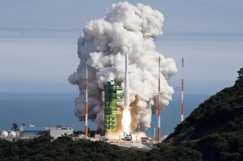
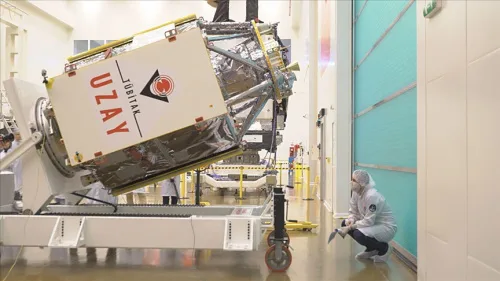
Chinese researchers say an artificial intelligence machine was given temporary full control of a satellite in near-Earth orbit, in a landmark experiment to test the technology’s behaviour in space. For 24 hours the Qimingxing 1, a small Earth observation satellite, was directed by a ground-based AI, without any human order, assignment or intervention, according to ...
scmp.com

Teledyne Introduces New Marine Lidar Sensor For USV

Teledyne Geospatial will bring its latest advancements in ocean mapping hardware and software solutions to Ocean Business 2023, being held at the National Oceanography Centre, Southampton, UK from April 18-20. Visitors to the Teledyne Geospatial booth U12 will be introduced to the CL-360 for marine applications, a lidar sensor that can be seamlessly integrated with ...
geospatialworld.net
Indigenous Chip For Navic-based Satellite Navigation Launched

Indigenous Chip For Navic-based Satellite Navigation Launched

In a step towards expanding usage of indigenous satellite-based Navigation, NavIC, a chip that can form the core of the Navigation, Positioning and Timing applications developed by Elena Geo Systems, a Bengaluru-based space technology company, was unveiled at ht Deefence Space Symposium on Thursday. The chip works using Navigation with Indian Constellation (NavIC) or the ...
thehindu.com
Kea Aerospace Debuts Solar-powered Stratospheric UAS With Audi EV Technology

Kea Aerospace Debuts Solar-powered Stratospheric UAS With Audi EV Technology

The New Zealand-based company Kea Aerospace has developed an innovative solar-powered stratospheric aircraft, called the Kea Atmos Mk 1, which is designed for high-altitude flight testing. The aircraft has a wingspan of 12.5 meters and weighs under 40 kilograms, making it lightweight enough to fly at altitudes higher than commercial airliners, up to 50,000 feet. ...
uasweekly.com
Spacex Transporter-7 Scrubs Launch Of 51 Payloads, Return Booster To LZ

Spacex Transporter-7 Scrubs Launch Of 51 Payloads, Return Booster To LZ

SpaceX scrubbed its 24th time this year with the Transporter-7 rideshare mission from Space Launch Complex 4E (SLC-4E) at Vandenberg Space Force Base due to weather constraints. The mission will try again on Friday at 11:47 PM PDT (06:47 UTC on April 15). On this flight, the launch integrators with ports on the payload stack ...
nasaspaceflight.com
Digital Twin Technology Brings Pompeii To Life

Digital Twin Technology Brings Pompeii To Life

Researchers have been using GIS and 3D modelling techniques to create highly accurate maps of Pompeii. This has led to the development of a digital twin of the ancient Italian city, which was buried by ash from the eruption of Mount Vesuvius in 79 AD. According to an article in Geosmart Magazine, a team of ...
gim-international.com
22,000 Tonnes Of Oil Spilled In UK Waters Since 2017

22,000 Tonnes Of Oil Spilled In UK Waters Since 2017

Over 22,000 tonnes of oil have been released into UK waters by the oil and gas industry in the last five years, according to new FOI data obtained by Oceana and Uplift. The data coincides with the launch of In Deep Water, the first-ever comprehensive review of how the oil and gas industry is damaging ...
oceana.org
Restoring Nature Can Lead To Fewer Road Repairs, Alberta Study Shows

Restoring Nature Can Lead To Fewer Road Repairs, Alberta Study Shows

‘Tis the season for flooding and road washouts. Not only can they create inconvenient, time-consuming detours and safety risks, but they’re also expensive to repair. And as climate change brings more extreme weather, including heavier rains, the cost of adapting infrastructure is expected to go up, along with the cost of repairing damage. But a ...
cbc.ca
Neural Networks Map The Ebb And Flow Of Tiny Ponds

Neural Networks Map The Ebb And Flow Of Tiny Ponds

Small ponds emit a surprisingly large amount of methane compared with larger water bodies. Because ponds are so tiny, they have been difficult to track, and their contributions to terrestrial greenhouse gas emissions are largely unaccounted for. In a new study, Mullen et al. used deep learning to construct a fine-grained map of ponds in ...
eos.org
An Unexpected Culprit Of Nitrogen Dioxide Emissions Identified

An Unexpected Culprit Of Nitrogen Dioxide Emissions Identified

NO2 emissions are known to be primarily generated by industrial facilities or vehicle exhausts. Recently, a research team from POSTECH analyzed satellite remote sensing data from ESA and released results showing that food processing facilities and high-rise apartments that are 10 stories or higher are significant sources of NO2 emissions. The team estimated average NO2 ...
technologynetworks.com
Study Shows Mountain Forests Being Lost At ‘Alarming Rate,’ Especially In Asia

Study Shows Mountain Forests Being Lost At ‘Alarming Rate,’ Especially In Asia

More than 7% of all mountain forests have been destroyed during the past two decades, according to a new study published in the journal One Earth. Using high-resolution satellite data and maps of mountain terrains, researchers found that 780,000 square kilometers (301,000 square miles) of mountain forest were lost worldwide between 2001 and 2018. The ...
news.mongabay.com
디지털 트윈·AI 기반 도시침수 예보·신속 대응체계 구축

디지털 트윈·AI 기반 도시침수 예보·신속 대응체계 구축

과학기술정보통신부와 환경부는 광주광역시, 경상북도, 경상남도와 가상모형(디지털 트윈), 인공지능(AI) 등 첨단 디지털 기술을 활용한 도시침수 예보체계 구축을 위해 12일 한강홍수통제소(서울 서초구 소재)에서 업무협약을 체결했다. 가상모형(Digital Twin)은 가상세계(Digital)에 실제 사물의 물리적 특징을 동일하게 반영한 쌍둥이(Twin)를 3D 모델로 구현하고, 실제 사물과 실시간으로 동기화한 시뮬레이션을 거쳐 관제·분석·예측 등 해당 사물에 대한 현실 의사결정에 활용하는 기술이다.
koit.co.kr

Mapeamento Com Drones Vai Ajudar Na Prevenção A Desastres Meteorológicos

O Governo do Estado do Espírito Santo, por meio do Instituto Jones dos Santos Neves (IJSN) e da Defesa Civil Estadual, está desenvolvendo um projeto que vai contribuir para a prevenção e o enfrentamento de desastres meteorológicos. É o aerolevantamento de território com uso de drones. A iniciativa prevê o mapeamento tridimensional do território, permitindo ...
es.gov.br
Trimble Opens First Trimble Technology Lab In New Zealand At The University Of Auckland

Trimble Opens First Trimble Technology Lab In New Zealand At The University Of Auckland

Trimble and the University of Auckland announced the opening of the first Trimble Technology Lab in New Zealand. The lab builds upon the university’s leadership in training and research in engineering and construction-related disciplines. The University of Auckland joins a network of nearly 30 universities around the world with Trimble Technology Labs. The Trimble Technology ...
prnewswire.com
New Map Gives Insight Into Ireland’s Land Cover Types

New Map Gives Insight Into Ireland’s Land Cover Types

Data from a new map has provided up-to-date insights on the types of land in Ireland, and how much of the country is covered by each of them. Ordinance Survey Ireland (OSI) and the Environmental Protection Agency (EPA) started a new national land cover mapping programme in 2018. The work was completed in September 2022, ...
agriland.ie
Oklahoma City Chosen For NOAA's Urban Heat Island Mapping Campaign

Oklahoma City Chosen For NOAA’s Urban Heat Island Mapping Campaign

The National Oceanic and Atmospheric Administration (NOAA) has selected Oklahoma City along with 17 other communities to participate in the 2023 NOAA Urban Heat Island (UHI) mapping campaign. Pending City Council approval, the campaign will kick off this summer, with volunteer citizen scientists using heat sensors mounted on their cars to map the hottest parts ...
kosu.org
Afet Sağlık Haritası Hizmete Girdi

Afet Sağlık Haritası Hizmete Girdi

MEDAK, Kahramanmaraş merkezli depremlerin etkilediği illerde sağlık kuruluşları hakkında sahadaki insanların doğru ve güncel olarak bilgilendirilmesi için çalışma başlattı. Bu kapsamda dernek, deprem bölgesinde görev alan tüm yabancılar da dahil resmi ve özel yardım yardım kuruluşlarıyla temasa geçerek, gerek kendi görevlileri gerekse diğer kurumların yetkili kişileri tarafından illerde hizmet veren sabit veya gezici tüm sağlık ...
yenicaggazetesi.com.tr
Launch Of Trimble Unity AMS Provides Electric Utilities With Enterprise Asset Management Solution To Improve Reliability And Efficiency

Launch Of Trimble Unity AMS Provides Electric Utilities With Enterprise Asset Management Solution To Improve Reliability And Efficiency

Trimble announced today the launch of its latest enterprise asset management solution designed for electric utilities worldwide to improve their service reliability and operational success. Built on Trimble’s industry-leading Cityworks® enterprise asset management platform, Trimble Unity® AMS enables utilities to manage the complete lifecycle of their asset infrastructure—from permits and construction to operations, maintenance and ...
prnewswire.com
Terras Indígenas Na Amazônia Brasileira Ajudam A Prevenir Doenças Causadas Por Queimadas, Diz Estudo

Terras Indígenas Na Amazônia Brasileira Ajudam A Prevenir Doenças Causadas Por Queimadas, Diz Estudo

Novo estudo de dez anos, revisado por pares, sugere que as florestas administradas por Indígenas na Amazônia Brasileira absorvem milhares de poluentes de gases venenosos provenientes de incêndios florestais, evitando 15 milhões de dispendiosos casos de doenças todos os anos. Com base em uma análise de dados de dez anos, os autores do novo estudo ...
blogdopedlowski.com
South Korea To Conduct 1st Launch Of Commercial-Grade Satellite

South Korea To Conduct 1st Launch Of Commercial-Grade Satellite

South Korea plans to conduct its first launch of a commercial-grade satellite aboard a domestically built rocket next month as part of its space development program, officials said Tuesday. In June last year, South Korea conducted its first satellite launch using the Nuri rocket. That launch involved what South Korean officials called a “performance verification” ...
military.com
Interactive Map Of Spring Hummingbird Migration Every State They'll Arrive In Plus Feeding Tips

Interactive Map Of Spring Hummingbird Migration: Every State They’ll Arrive In Plus Feeding Tips

Spring has arrived in the United States and hummingbirds are headed north. The birds typically migrate north in the late winter and spring, after spending their winters in parts of Central America or Mexico. An online map gives you a close look at the birds’ route north and when to expect their arrival as they ...
usatoday.com
Digital Map Created Of UK's Underground Pipes And Cables

Digital Map Created Of UK’s Underground Pipes And Cables

The government has announced the launch of a new digital map of the entire network of underground power cables, gas pipes, sewers and water mains across the country. The interactive map has been tested in the North East of England and will be rolled out throughout England, Wales and Northern Ireland by 2025. In the ...
bbc.com
Türkiye To Launch New Observation Satellite On Tuesday

Türkiye To Launch New Observation Satellite On Tuesday

IMECE, our first high-resolution observation satellite produced with domestic and national means, will be launched into orbit on April 11. IMECE is a remote sensing satellite produced with local resources of up to 60% by the Space Technologies Research Institute of Türkiye’s Scientific and Technological Research Council (TUBITAK). With the inauguration of IMECE, Türkiye will, ...
aa.com.tr
URI Grad Student Mapping Shoreline Access In The State

URI Grad Student Mapping Shoreline Access In The State

Though just 37 miles wide and 48 miles long, Rhode Island boasts 400 miles of shoreline. And University of Rhode Island graduate student Erica Meier knows most all of its 400-plus public access points. Meier spent the summer and fall of 2022 visiting and recording public shoreline access points along the coast with 41°N editor ...
Cattle Country Manitoba’s Agricultural Crown Grazing Lands – Assessing Potential For Growing The Beef Industry

Cattle Country: Manitoba’s Agricultural Crown Grazing Lands – Assessing Potential For Growing The Beef Industry

Researchers with the Department of Animal Science at the University of Manitoba have taken a closer look at the current productivity of agricultural Crown lands (ACL) in Manitoba for grazing. The new research has determined that unclaimed productivity within these areas can be economically valuable to producers, thereby supporting the strategies and goals outlined in ...
news.umanitoba.ca
Meta’s New AI Can Pick Out And Cut Any Object In An Image—even Ones It’s Never Seen Before

Meta’s New AI Can Pick Out And Cut Any Object In An Image—even Ones It’s Never Seen Before

“Object segmentation” is nothing new; AI researchers have worked on it for years. But typically, building these models has been a time-consuming process requiring lots of human annotation of images and considerable computing resources. And typically the resulting models were highly specialized to particular use cases. Now though, researchers at Meta have unveiled the Segment ...
singularityhub.com
Diffractive Optical Network Enables Snapshot Multispectral Imaging

Diffractive Optical Network Enables Snapshot Multispectral Imaging

UCLA researchers led by Aydogan Ozcan and Mona Jarrahi have developed a multispectral imaging technology capable of turning a monochrome sensor into a multispectral one. Rather than the traditional absorptive filters used for multispectral imaging, the technology uses a diffractive optical network to form 16 unique spectral bands periodically repeating at the output image field ...
photonics.com