Geomaticians

22

OGC Seeks Public Comment On Parts 1 & 3 Of OGC Abstract Specification Topic 6 For Coverage Geometry And Functions

The Open Geospatial Consortium (OGC) seeks public comment on Parts 1 (Fundamentals) & 3 (Processing Fundamentals) of the OGC Abstract Specification Topic 6: Schema for Coverage Geometry and Functions. Comments are due by May 21, 2023. OGC Abstract Specification Topic 6: Schema for Coverage Geometry and Functions – Part 1: Fundamentals (also adopted as ISO ...
directionsmag.com

India’s Space Policy Draft Document Released

The draft of the recently released India’s Space policy is out. The document is forward-looking and aims at creating an innovative private space ecosystem along with delineating the roles and responsibilities of InSpace and NSIL. Last week, when the space policy was finalized Union Minister, Jitendra Singh said, “In brief, the Indian Space Policy will ...
geospatialworld.net
Aragón Ya Dispone De Una Cartografía 1:5.000 Con Información Sobre Relieve, Red Hidrográfica Y Sistema Parcelario

Aragón ya cuenta con la Base Cartográfica de Aragón 1:5.000, constituida por conjuntos de datos espaciales de carácter topográfico y en los que se recoge la información de relieve, infraestructuras de comunicación, red hidrográfica, construcciones, poblamiento, sistema parcelario y toponimia. El consejero de Vertebración del Territorio, Movilidad y Vivienda, José Luis Soro, ha indicado que ...
lavanguardia.com
St. Cloud Launches Interactive Road Closure Map

St. Cloud Launches Interactive Road Closure Map

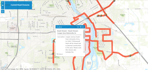
St. Cloud has a live interactive map to help people navigate the city’s road closures. The online information includes long-term road projects, short-term closures for repairs or emergencies, and event-related road closures. The map is updated with every closure that occurs. Just click on the highlighted road segment, and a pop-up window will appear with ...
knsiradio.com
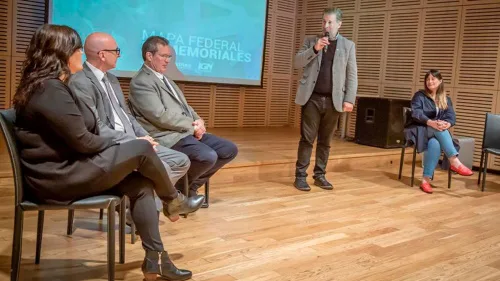
Inauguraron la nueva Plataforma Mapa Federal de Memoriales de Malvinas

Inauguraron la nueva Plataforma Mapa Federal de Memoriales de Malvinas

Con la presencia del ministro de Cultura, Tristán Bauer, el director del Instituto Geográfico Nacional (IGN), Sergio Cimbaro, y el director del Museo Malvinas e Islas del Atlántico Sur, Edgardo Esteban, se inauguró la nueva plataforma del Mapa Federal de Memoriales en el Museo Malvinas. El Mapa Federal de Memoriales de Malvinas reúne no sólo ...
telam.com.ar
Hackathon Gathers Global Students To Tackle Social, Environmental Issues

Hackathon Gathers Global Students To Tackle Social, Environmental Issues

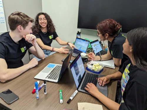
Nearly 150 students from around the world convened in person and virtually in March to take part in the Interplanetary Initiative pilot project SpaceHACK for Sustainability Hackathon at Arizona State University. Participants worked in teams to explore how satellite Earth observations and remote sensing technology from space can be used to better understand and address ...
news.asu.edu
Sivas Belediyesi Su Kaçaklarını Yapay Zekalı Sistemle Tespit Edecek

Sivas Belediyesi Su Kaçaklarını Yapay Zekalı Sistemle Tespit Edecek

Yeni nesil teknoloji şirketi Cerebrum Tech, Sivas Belediyesi Su ve Kanalizasyon İşleri (Sibeski) Müdürlüğü ve Kore Çevresel Endüstri ve Teknoloji Enstitüsü (KEITI), su kaçaklarının yönetimi ve tespitinin sağlanması için birlikte çalışmaya başlıyor. 8 ay sürecek olan ‘Akıllı Su Kaybı Yönetimi Projesi’nde, iki Bölgesel Ölçüm Alanında (DMA) yaklaşık 5000 aboneyi kapsayan bir çalışma gerçekleştirilecek. DMA kontrolünü ...
yenigungazetesi.net

Intermap To Supply Indonesia With 3D Digital Elevation Models

Intermap Technologies, a global leader in 3D geospatial products and intelligence solutions, announced a contract to supply 3D digital elevation models (DEMs) to reduce crop loss for an agricultural company in Indonesia. The country is utilising the Intermap’s precision data for monitoring and site assessment over large areas across the islands of Sumatra and Borneo. ...
fareasternagriculture.com
ISRO To Launch Singapore’s EO Satellite

ISRO To Launch Singapore’s EO Satellite

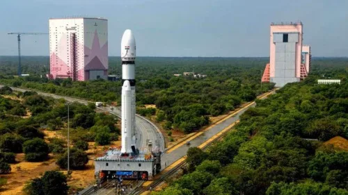
The Indian Space Research Organisation (ISRO) will launch the Singaporean Earth Observation satellite TeLEOS-02 on Saturday, April 22. The launch will take place at 2.19 pm from the first launch pad at Sriharikota. The satellite on board will be TeLEOS 2—a 750kg earth observation satellite that has synthetic aperture radar capable of providing data in ...
geospatialworld.net
La UMA Crea Un Sistema De Seguimiento De Humedales En Tiempo Real

La UMA Crea Un Sistema De Seguimiento De Humedales En Tiempo Real

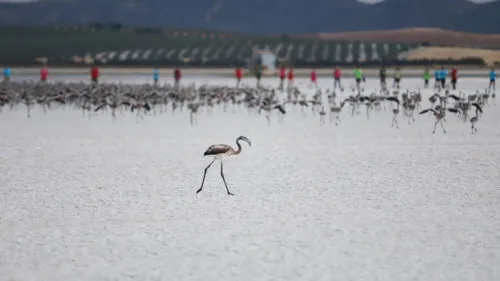
El Centro Temático Europeo de la Universidad de Málaga (ETC-UMA) ha desarrollado un nuevo sistema de seguimiento de humedales basado en datos de teledetección, que ha sido construido sobre la plataforma de computación en la nube ‘Google Earth Engine’ y que ayer fue presentado. En el marco del proyecto para el estudio de la biodiversidad ...
laopiniondemalaga.es
Bayesian Inversion Used To Recover Geometry Of Ruptured Fault

Bayesian Inversion Used To Recover Geometry Of Ruptured Fault

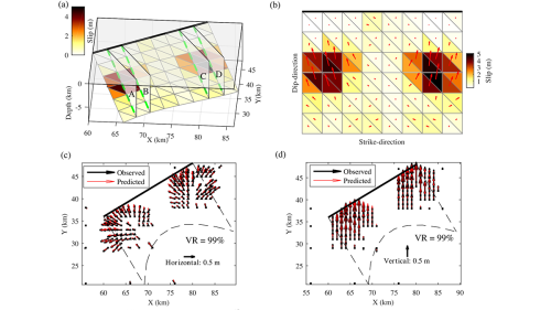
Large earthquakes generally produce ground deformation that can be measured by geodetic instruments. Geophysicists can use these measurements to invert the earthquake source parameters, that is, to recover the earthquake slip on the ruptured fault. However, the conventional inversion of geodetic data does not fully resolve the geometry of the broken fault at depth. Wei ...
eos.org
New Study Finds Shifting Climate Regions Leading To Hotter, Drier Conditions Across Kenya

New Study Finds Shifting Climate Regions Leading To Hotter, Drier Conditions Across Kenya

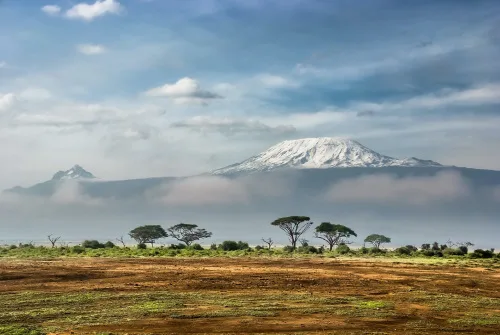
Research published in Regional Environmental Change has shown that as climate zones shift toward hotter and drier conditions, ecological diversity will decline, posing a major threat to terrestrial ecosystems with far-reaching social and ecological impacts. The research team analyzed Kenya’s geographic distribution and arrangement of climate zones between 1980-2020. Over that time, tropical climate regions ...
eurekalert.org
New Project Will Track Changes To Water, Ecosystems And Land Surface

New Project Will Track Changes To Water, Ecosystems And Land Surface

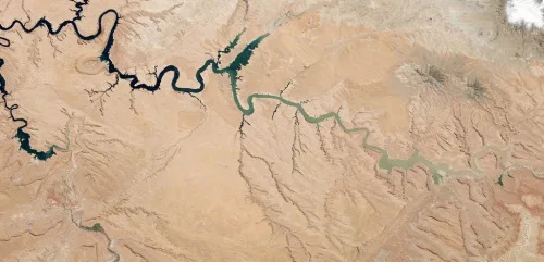
Scientists routinely rely on data-intensive analysis and visualization of satellite observations to track Earth’s ever-changing surface. A new project will make it possible for anyone with an internet connection to begin to answer these questions and more about changes to our dynamic planet. The OPERA (Observational Products for End-Users from Remote Sensing Analysis) project is ...
sciencex.com