Geomaticians

19

GIS-expert Ułatwi Planowanie Przestrzenne W 3D

Jak zapewniają twórcy rozwiązania, jego użytkownicy wcale nie muszą znać tajników modelowania 3D. Aplikacja zawiera bowiem kilkadziesiąt gotowych do wykorzystania szablonów trójwymiarowych modeli budynków, zieleni czy małej architektury. Można również skorzystać z bogatej biblioteki modeli z serwisu Sketchfab. Użytkownicy Placemaker3D mogą ponadto ładować modele 3D istniejącej zabudowy oraz usuwać z tej warstwy wybrane obiekty. Ta ...
geoforum.pl
Dados Sobre O Relevo De Minas São Disponibilizados Pelo Ide-sisema

Dados Sobre O Relevo De Minas São Disponibilizados Pelo Ide-sisema

Informações sobre o relevo de Minas Gerais estão disponíveis na plataforma de dados espaciais do Sistema Estadual de Meio Ambiente e Recursos Hídricos (IDE-Sisema), para pesquisas dos cidadãos sobre as características físicas do território mineiro, além de subsidiar as análises ambientais feitas pelo Governo de Minas. A novidade, publicada na plataforma na última semana, passa ...
agenciaminas.mg.gov.br

Locana Showcases Leading Mobile Geospatial Capabilities To Energy, Utilities And Infrastructure Markets At European Shows

Locana, an international leader in spatial technology, announced that its Lemur mobile GIS solution will be showcased at the International SAP Conference for Utilities in Basel, Switzerland and the ESRI International Infrastructure Management & GIS Conference in Frankfurt, Germany. Both events will address how mobile field work requirements across Europe are rapidly shifting — and ...
directionsmag.com
ICSM Publishes Spatial Cadastre Accuracy Standard

ICSM Publishes Spatial Cadastre Accuracy Standard

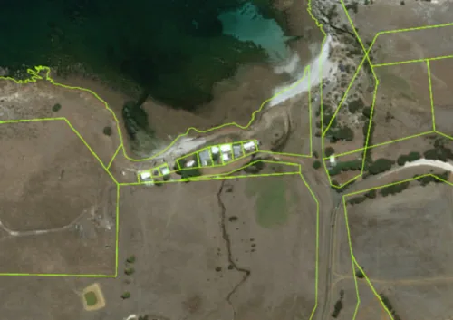
To increase the confidence in, and usefulness of spatial cadastre data, the Intergovernmental Committee on Surveying and Mapping (ICSM) has produced a Standard for the Accuracy of Spatial Cadastres in Australia and New Zealand, along with a Supporting Document. The Standard establishes targets and a reporting framework for acceptable Positional Uncertainty (PU) for the horizontal ...
spatialsource.com.au
Ecopia Partners With Nextnav To Equip First Responders With 3D Visualizations

Ecopia Partners With Nextnav To Equip First Responders With 3D Visualizations

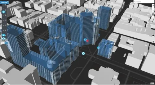
Ecopia AI (Ecopia) and NextNav announced a partnership that will enable first responders to visualize situations in 3D and locate where in a building an emergency call is coming from. The partnership combines NextNav’s mission-critical z-axis positioning solution derived from ground stations and barometric calibration with Ecopia’s comprehensive, accurate, and up-to-date 3D building data generated ...
geospatialworld.net
Esri Releases Reality Mapping Extension For ArcGIS Pro

Esri Releases Reality Mapping Extension For ArcGIS Pro

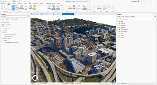
A large, new release of Esri’s desktop GIS software ArcGIS Pro has been released. Version 3.1 includes many new features and tools. Perhaps the biggest new feature is a reality mapping toolbox named ArcGIS Reality for ArcGIS Pro. The extension complements ArcGIS Pro’s ortho mapping capability with high-fidelity 2D and 3D product generation. This new ...
geoweeknews.com

AIIMS To Launch India-made Real-time Navigation System

All India Institute of Medical Sciences (AIIMS), New Delhi, to launch an internal navigation system to help patients and their caregivers with accurate location. To help it materialise as soon as possible, a five-member team has been formed by Dr M Srinivas, Director, AIIMS. The team, headed by Dr Vivek Tandon from the neurosurgery department, ...
newindian.in
Cartographier Les Arbres Géants Pour Mieux Les Protéger

Cartographier Les Arbres Géants Pour Mieux Les Protéger

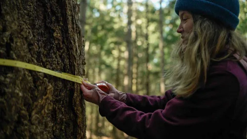
Une nouvelle carte géographique publique, qui répertorie les grands arbres en Colombie-Britannique, vient d’être lancée en février 2023. L’organisme responsable du projet, la Raincoast Conservation Foundation, invite les citoyens à mesurer les arbres géants qui trônent autour d’eux. En les rendant visibles à tous, ils espèrent sensibiliser les populations à la protection des forêts. La ...
ici.radio-canada.ca

Neue Plattform Beleuchtet Die Bioökonomie

Eine biobasierte Wirtschaft, die sich an natürlichen Kreisläufen orientiert, nachhaltig und klimaneutral ist – das ist das Ziel der Bioökonomiestrategie der Bundesregierung. Doch entwickelt sich die Bioökonomie in allen Bereichen in die gewünschte Richtung? Die Nutzung von Biomasse kann zu Zielkonflikten führen, die nicht immer auf den ersten Blick sichtbar sind, weil sie global oder ...
idw-online.de
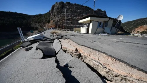
Heigit Disaster Portal Erfolgreich Nach Erdbeben In Der Türkei Und In Syrien Eingesetzt

Heigit Disaster Portal Erfolgreich Nach Erdbeben In Der Türkei Und In Syrien Eingesetzt

Das Heidelberg Institute for Geoinformation Technology (HeiGIT) hat im Februar 2023 mit Input des GIS-Team Nahost der Médecins Sans Frontières (Ärzte ohne Grenzen/MSF) sein Disaster Portal für die betroffene Region eingerichtet. Das Portal ist ein wichtiges Werkzeug für Hilfsorganisationen wie MSF und hilft mit seinen Echtzeitinformationen, die Einsätze der Helfer:innen vor Ort effizient zu planen. ...
idw-online.de

ChatGPT-style Tool For Satellite Photos Already Exists

Corey Jaskolski, founder and CEO of Synthetaic, dubbed his satellite image scanning tool Rapid Automatic Image Categorization, or RAIC. After the Chinese weather balloon incident caught the nation’s attention in January, Jaskolski applied RAIC to satellite photos of the Earth’s surface, as collected by geospatial satellite imaging company Planet. He was able to trace the ...
govtech.com