Geomaticians

06

Seoul Robotics Partners With Temple For Street-level 3D Solutions

Seoul Robotics, the company powering smart 3D infrastructure solutions, announced a distribution partnership with Temple, a provider of intelligent transportation systems, to bring its proprietary software, SENSR™, to customers in the Southeast. This is Seoul Robotics’ first partnership with a transportation technology distributor in the U.S. and will expand the company’s deployment of smart infrastructure ...
geospatialworld.net
Drones To Tally Canines

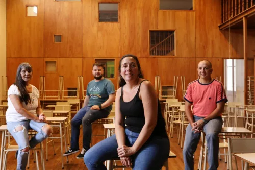
The Bruhat Bengaluru Mahanagara Palike (BBMP) is contemplating using drones to aid the upcoming dog census in the city. According to the officials, the technology is being actively considered as it will help cover a larger area in a short period and will give a better understanding of the stray population. “Property surveys in the ...
bangaloremirror.indiatimes.com

Signing Ceremony Of New Documents Of Cooperation Between Tajikistan And Azerbaijan

Following the meeting and negotiations at the highest level between Tajikistan and Azerbaijan, a ceremony of signing of new documents of cooperation took place. Agreement between the Government of the Republic of Tajikistan and the Government of the Republic of Azerbaijan on cooperation in the field of geodesy, cartography, land surveying, cadastre and remote land ...
einnews.com
Desarrollan Mapas Temáticos Que Reflejan Cambios Ambientales Producidos Por La Actividad Agropecuaria

Desarrollan Mapas Temáticos Que Reflejan Cambios Ambientales Producidos Por La Actividad Agropecuaria

Investigadores que trabajan en el Laboratorio de Investigación y Reflexión en Agroecología (LIRA), de la Facultad de Ciencias Agrarias y Forestales de la UNLP diseñan, a partir de diferentes índices calculados, mapas temáticos que permiten visualizar el riesgo ambiental de las actividades agropecuarias en la provincia de Buenos Aires. Cuando se habla de riesgo, entran ...
unlp.edu.ar
Scientists Use NASA Satellite Data To Determine Belize Coral Reef Risk

Scientists Use NASA Satellite Data To Determine Belize Coral Reef Risk

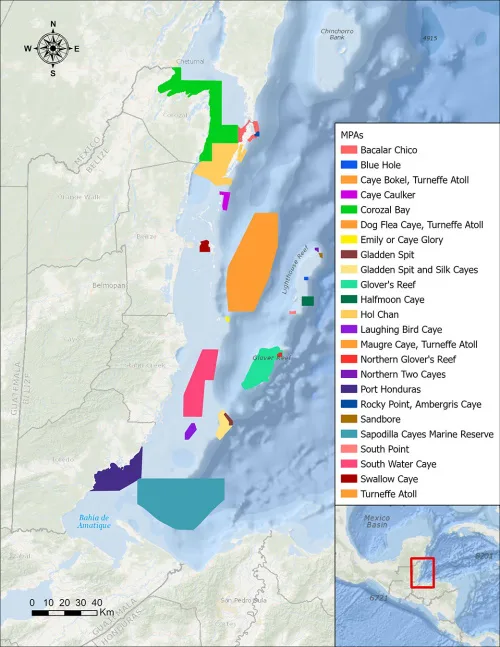
Using two decades of NASA satellite measurements stored in the cloud, scientists recently assessed the vulnerability of Belize’s renowned coral reefs to bleaching and collapse. The findings could help management authorities protect the reefs from human impacts such as development, overfishing, pollution, and climate change. In a study published in Frontiers in Remote Sensing, the ...
climate.nasa.gov

Civil Engineers Use Public Satellite Images To Study Why The Jagersfontein Dam Failed

On 11 September 2022, a diamond mine waste storage facility, known as a tailings dam, failed in the town of Jagersfontein in the Free State province of South Africa. In the failure, one person was killed and multiple homes destroyed. Tailings are the finely ground leftovers that remain after valuable metals are removed from rock ...
sciencedaily.com

Calgary Researcher Hoping To Drive Change For People With Dementia

“Physicians usually use a cognitive assessment, with pen and paper usually, to determine whether a driver is fit to drive. But these assessments are very limited,” said Dr. Sayeh Bayat, an assistant professor in both the University of Calgary’s department of biomedical engineering and geomatics engineering at the Schulich School of Engineering. Bayat recently received ...
globalnews.ca