Geomaticians

December

United States, Australia Ocean Science Agencies Team Up To Explore And Map Pacific Ocean

United States, Australia Ocean Science Agencies Team Up To Explore And Map Pacific Ocean

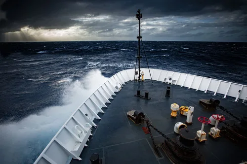
NOAA and two of Australia’s leading science agencies announced a formal agreement Tuesday to work together to advance Pacific Ocean exploration and mapping, a major priority for NOAA and of the United Nations Decade of Ocean Science for Sustainable Development. The memorandum of understanding (MOU) was signed by NOAA Administrator Rick Spinrad, Ph.D., Geoscience Australia ...
oceanexplorer.noaa.gov

무주군, 공간정보시스템 시범운영

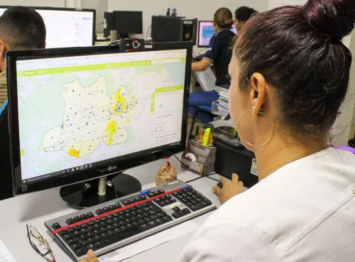
무주군이 각종 지하시설물과 행정정보를 쉽고 편리하게 확인할 수 있는 공간정보시스템을 시범운영 한다. 15일 무주군에 따르면 이번에 운영하는 공간정보시스템은 도로와 지하시설물(상·하수도)의 체계적인 유지 관리, 토지대장, 공시지가, 토지이용계획, 부동산 정보는 물론 군민들의 생활과 밀접한 지번, 도로명 주소, 건물 위치 등 각종 정보를 쉽게 확인할 수 있는 시스템이다. 또한 연도별 항공사진을 탑재함으로써 특정 지역의 위성 영상 변화를 시계열로 ...
jeollailbo.com

Gugik Prezentuje Mapę Pokrycia Terenu Polski

Centralny zasób geodezyjny i kartograficzny wzbogacił się właśnie o mapę pokrycia terenu Polski w skali 1:500 000. Głównym źródłem danych dla tej mapy były bazy: Państwowego rejestru granic (PRG), Państwowego rejestru nazw geograficznych (PRNG), Bazy danych obiektów topograficznych (BDOT10k), Bazy danych obiektów ogólnogeograficznych (BDOO), urzędowego wykazu polskich nazw geograficznych świata, Generalnej Dyrekcji Dróg Krajowych i ...
geoforum.pl
Milano Lancia Il Suo Primo Progetto Di Scienza Partecipata

Programmare interventi mirati di prevenzione e cura della popolazione partendo dai dati raccolti su piccole porzioni di città. Un primo progetto di citizen science per creare politiche che migliorino la qualità della vita dei milanesi. Sono questi i pilastri del progetto Ciao Milano, dimmi come stai! finanziato da Fondazione Cariplo, coordinato dalla Ats (Agenzia per ...
wired.it

Trelleborg Launches Advanced Navigation System For Panama Canal

Trelleborg Marine and Infrastructure launches its latest fixed-installed piloting unit, SafePilot P3, developed in response to the recent advisory issued by the Panama Canal Authority (ACP) requiring a new positioning system for Neopanamax vessels beginning in October 2023. SafePilot P3 from Trelleborg is a high-accuracy navigation solution that provides real-time certified data to and from ...
drycargomag.com
China Launches New Remote Sensing Satellite_

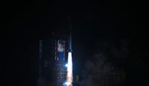
China Launches New Remote Sensing Satellite

China has sent a new remote sensing satellite into space from the Xichang Satellite Launch Center in the southwestern province of Sichuan. The satellite, Yaogan-36, was launched by a Long March-2D carrier rocket at 2:25 a.m. (Beijing Time) on Thursday, and entered its planned orbit successfully. The launch was the 455th flight mission of the ...
english.news.cn

SI Imaging Services, Terra Cover Signs An MOU To Expand The Use Of Satellite Images

SI Imaging Services announced that it signed an MOU with Terra Cover, a company specializing in AI-based geospatial analytics. Through this agreement, the two companies plan to focus on various technology businesses using satellite imagery data. It is to seek various collaborations in terms of technology and data in line with this point in time ...
geospatialworld.net

GPS Signals Are Being Disrupted In Russian Cities

New data analysis reveals that multiple major Russian cities appear to have faced widespread GPS disruption during the past week. The signal interference follows Ukraine launching long-range drone attacks deep into Russian territory, and it may act as a way to potentially stop drones that rely upon GPS for navigation, experts say. The GPS interference ...
wired.com

New Tailte Éireann Agency To Provide Streamlined Access To Land And Geospatial Services To Public And Government

The Tailte Éireann Bill 2022 which today (14 December 2022) passed through both Houses of the Oireachtas provides for an authoritative new centralised agency to provide a property registration system, property valuation service, and national mapping and surveying infrastructure for the State. This will be achieved through a merger of the Property Registration Authority, Valuation ...
gov.ie

NASA Has Lost Contact With A Hurricane-watching Satellite

NASA is working to reestablish contact with one of the eight spacecraft that make up its Cyclone Global Navigation Satellite System (CYGNSS) constellation, which monitors hurricanes. CYGNSS is the first space-based system to collect frequent measurements of wind speeds from the ocean’s surface near the eye of storms such as tropical cyclones, typhoons and hurricanes. ...
space.com
Esri's GIS Helps Vodafone Create National Digital Twin

Esri’s GIS Helps Vodafone Create National Digital Twin

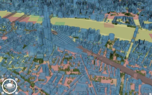
Vodafone has created a 3D digital twin of its UK mobile mast network to allow its engineers to visualise and strategise network improvements or expansion. It will allow them to make instant decisions to improve services to customers without leaving their desks. The digital twin involved mapping more than 40 million environmental features using advanced ...
directionsmag.com

Meta, Microsoft, AWS And TomTom Launch The Overture Maps Foundation To Develop Interoperable Open Map Data

The Linux Foundation has partnered with some of the world’s biggest technology companies to develop interoperable and open map data, in what is a clear move to counter Google’s dominance in the mapping realm. The Overture Maps Foundation, as the new effort is called, is officially hosted by the Linux Foundation, but the program is ...
techcrunch.com

Brasileiros Criam Satélite Para Prever Interferências Em Sinal De Geolocalização

Cientistas brasileiros estão entre os encarregados de uma missão espacial para estudar anomalias que bloqueiam sinais de satélite. Com o lançamento do Sport no final deste mês, será possível entender, com maior precisão, como essas ocorrências afetam a infraestrutura de comunicação. Sigla para Tarefa de Pesquisa, Observação e Previsão de Cintilação, o Sport resultou da ...
acessa.com
Amazonas Ganha Plataforma Georreferenciada Com Mapas E Dados Sobre Educação E Trabalho

Amazonas Ganha Plataforma Georreferenciada Com Mapas E Dados Sobre Educação E Trabalho

O Amazonas passa a contar, pela primeira vez, com o Geoportal Amazonas em Mapas, uma plataforma on-line georreferenciada com dados públicos em formato de mapas que serão úteis para a formulação de políticas públicas no estado. A ferramenta faz parte da parceria entre o Governo do Amazonas, por meio da Secretaria de Desenvolvimento Econômico, Ciência, ...
agenciaamazonas.am.gov.br
Pampa Sul-americano Perde Um Quinto Da Vegetação Campestre Entre 1985 E 2021

Pampa Sul-americano Perde Um Quinto Da Vegetação Campestre Entre 1985 E 2021

A análise de imagens de satélite captadas entre 1985 e 2021 por uma rede colaborativa de especialistas da Argentina, Brasil e Uruguai, sob coordenação do MapBiomas, mostra que o Pampa Sul-Americano perdeu 20% de sua vegetação campestre no período, incluindo 8,7 milhões de hectares de campos nativos e 260 mil hectares de florestas. Os dados ...
extraclasse.org.br
Con Datos Geoespaciales Cuantifican El Estado De Los Suelos Degradados En Chile

Con Datos Geoespaciales Cuantifican El Estado De Los Suelos Degradados En Chile

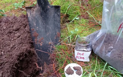
El Ministerio de Agricultura impulsó en 2010 el ‘Sistema de Incentivos para la Recuperación de Suelos Degradados (SIRSD-S)’, un instrumento que busca rescatar el potencial productivo de los suelos agropecuarios en degradación. La iniciativa es coordinada por la Subsecretaría de Agricultura y ejecutada por el Servicio Agrícola y Ganadero (SAG), en conjunto con el Instituto ...
mundoagro.cl
AgEagle Introduces The New eBee VISION Intelligence, Surveillance And Reconnaissance Drone

AgEagle Introduces The New eBee VISION Intelligence, Surveillance And Reconnaissance Drone

AgEagle Aerial Systems Inc. , an industry-leading provider of full stack flight hardware, sensors and software for commercial and government/defense use, today announced its introduction of the new eBee™ VISION, a small, fixed-wing unmanned aerial system (“UAS”) designed to provide real-time, enhanced situational awareness for critical Intelligence, Surveillance and Reconnaissance (“ISR”) missions. Scheduled for global ...
uasweekly.com
Airbus Foundation Looks To Put Satellites To New Biodiversity Conservation Uses

Airbus Foundation Looks To Put Satellites To New Biodiversity Conservation Uses

The Airbus Foundation and the Connected Conservation Foundation (CCF) recently announced a new award for research that would use satellites to aid in biodiversity conservation. The application period, open to individual researchers and nonprofit organizations, began Dec. 5 and ends Feb. 3, 2023. A team of four judges will assess the potential of proposals designed ...
news.mongabay.com

High Tech Snow Flights To Cover Most Of California’s Watersheds This Year

You probably didn’t notice a twin-engine prop plane loaded with high-tech equipment circling 23,000 feet over the San Joaquin Valley’s upper watersheds this fall. But it was there, gathering information about those watersheds in their “snow off” condition. That detailed information will be vital to multiple follow up flights of Airborne Snow Observatories, Inc. (ASO) ...
kvpr.org

Iran, Russia Sign Deal To Develop Space Cooperation

The agreement was signed by the head of Iran’s Space Agency Hassan Salarieh and the chief of Russia’s space agency, Roscosmos Yury Borisov on the sidelines of an International Aerospace Exhibition in Kish Island in southern Iran in the Persian Gulf. This cooperation document includes a variety of topics, including cooperation in the construction of ...
en.mehrnews.com
Unveiling Italy’s Hidden History With Fixed-wing Mapping UAVs

Unveiling Italy’s Hidden History With Fixed-wing Mapping UAVs

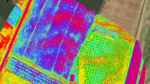
Mapping an archaeological site is key to being able to dig with greater precision. Now with the latest digital methods, areas of interest can easily be identified rapidly and non-invasively – helping to protect the site and future excavations. Here, Chris Thompson, Global Sales Manager at AgEagle, looks at how a team of Duke University ...
gim-international.com
Ora Bologna È Tridimensionale, Ecco La Mappa Per Navigare In Città

Ora Bologna È Tridimensionale, Ecco La Mappa Per “Navigare” In Città

Una mappa web che consente di visualizzare in modalità tridimensionale il contenuto della CTC – Carta Tecnica Comunale. La mette a disposizione il Comune di Bologna, aggiornando la cartografia in scala 1:2000, realizzata nel 2001 con il metodo fotogrammetrico diretto (rilievo per punti con riferimenti spaziali – ndr). Quindi, ad esempio, vengano mappati gli edifici, ...
bolognatoday.it

Satellogic Firma Carta De Intención Con La Agencia Espacial Mexicana Para Programa Satelital Dedicado De Observación De La Tierra

Satellogic Inc., líder en recolección de datos de Observación de la Tierra de resolución submétrica, anunció hoy que firmó una carta de intención (“LOI” por sus siglas en inglés – Letter of Intent) con la Agencia Espacial Mexicana (“AEM”) para desarrollar un programa integral de ‘constelación como servicio’ para monitorear aproximadamente 2 millones de kilómetros ...
technocio.com

ESPECIAL: Panamá Prevé Potenciación De Posibilidades Con “Hub” Digital Copernicus

La operación del “hub” (centro de conexiones) digital Copernicus en Panamá, mediante el cual la Unión Europea (UE) pone a disposición información de un conjunto de satélites para la observación de la Tierra, potenciará al país como un “hub” en diferentes campos, al aprovechar su estratégica posición geográfica en el istmo centroamericano. Representantes del gobierno ...
spanish.peopledaily.com.cn

Banco De Alimentos FESBAL-UPM Utiliza Mapas Inteligentes Para Luchar Contra El Desperdicio

La Cátedra Banco de Alimentos FESBAL-UPM busca dar seguimiento a la lucha contra el desperdicio alimentario. Para ello, ha desarrollado un geoportal para poner a disposición de la ciudadanía, investigadores, y el sector público y privado la información de los bancos de alimentos y sus actividades de apoyo a la seguridad alimentaria y al consumo ...
retema.es

OGC Seeking Public Comment On Update To GeoSPARQL Standard

The Open Geospatial Consortium (OGC) is seeking public comment on the adoption of GeoSPARQL v1.1 as an OGC Standard. OGC GeoSPARQL extends W3C’s SPARQL to provide a geographic query language for RDF data. Comments are due by 11 January, 2023. Version 1.1 of GeoSPARQL extends the originally published standard in 2012 that is used for ...
directionsmag.com

Hexagon And OSASI Technos Partner To Develop Disaster Management And Prediction Solutions

Hexagon’s Safety, Infrastructure & Geospatial division and OSASI Technos Inc. have announced a partnership to deliver next-generation disaster management and monitoring solutions. Using 3D visualization capabilities, governments will be able detect, predict and simulate impending disasters, enabling them to better plan for and respond to impending disasters, enabling them to better plan for and respond ...
geospatialworld.net
Tsunami Warning Systems Improved Using Signals From Earth’s Ionosphere

Tsunami Warning Systems Improved Using Signals From Earth’s Ionosphere

The study, ‘Spectral Characteristics of Ionospheric Disturbances Over the Southwestern Pacific From the 15 January 2022 Tonga Eruption and Tsunami,’ explores how evidence from the ionosphere explains why the tsunami grew larger and travelled faster than tsunami forecasts predicted. Due to tsunamis being an extremely rare natural disaster, current tsunami warning systems are far from ...
innovationnewsnetwork.com
'Google Earth On Steroids' Gives A Boost To Urban Development

‘Google Earth On Steroids’ Gives A Boost To Urban Development

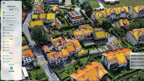
A new approach uses aerial imaging to generate 3D models of cities and regions with advanced precision, enabling urban planners to incorporate full-scale designs of all types of architectural and urban structures. Two months ago, EPFL spin-off Uzufly moved into The Garage, a business incubator at EPFL Innovation Park where startups can grow and expand. ...
techxplore.com
Smartsurveyor, Czyli Odbiornik Do Ręki I Dla Drona

Smartsurveyor, Czyli Odbiornik Do Ręki I Dla Drona

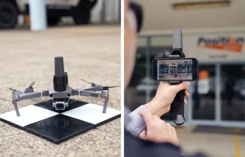
Australijska firma Position Partners zaprezentowała odbiornik satelitarny SmartSurveyor, który służy nie tylko do zwykłych pomiarów satelitarnych, ale także w pracach fotogrametrycznych. Producent promuje to rozwiązanie hasłem „3 w 1”. Jego pierwszym zastosowaniem jest możliwość integracji z popularnymi dronami DJI Mavic serii 2 i 3 oraz Phantom 4. W tym przypadku ciekawą cechą urządzenia jest brak ...
geoforum.pl