Geomaticians

23

Venezuela Contará Con Nueva Estación Para Sistema De Navegación Global Por Satélite En 2023

Representantes de la Agencia Bolivariana de Actividades Espaciales (ABAE) y de la corporación espacial rusa Roscosmos firmaron un convenio para la instalación de una nueva estación de medición para el Sistema de Navegación Global por Satélite (Glonass por sus siglas en ruso) en la Base Aeroespacial Capitán Manuel Ríos, ubicada en la población El Sombrero, ...
correodelorinoco.gob.ve
El JEME Firma Un Importante Protocolo Con El Ministerio De Transportes

El JEME Firma Un Importante Protocolo Con El Ministerio De Transportes

El jefe de Estado Mayor del Ejército (JEME), general de ejército Amador Enseñat, ha presidido la firma del Protocolo General de Actuación con el Ministerio de Transportes, Movilidad y Agenda Urbana, que ha tenido lugar el 21 de diciembre, en el Palacio de Buenavista, sede del Cuartel General del Ejército. Esta rúbrica tiene como finalidad ...
ejercito.defensa.gob.es

Russia Provides Space Imagery Of The Earth’s Territories To The BRICS Countries

The data were provided within the framework of the agreement signed in 2021 between the BRICS countries on exchanging such information to tackle climate change, help protect the environment and mitigate the consequences of natural and man-made emergencies and disasters. “From June to October 2022, under a contract with Roscosmos, a space survey of foreign ...
tvbrics.com

NASA Awards SpaceX Launch Services Contract For Sentinel-6B

NASA has selected Space Exploration Technologies (SpaceX) to provide launch services for the Sentinel-6B mission. Sentinel-6B will continue the long-term global sea level data record begun in 1992 by Topex/Poseidon, followed by Jason 1, 2, 3, and Sentinel-6 Michael Freilich. The mission is a partnership between NASA, the National Oceanic and Atmospheric Administration, the European ...
spacewatch.global
Six Malaysian City Councils To Get Centralised Platform By 2025

Six Malaysian City Councils To Get Centralised Platform By 2025

Quantela and Malaysian-based Geographic Information System (GIS), MAP2U entered a partnership to roll out what they claim to be Malaysia’s first centralised platform for urban observatory and smart city services by 2025. The move was done for PLANMalaysia, an agency under the Ministry of Housing and Local Government tasked with urban planning services. Under its ...
digitalnewsasia.com
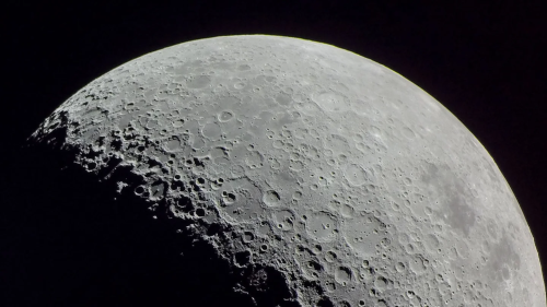
This Map-Making AI Could Be The First Step Towards GPS On The Moon

This Map-Making AI Could Be The First Step Towards GPS On The Moon

On Earth, “we have GPS, and it’s easy to take advantage of that and not think about all the technology that goes into it,” says Alvin Yew, a research engineer at NASA’s Goddard Space Flight Center in Greenbelt, Maryland. “But now when we’re on the moon, we just don’t have that.” Inspired by previous research ...
popsci.com