Geomaticians

16

무주군, 공간정보시스템 시범운영

무주군이 각종 지하시설물과 행정정보를 쉽고 편리하게 확인할 수 있는 공간정보시스템을 시범운영 한다. 15일 무주군에 따르면 이번에 운영하는 공간정보시스템은 도로와 지하시설물(상·하수도)의 체계적인 유지 관리, 토지대장, 공시지가, 토지이용계획, 부동산 정보는 물론 군민들의 생활과 밀접한 지번, 도로명 주소, 건물 위치 등 각종 정보를 쉽게 확인할 수 있는 시스템이다. 또한 연도별 항공사진을 탑재함으로써 특정 지역의 위성 영상 변화를 시계열로 ...
jeollailbo.com

Gugik Prezentuje Mapę Pokrycia Terenu Polski

Centralny zasób geodezyjny i kartograficzny wzbogacił się właśnie o mapę pokrycia terenu Polski w skali 1:500 000. Głównym źródłem danych dla tej mapy były bazy: Państwowego rejestru granic (PRG), Państwowego rejestru nazw geograficznych (PRNG), Bazy danych obiektów topograficznych (BDOT10k), Bazy danych obiektów ogólnogeograficznych (BDOO), urzędowego wykazu polskich nazw geograficznych świata, Generalnej Dyrekcji Dróg Krajowych i ...
geoforum.pl

Milano Lancia Il Suo Primo Progetto Di Scienza Partecipata

Programmare interventi mirati di prevenzione e cura della popolazione partendo dai dati raccolti su piccole porzioni di città. Un primo progetto di citizen science per creare politiche che migliorino la qualità della vita dei milanesi. Sono questi i pilastri del progetto Ciao Milano, dimmi come stai! finanziato da Fondazione Cariplo, coordinato dalla Ats (Agenzia per ...
wired.it

Trelleborg Launches Advanced Navigation System For Panama Canal

Trelleborg Marine and Infrastructure launches its latest fixed-installed piloting unit, SafePilot P3, developed in response to the recent advisory issued by the Panama Canal Authority (ACP) requiring a new positioning system for Neopanamax vessels beginning in October 2023. SafePilot P3 from Trelleborg is a high-accuracy navigation solution that provides real-time certified data to and from ...
drycargomag.com
China Launches New Remote Sensing Satellite_

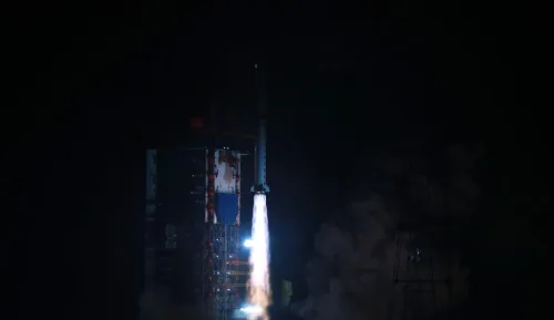
China Launches New Remote Sensing Satellite

China has sent a new remote sensing satellite into space from the Xichang Satellite Launch Center in the southwestern province of Sichuan. The satellite, Yaogan-36, was launched by a Long March-2D carrier rocket at 2:25 a.m. (Beijing Time) on Thursday, and entered its planned orbit successfully. The launch was the 455th flight mission of the ...
english.news.cn

SI Imaging Services, Terra Cover Signs An MOU To Expand The Use Of Satellite Images

SI Imaging Services announced that it signed an MOU with Terra Cover, a company specializing in AI-based geospatial analytics. Through this agreement, the two companies plan to focus on various technology businesses using satellite imagery data. It is to seek various collaborations in terms of technology and data in line with this point in time ...
geospatialworld.net

GPS Signals Are Being Disrupted In Russian Cities

New data analysis reveals that multiple major Russian cities appear to have faced widespread GPS disruption during the past week. The signal interference follows Ukraine launching long-range drone attacks deep into Russian territory, and it may act as a way to potentially stop drones that rely upon GPS for navigation, experts say. The GPS interference ...
wired.com

New Tailte Éireann Agency To Provide Streamlined Access To Land And Geospatial Services To Public And Government

The Tailte Éireann Bill 2022 which today (14 December 2022) passed through both Houses of the Oireachtas provides for an authoritative new centralised agency to provide a property registration system, property valuation service, and national mapping and surveying infrastructure for the State. This will be achieved through a merger of the Property Registration Authority, Valuation ...
gov.ie

NASA Has Lost Contact With A Hurricane-watching Satellite

NASA is working to reestablish contact with one of the eight spacecraft that make up its Cyclone Global Navigation Satellite System (CYGNSS) constellation, which monitors hurricanes. CYGNSS is the first space-based system to collect frequent measurements of wind speeds from the ocean’s surface near the eye of storms such as tropical cyclones, typhoons and hurricanes. ...
space.com
Esri's GIS Helps Vodafone Create National Digital Twin

Esri’s GIS Helps Vodafone Create National Digital Twin

Vodafone has created a 3D digital twin of its UK mobile mast network to allow its engineers to visualise and strategise network improvements or expansion. It will allow them to make instant decisions to improve services to customers without leaving their desks. The digital twin involved mapping more than 40 million environmental features using advanced ...
directionsmag.com

Meta, Microsoft, AWS And TomTom Launch The Overture Maps Foundation To Develop Interoperable Open Map Data

The Linux Foundation has partnered with some of the world’s biggest technology companies to develop interoperable and open map data, in what is a clear move to counter Google’s dominance in the mapping realm. The Overture Maps Foundation, as the new effort is called, is officially hosted by the Linux Foundation, but the program is ...
techcrunch.com