Geomaticians

13

Smartsurveyor, Czyli Odbiornik Do Ręki I Dla Drona

Smartsurveyor, Czyli Odbiornik Do Ręki I Dla Drona

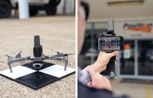
Australijska firma Position Partners zaprezentowała odbiornik satelitarny SmartSurveyor, który służy nie tylko do zwykłych pomiarów satelitarnych, ale także w pracach fotogrametrycznych. Producent promuje to rozwiązanie hasłem „3 w 1”. Jego pierwszym zastosowaniem jest możliwość integracji z popularnymi dronami DJI Mavic serii 2 i 3 oraz Phantom 4. W tym przypadku ciekawą cechą urządzenia jest brak ...
geoforum.pl

Immersion Dans Versity®, Le Premier Metaverse Immobilier Au Monde

“Les Agences de Papa” est une agence immobilière 100 % digitale, créée fin 2019. Sa particularité, ce sont ses frais d’agence peu élevés, ce qui nous a poussés à rechercher de l’efficacité dans nos actions. L’idée étant de penser autrement l’immobilier. Néanmoins, au gré de notre activité, nous avons réalisé qu’une problématique était récurrente : ...
latribune.fr
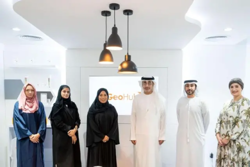
بلدية دبي تُعلن عن إطلاق حاضنة الأعمال والابتكار الجيومكانية جيوهب

بلدية دبي تُعلن عن إطلاق حاضنة الأعمال والابتكار الجيومكانية “جيوهب”

أعلنت بلدية دبي عن إطلاق حاضنة الأعمال والابتكار الجيومكانية “جيوهب”، التي تُعدُّ الحاضنة الجيومكانية الرسمية الأولى من نوعها في المنطقة، وذلك في إطار التعاون المشترك بين مركز نظم المعلومات الجغرافية التابع للبلدية، ومؤسسة محمد بن راشد لتنمية المشاريع الصغيرة والمتوسطة، ومركز حمدان للإبداع والابتكار، حيث ترتكز الحاضنة في وتكوينها على منظومتين أساسيتين في الإبداع والابتكار ...
zawya.com
Cantabria Crea Su Propio Gemelo Digital

Cantabria Crea Su Propio Gemelo Digital

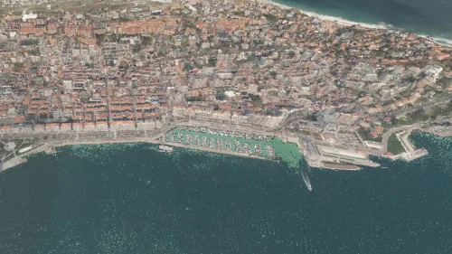
Cantabria ya tiene un gemelo digital. El gobierno autónomo ha creado una réplica virtual de las 533.000 hectáreas que componen la comunidad, en el que se puede ver en 3D todo su territorio y edificios. En una alianza con el Centro Nacional de Información Geográfica (CNIG), el Gobierno de Cantabria ha creado uno de los ...
ciospain.es

Ki-unterstütztes Datenprodukt Wertet Standortanalysen Auf Digitalen Landkarten Auf

„Gleich und Gleich gesellt sich auch im Handel gern”, sagt Marc Urner, Senior Manager bei WIGeoGIS, einem der führenden Anbieter von Geomarketing und GIS-Software in Europa. „So wird man zum Beispiel in einer Luxusmeile keinen Hermes Paketshop finden, dafür aber einen Hermès Paris“, erklärt er. Anders gesagt: Handel, Gastronomie und konsumnahe Dienstleister suchen für ihre ...
ots.at
Swiss Unis Develop Population Density Tool To Help Humanitarian Work

Swiss Unis Develop Population Density Tool To Help Humanitarian Work

EPFL researchers, along with scientists from the Federal Technology Institute ETH Zurich and Qatar’s Bin Khalifa University, thus worked on an artificial intelligence tool which can estimate population density and help reconstruction or crisis management efforts. The programme – as outlined in the Scientific Reports journal – uses data gleaned via remote sensing concerning factors ...
swissinfo.ch
Golden Bauhinia Satellite No. 1 0506 Successfully Launched The Application Of Remote Sensing Data Enters Fast Lane

Golden Bauhinia Satellite No. 1 05/06 Successfully Launched The Application Of Remote Sensing Data Enters Fast Lane

Hong Kong Aerospace Technology Group Limited announced last Friday 9 December 2022, two satellites under Golden Bauhinia No. 1 05/06 have been launched from the sea launch platform in the Yellow Sea area, China, using the Jielong — 3 (Y1) carrier rocket which marked its first sea hot launch. Both of Golden Bauhinia No. 1 ...
prnewswire.com
Interactive ​​​​​​​NYC Tree Map Aims To Help Residents Care For Urban Forest

Interactive ​​​​​​​NYC Tree Map Aims To Help Residents Care For Urban Forest

New York City launched a comprehensive map showing the location, species, maintenance status and other information of about 800,000 trees located in city parks and along its streets, the city’s Department of Parks and Recreation announced last week. The tool builds on a previous map that listed 650,000 street trees. In addition to helping users ...
smartcitiesdive.com