Geomaticians

08

디지털지도 POI 데이터 활용해 유동인구 및 상권 분석 추출

국토연구원 국토모니터링연구센터 국토데이터랩 이영민 부연구위원은 워킹페이퍼를 통해 세종시를 사례로 POI(관심지점) 데이터를 활용한 활동 중심지 추출 및 분석 방법을 소개했다. 이영민 부연구위원은 “이번 연구는 사람들의 활동을 나타내는 POI 데이터를 활용해 도시공간의 활동 중심지를 추출하고 분석하는 방법을 제안한 것으로 해당 방법을 통해 세종시의 공간구조나 중심지 체계 구상을 위한 방향 설정에 기여하고자 한다”고 밝혔다.
pmnews.co.kr
Profesora Y Alumno Idean Aplicación Para Registrar Distintos Tipos De Incendios

Profesora Y Alumno Idean Aplicación Para Registrar Distintos Tipos De Incendios

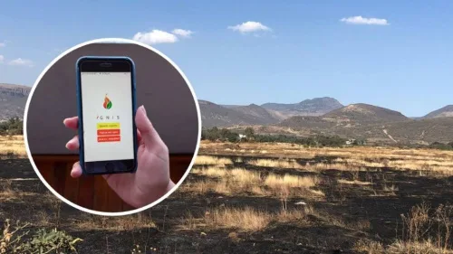
Una profesora y un estudiante de la Universidad de Guanajuato (UG), del Departamento de Ingeniería Geomática e Hidráulica, crearon una aplicación que realiza el reporte de diferentes tipos de incendios, esta “app” vincula, directamente, los reportes a las distintas instituciones encargadas de controlar y apagar el fuego. La investigadora de la Universidad de Guanajuato explicó ...
lasillarota.com
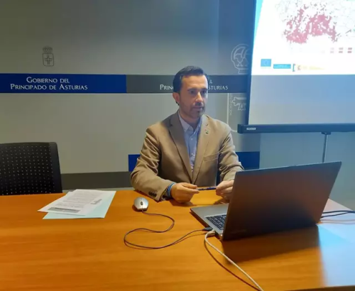
El Principado Publica Una Recopilación De Datos Cartográficos Sobre Espacios Naturales Y Animales Silvestres

El Principado Publica Una Recopilación De Datos Cartográficos Sobre Espacios Naturales Y Animales Silvestres

La Consejería de Medio Rural y Cohesión Territorial ha publicado la mayor recopilación divulgada hasta ahora de datos cartográficos sobre los espacios naturales protegidos que integran la Red Natural de Asturias (RENA) y los animales silvestres que los habitan, un trabajo que permitirá mejorar su conocimiento y gestión. La información incluye más de 15.000 referencias ...
europapress.es

Coclico, El Proyecto Europeo Que Analiza Riesgos Costeros E Implementa Medidas De Adaptación Más Eficientes Y Sostenibles

IHCantabria, junto a otras diecisiete instituciones socias como Deltares (Países Bajos), Sayers and partners LLP (Reino Unido) o el Global Climate Forum EV (Alemania), está desarrollando el proyecto Coastal Climate Core Service (CoCliCo) financiado por la Comisión Europea en la convocatoria H2020 cuya duración se extenderá hasta 2026. La finalidad del proyecto, liderado por BRGM ...
web.unican.es

Governo Amplia Consulta De Informações Ambientais Em Minas Gerais

A plataforma pública de acesso e obtenção de dados geográficos de temática socioambiental em Minas Gerais está mais funcional com o Catálogo de Metadados Geoespaciais, lançado nesta semana. A ferramenta compõe o hall de recursos e informações distribuídas pelo recurso Infraestrutura de Dados Espaciais do Sistema Estadual de Meio Ambiente e Recursos Hídricos (IDE-Sisema). Por ...
agenciaminas.mg.gov.br

ISRO To Develop “Spatial Data Infrastructure Geoportal ‘Geo-ladakh’ For Ut-ladakh”

Union Minister of State (Independent Charge) Science & Technology; Minister of State (Independent Charge) Earth Sciences; MoS PMO, Personnel, Public Grievances, Pensions, Atomic Energy and Space, Dr Jitendra Singh today informed that Government of UT – Ladakh has approached the Indian Institute of Remote Sensing (IIRS), a unit of Indian Space Research Organisation (ISRO) for ...
indiaeducationdiary.in
Testing Lidar Technology On A Real-world Rail System In Canada

Testing Lidar Technology On A Real-world Rail System In Canada

Canadian start-up Lux Modus has tested its Lidar technology as an affordable and easy-to-use 3D data collection platform on a real-world light rail system by participating in the city of Calgary’s Living Labs. A number of years ago, the city’s Living Labs helped Calgary-based Lux Modus successfully test its Lidar technology built for pipeline construction ...
gim-international.com
Understand The Dimensions Of A Flower In Specialized 3D Models

Understand The Dimensions Of A Flower In Specialized 3D Models

A team in biology from the Universite de Montreal, the Montreal Botanical Garden, and McGill University has successfully used photogrammetry to quickly and accurately build a model of a flower from two-dimensional images and transform it into 3D. This is done in order to have greater clarity about the evolution of flowers. Photogrammetry is much ...
aninews.in
City Sprawl Responsible For Acceleration Of Deep Landslide Movement, Finds Study

City Sprawl Responsible For Acceleration Of Deep Landslide Movement, Finds Study

An international team of researchers has found that an acceleration in movement of a deep landslide beneath the city of Bukavu, in the Democratic Republic of the Congo, is due to city sprawl, not natural forces. In their study, published in the journal Nature Geoscience, the group analyzed satellite imagery and aerial photographs of the ...
phys.org
Japan Launches Project To Map 90% Of Coastal Waters

Japan Launches Project To Map 90% Of Coastal Waters

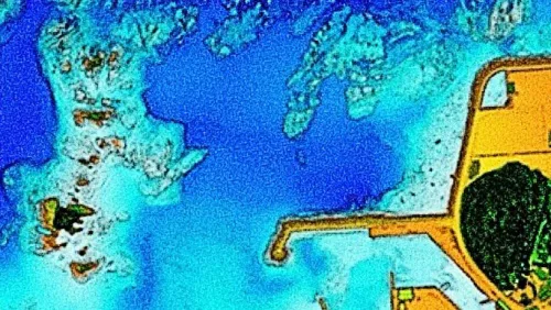
The ‘Umi-no-Chizu’ (‘Map of the Sea’) project will use aerial measurement to map 90% of Japan’s shallow coastal waters (to a depth of 20m). This is a joint project by the Japan Hydrographic Association (JHA) and The Nippon Foundation. Regulatory, administrative management and jurisdiction issues have meant that less than roughly 2% of Japan’s coastal ...
gim-international.com