Geomaticians

01

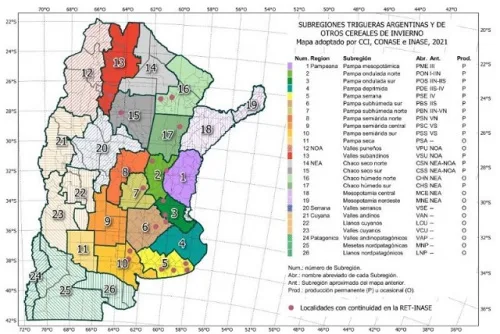
Un Mapa Digital Para Potenciar El Trigo Y Otros Cereales Invernales

Un Mapa Digital Para Potenciar El Trigo Y Otros Cereales Invernales

El trigo es uno de los tres granos más importantes a nivel mundial. En la Argentina, cada año se cultivan entre 5 y 6 millones de hectáreas, cuya producción se exporta sobre todo a Brasil, Perú y Bolivia, y también a países fuera de la región como Turquía y Marruecos. En este contexto, resulta indispensable ...
agrositio.com.ar
Venezuela Y Mozambique Fortalecen Cooperación En Materia Espacial

Venezuela Y Mozambique Fortalecen Cooperación En Materia Espacial

El presidente de la Agencia Bolivariana para Actividades Espaciales (ABAE), Adolfo Godoy, sostuvo un encuentro con la coordinadora de la Agencia Nacional para el Desarrollo Geoespacial de Mozambique, Odete Semiao, con el fin de impulsar la cooperación estratégica y la formación en el área espacial. De acuerdo con el presidente de la ABAE, Adolfo Godoy, ...
correodelorinoco.gob.ve

Public Comment Requested On Draft Charter For New OGC Analysis Ready Data Standards Working Group

The Open Geospatial Consortium (OGC) seeks public comment on the draft charter for a new Analysis Ready Data Standard Working Group (ARD SWG). Comments are due by December 21, 2022. Born from work undertaken in the OGC Disaster Pilot 2021 and Testbed-16, the Analysis Ready Data (ARD) SWG will develop a multi-part Standard for geospatial ...
directionsmag.com

EAASI Becomes A Member Of EUROGI

The European Association of Aerial Surveying Industries (EAASI) has recently joined EUROGI, the European Umbrella Organisation for Geographic Information. Established in 1994, EUROGI represents the needs of all organizations in Europe that generate and use geographic information. EUROGI aims to facilitate value creation from location-based information for a sustainable, prosperous and cohesive Europe. The organization ...
gim-international.com

Hexagon And Fujitsu Support Stuttgart Urban Digital Twin Project

Hexagon’s Safety, Infrastructure & Geospatial division and Fujitsu Limited have partnered to deliver a digital twin platform for Stuttgart, Germany, to support the city’s urban digital twin project. The Civil Engineering Office will use the SaaS solution to visualize and analyse data from IoT sensors across the city to promote sustainability and enhance quality of ...
gim-international.com

India’s Latest Earth Observation Satellite Starts Serving Images

The Earth Observation Satellite-06 launched by the Indian Space Research Organisation on November 26 has started serving images, the national space agency said on Wednesday. Bengaluru-headquartered ISRO shared on Twitter the first-day images received on Tuesday at National Remote Sensing Centre, Shadnagar, Telangana, covering the Himalayan region, Kutch region of Gujarat and the Arabian Sea. ...
thehindu.com
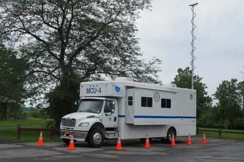
RIT Researchers Explore How To Improve Emergency Management For The Deaf Community

RIT Researchers Explore How To Improve Emergency Management For The Deaf Community

At Rochester Institute of Technology and the National Technical Institute for the Deaf, a team of researchers is studying how to identify and bridge gaps in emergency management resources and services for the Deaf and Hard-of-Hearing community. Supported by a grant from the National Science Foundation Civic Innovation Challenge, the project is bringing together academic ...
rit.edu
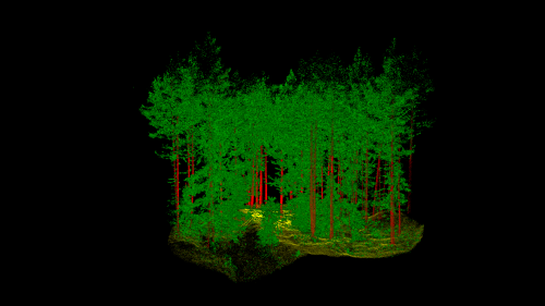
Norway’s Answer To The Smart City Is A “Smart Forest”

Norway’s Answer To The Smart City Is A “Smart Forest”

Norwegian scientists are using mobile lidar to see how individual trees are connected with each other, to help innovate its forest sector and realize efficiency gains. Led by The Norwegian Institute of Bioeconomy Research (NIBIO), the SFI SmartForest aims to bring industry 4.0 to the sector over an 8-year period. Focusing on silviculture, forest operations, ...
geoweeknews.com