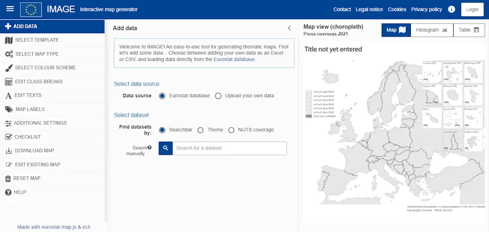
The Interactive Map Generator (IMAGE) is a web-based tool that allows users to quickly make professional statistical maps in several predefined map layouts. You can add your data, or load data directly from the Eurostat database. What’s special about our map generator is that it offers a wide variety of options. For example, you can create maps of the EU at the national and regional level, including all the overseas regions, but also a map of your own country or a world map. Another interesting feature is the map type, where you can choose the map format according to the characteristics of the data and what you want to show.