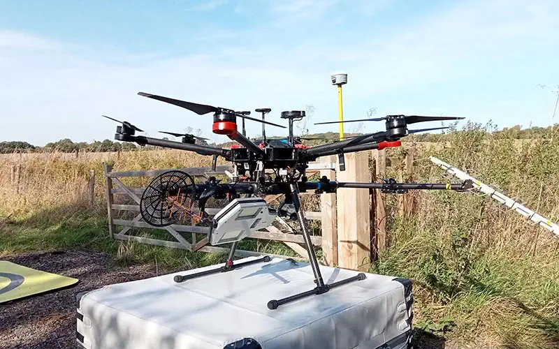
Experts at Cranfield University are leading a two-year project which combines Synthetic Aperture Radar with uncrewed aerial vehicles (UAV), evaluating how radar-equipped drones could simplify soil moisture measurements and revolutionise flood and drought management. The project, led by Dr Dan Evans, will assess the accuracy and potential applications of the innovative technology in soil moisture monitoring.
By obtaining detailed measurements of soil moisture at the field scale, the project seeks to improve flood and drought risk management, aiding farmers in making informed irrigation decisions and planning for extreme weather events. The technology could also find applications in testing the stability of railway embankments. The project also aims to identify the effectiveness of radar-based soil moisture measurements across different land use contexts, including grasslands, arable farmlands and woodlands.
Cranfield University, along with partner institutions including the University of Stirling and the University of Missouri, will compare the UAV-based radar data with conventional ground-based measurements to validate the accuracy of UAV radar in comparison to existing methods. If successful, the technology could be expanded for applications such as biomass mapping and yield measurements.