Geomaticians

Tool | Resource

USDA Introduces Geospatial Data Product To Show Crop Rotation Patterns

The U.S. Department of Agriculture unveiled a geospatial product called Crop Sequence Boundaries (CSB) that offers public access to national-scale visual crop rotation data for the first time. The new tool was developed by USDA’s National Agricultural Statistics Service (NASS) and Economic Research Service (ERS), two of the department’s statistical scientific research agencies. CSB is ...
nass.usda.gov

Получить Сведения Из Фонда Пространственных Данных Московской Области Теперь Можно Онлайн

Мособлархитектурой совместно с ГБУ МО «Мособлгеотрест» реализована новая онлайн-услуга «Предоставление пространственных данных и материалов, содержащихся в фонде пространственных данных Московской области», которая доступна на региональном портале госуслуг. В Фонд пространственных данных Московской области передаются данные и материалы, полученные в результате выполнения геодезических работ, ортофотопланы и результаты аэро- и космических съемок. На сегодня Фонд содержит порядка ...
inpushkino.ru

Wyoming Natural Diversity Database Debuts New Online Tool At UW

The Wyoming Natural Diversity Database (WYNDD) at the University of Wyoming will replace two of its most popular online data access tools with a new online tool. The WYNDD Data Explorer will combine and streamline the functionality of the two former tools. “This new web application allows users to view and download spatial data related ...
uwyo.edu
UNESCO Launches Map Of UK Sites Including The Living Coast

UNESCO Launches Map Of UK Sites Including The Living Coast

A new map has been unveiled featuring all 58 United Nations Education, Scientific and Cultural Organization (UNESCO) sites in the UK. It includes biospheres, creative cties, global geoparks and World Heritage sites. The map, illustrated by artist Tom Woolley, was launched by UNESCO to raise awareness of the breadth of natural, cultural and built heritage ...
brighton-hove.gov.uk

New Online App Launches To Map Out Public Art Across Fairfax County

ArtsFairfax wants you to help it keep track of all the public art popping up around Fairfax County. The county’s designated, nonprofit local arts agency recently launched an online Public Arts Locator to identify and map out murals, sculptures and other installations placed in the community, either permanently or on a temporary basis. The app ...
ffxnow.com

Stadt Bern Stellt Geodaten Der Öffentlichkeit Zur Verfügung

Wo darf mit welcher Parkkarte parkiert werden? Wo ist das Bauen aufgrund von Naturgefahren eingeschränkt? Die Stadt Bern nutzt als Grundlage für ihr Handeln eine Vielzahl von Geodatensätzen. Neu stellt sie diese Daten über das städtische Geoportal www.bern.ch/geoportal auch der Öffentlichkeit zur Verfügung. Die Stadt Bern macht einen weiteren Schritt in Richtung digitale Verwaltung und ...
bern.ch

New Online ‘Forest Eye’ Will Daylight Old-Growth Logging In B.C.

An online tracking system developed by an international environmental group goes live today. It will enable the public to monitor where old growth is being logged and is designed to hold the province accountable for promises to reform forestry, said project lead Angeline Robertson, a senior investigative researcher with Stand.earth. Forest Eye — an online ...
nationalobserver.com
New Wave Of Satellite Tech Can Help Protect Against Ocean Overfishing

New Wave Of Satellite Tech Can Help Protect Against Ocean Overfishing

Around one-third of fish stocks worldwide are overfished, while 20 percent of all seafood is obtained through illegal, unreported, and unregulated fishing. Most such fishing, known as IUU, occurs on the high seas, where the governance of marine areas is tricky and their protection is virtually non-existent. IUU fishing vessels pursuing the largest profits often ...
earthisland.org

WSA Announces Launch Of GeoHub Portal

The Water Security Agency of Saskatchewan (WSA) announced the launch of its GeoHub portal, making data used by the agency to monitor and manage the province’s water resources freely available for the public. The new WSA GeoHub brings together 17 Geographic Information System (GIS) layers and four web maps in one place. This open-data portal ...
saskatchewan.ca

Una Mappa “Digitale” Della Lettura In Città: Al Via Un Questionario Online Per La Ricognizione

Una mappa per rendere i luoghi della lettura di Firenze visibili e accessibili, questo è il progetto che il Comune di Firenze attraverso le Biblioteche Comunali Fiorentine sta disegnando. La mappa raccoglierà sia i luoghi della lettura più conosciuti, ma anche quelli più insoliti, in cui la lettura è presente come veicolo di socialità e ...
comune.fi.it

Introducing The Digital Atlas: Unlocking The Power Of Location-Based Data

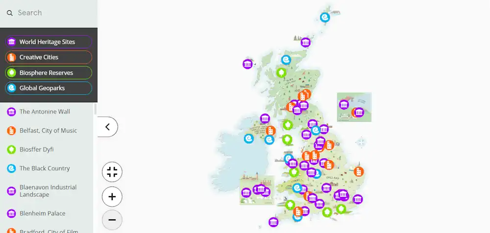
In an exciting step forward in how we access and use location data, the Digital Atlas of Australia beta was released to the public on 30 June 2023. The interactive, secure, and easy-to-use platform brings together, curates and connects trusted data from across government. Anyone, anywhere can explore, analyse and visualise data on Australia’s geography, ...
ga.gov.au
Bióloga Cria Aplicativo Para Mostrar Localização Dos Ipês Do DF

Bióloga Cria Aplicativo Para Mostrar Localização Dos Ipês Do DF

Este período do ano é considerado a época em que Brasília se pinta. As cores dos ipês se misturam ao azul do céu, ofuscam o verde das árvores e combatem o cinza da cidade. Talvez você nem tenha saído de casa, mas com certeza viu um nas redes sociais. Ao mesmo tempo em que brotam ...
correiobraziliense.com.br
Calvin University's 'Returning Citizens Map' Aims To Connect Former Inmates To Resources

Calvin University’s ‘Returning Citizens Map’ Aims To Connect Former Inmates To Resources

Central to the mission of Calvin University is restorative justice; and for years, it has helped inmates get a degree through the Calvin Prison Initiative. Calvin also developed valuable resources, like the “Returning Citizens Map,” an interactive web page that helps people chart a new path forward after they serve their time. In 2018, a ...
fox17online.com

Archeologia Italiana A Portata Di Click: Il Nuovo Geoportale Nazionale Svela I Segreti Del Nostro Patrimonio Storico

Il Geoportale Nazionale per l’Archeologia (GNA) è un punto di raccolta e di condivisione dei dati esito delle indagini archeologiche condotte sul territorio italiano, realizzato grazie alla collaborazione delle soprintendenze e degli archeologi, di altri enti e liberi professionisti. Si tratta di una mappa archeologica dinamica del territorio nazionale, di accesso libero e di facile ...
scintilena.com

New Trimble Terra Office Workflow Delivers Integration With Esri ArcGIS Pro

Trimble announced today the release of the Trimble® Terra™ Office add-in for Esri ArcGIS Pro. The add-in is a new product in Trimble’s Terra Office suite of desktop solutions for integrating Trimble TerraFlex® field data collection software with GIS systems of record. With a streamlined user interface, the new Terra Office add-in for ArcGIS Pro ...
directionsmag.com
Así Puedes Personalizar Los Mapas Cartográficos De Madrid Para Planificar Una Escapada Al Aire Libre

Así Puedes Personalizar Los Mapas Cartográficos De Madrid Para Planificar Una Escapada Al Aire Libre

Con la llegada del verano y las vacaciones las ganas de descubrir nuevas rutas de senderismo, bicicleta o, en definitiva, para practicar cualquier disciplina deportiva al aire libre aumentan, con una Comunidad de Madrid en la que hay infinidad de rincones que son desconocidos… hasta ahora. Porque con el «Mapa a la Carta» del Ministerio ...
madridesnoticia.es
NETL CO2-locate Database To Enhance Carbon Capture And Storage Projects

NETL CO2-locate Database To Enhance Carbon Capture And Storage Projects

Creating a net-zero carbon emissions power sector and economy is an immense endeavor that requires a host of intricate technologies and applications, and the CO2-Locate database is a centralized platform that allows users to quickly and accurately obtain the data they need. Now published on the Energy Data eXchange® (EDX), CO2-Locate is one of several ...
netl.doe.gov

L’observatoire Des Forêts Françaises Est Lancé

Le ministre de l’Agriculture Marc Fesneau et le ministre de la Transition écologique Christophe Béchu lancent l’Observatoire des forêts françaises, afin de rassembler et proposer en un lieu unique les informations indispensables au pilotage des forêts. Cet observatoire a « pour vocation de constituer un centre de partage et de production de données indispensables pour ...
lafranceagricole.fr

Geoinformationen Für Stadtkreis Baden-baden Öffentlich Zugänglich – Fachbereichsleiter Stefan Hetzel Präsentiert Neues Portal

Die Web-Anwendung wartet jetzt mit einer Reihe neuer Funktionen auf und bietet noch mehr Möglichkeiten, verschiedenste geografische Daten interaktiv zu entdecken. Mit dem neuen Portal bieten wir weitere Möglichkeiten und das nicht nur für Fachleute, sondern auch für die breite Öffentlichkeit», so Hetzel weiter. Das Geoportal wurde 2017 mit dem Ziel ins Leben gerufen, Geoinformationen ...
goodnews4.de
GeoSuzano Oferece Novas Camadas De Funcionalidades

GeoSuzano Oferece Novas Camadas De Funcionalidades

O portal de georreferenciamento de informações GeoSuzano, executado pela Prefeitura de Suzano por meio da Secretaria Municipal de Planejamento Urbano e Habitação, passa a oferecer novas funcionalidades a fim de contemplar o Plano Municipal de Conservação e Recuperação da Mata Atlântica (PMMA). Essa é a quinta atualização da ferramenta, que visa a democratização dos dados ...
suzano.sp.gov.br
Tennessee Department Of General Services Launches New GIS Map To Display State-owned Land

Tennessee Department Of General Services Launches New GIS Map To Display State-owned Land

The Tennessee Department of General Services is pleased to announce the launch of the new State-Owned Land Dashboard, a Geographic Information System (GIS) public-facing map displaying all the land the state owns. The map gives users access to a comprehensive list of state-owned properties with numerous data points for each property, including address, District, State ...
clarksvilleonline.com
Mapping The Solar Transformation In Budapest

Mapping The Solar Transformation In Budapest

The city’s municipality has created an online solar map which provides the first ever estimation of the solar possibilities for every rooftop in Budapest. Using the solar map as its first step, the ultimate goal of the project is to increase the use of solar energy across the city, leading to greater production of clean ...
eurocities.eu
A New State Study Shows Where Solar Is Most Suitable In Mass. — Including Your Home

A New State Study Shows Where Solar Is Most Suitable In Mass. — Including Your Home

For Massachusetts to meet it ambitious clean energy goals, the state needs to build between 25 and 35 gigawatts of solar capacity by 2050. Currently, there are about 3 gigawatts installed — so it’s a tall order. But according to a new study from the state’s Department of Energy Resources, there’s more than enough suitable ...
wbur.org

GeoHub: Nueva Aplicación Monitorea Riesgos Ambientales Y Ante Desastres En La Cuenca Del Río Maipo

El objetivo de esta plataforma, desarrollada por el Centro de Investigación para la Gestión Integrada del Riesgo de Desastres (CIGIDEN) y el Observatorio de la Costa, es transferir conocimiento científico relacionado con la gestión de cuencas y áreas litorales. La aplicación incorpora herramientas de captura, catalogación y visualización de datos geoespaciales. El trabajo es liderado ...
uc.cl
Met Office Launches Climate Data Portal

Met Office Launches Climate Data Portal

The Met Office has launched a new online portal to provide government and business organisations with improved access to climate data. The Climate Data Portal has been built using geospatial technology from Esri UK as part of their strategic partnership, and to help users combine Met Office data with their own to assess the future ...
ukauthority.com

New Website Allows People To Report And Track Non-emergency Issues In Santa Maria

The City of Santa Maria has launched a new website that allows people to report and track non-emergency issues located within the city limits. Called Neighborhood Connect, the website is a GIS (geographic information system)-based program designed to help city government track and identify trends, and to improve overall customer service. The website allows users ...
Building A Governance Framework For Forest Data In Eastern And Southern Africa

Building A Governance Framework For Forest Data In Eastern And Southern Africa

The East and Southern Africa Forest Observatory (OFESA) was launched at the Global Landscapes Forum (GLF)’s Nairobi conference in late 2018, with twin goals of supporting improved forest monitoring and reporting practices, and developing a data governance framework for the countries in the region. The Observatory’s geoportal, hosted by the Kenya-based Regional Centre for Mapping ...
forestsnews.cifor.org

El IECA Cuenta Con Una Nueva Base De Datos Espacial De Lugares Donde Se Asienta La Población

La localización, delimitación y asignación de topónimos de los asentamientos en los que el hombre ejerce alguna actividad sobre el territorio es fundamental para lograr un adecuado análisis de la realidad existente en el mismo, que permita planificar correctamente un desarrollo sostenible y sostenido en el tiempo. Con este objetivo, el Instituto de Estadística y ...
europapress.es

Una Nueva Herramienta Explora El Riesgo De Inundaciones Costeras En Garachico

El proyecto Life Garachico, que acaba de finalizar su primera fase, ha presentado una nueva herramienta en línea que sirve para mejorar la vigilancia y el conocimiento sobre el riesgo de inundaciones por temporales marítimos en el casco urbano de Garachico, en la Isla Baja. Se trata del llamado Visor GIS, un mapa interactivo que ...
elperiodicodeycodendaute.es

The Institute Of Geosciences And Georesources Of The National Resource Council Has Published An Update Of Geothopica

The Institute Of Geosciences And Georesources Of The National Resource Council Has Published An Update Of Geothopica – Italy’s National Geothermal Data Platform. The updated version of GeoThopica, which was originally created in 2007 by CNR-IGG, benefits from the BNDG currently containing about twice the data compared to when it was originally created. The most ...
thinkgeoenergy