Geomaticians

Tool | Resource

Biden Administration Launches Portal To Help Communities Assess Exposure To Climate Hazards

Today, the Biden-Harris Administration in partnership with Department of Commerce’s National Oceanic and Atmospheric Administration (NOAA) and the Department of the Interior (DOI) jointly launched a new website to help communities across the nation understand the real-time climate-related hazards in their area, analyze projected long-term exposure to those hazards, and identify federal funds to support ...
noaa.gov

Jak Zmieniała Się Zabudowa Warszawy Tym Razem Na Modelu 3D

Firma GIS-Expert opublikowała animację pokazującą rozwój istniejącej zabudowy w Warszawie w latach 1945–2020 na modelu 3D. To nie pierwsza prezentacja GIS-Expert na temat rozwoju zabudowy miast. Jak już informowaliśmy na Geoforum.pl, kilka lat temu firma opracowała aplikację prezentującą rozwój zabudowy Lublina, która cieszyła się sporym zainteresowaniem i zdobyła tytuł internetowej mapy roku 2016/2017. Wspólnie z ...
geoforum.pl

إطلاق خريطة الثروات المعدنية ومناطق استكشاف البترول والغاز في الأردن

أطلق وزير الطاقة والثروة المعدنية، صالح الخرابشة، الاثنين، خريطة تفاعلية لتسويق قطاعي (الثروات المعدنية والتنقيب عن البترول والغاز). وقال الخرابشة، إنّ الخريطة تعرض التوزيع الجغرافي والمعلومات الفنية للفرص الاستثمارية المتاحة في القطاعين، بالإضافة إلى أن الخريطة توفر موقعاً متكاملاً لتوجيه المستثمر في البحث عن خيارات مختلفة في قطاع التعدين توفيرا للجهد والوقت في الوصول إلى ...
almamlakatv.com

البوابة المكانية لمنطقة الرياض الأراضي الموقوفة مستخدم عام

تتيح أمانة منطقة الرياض من خلال الإدارة العامة لتقنية المعلومات ومركز نظم المعلومات الجغرافية فرقة من البيانات القيمة التي تتعلق ب التطور العمراني للمنطقة و التي تسهل على المواطن الدخول إلى البوابة المكانية لمنطقة الرياض و الدخول مباشرة إلى الخريطة التفاعلية المنطقة والبحث عن موقِع معين ما إذا باستخدام الإحداثيات أو عن الطريق تصفح الخريطة.
mokhtsr.com
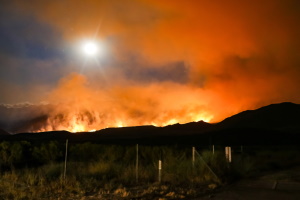
Mapping Company Develops Web App To Provide Context, Resources During Local Wildfires

Mapping Company Develops Web App To Provide Context, Resources During Local Wildfires

A new web service by a California-based mapping company shows detailed information on wildfires in real time. It shows information like nearby population size, climate and drought conditions to try to give people context on wildfires around them. Chris Ferner is a wildland fire specialist for the company. She said Esri developed Wildfire Aware to ...
kcbx.org
„Dreckspotz“ App Hilft Bei Kampf Gegen Plastikmüll Im Gebirge

„Dreckspotz“: App Hilft Bei Kampf Gegen Plastikmüll Im Gebirge

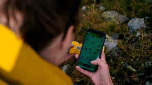
Plastikmüll ist weltweit mittlerweile fast allgegenwärtig. Das wird in der Forschung immer deutlicher. Ob als „Great Pacific Garbage Patch“ oder in Form von Mikroplastik in Fischen und anderen Lebensmitteln – immer mehr wird klar, wie groß das Problem wirklich ist. Selbst im Hochgebirge findet sich Plastik mittlerweile. Die Universität Innsbruck nimmt sich diesem Problem jetzt ...
trendingtopics.eu

El Gobierno De Navarra Acerca El Conocimiento Del Territorio Foral A La Ciudadanía De Forma Más Sencilla E Intuitiva Con El Nuevo Geoportal

El Departamento de Universidad, Innovación y Transformación Digital, a través de la Dirección General de Telecomunicaciones y Digitalización, ha renovado el Geoportal,la nueva página web del Sistema de Información Territorial de Navarra (SITNA), cuyo objetivo es lograr que la información y el conocimiento referidos al territorio de la Comunidad Foral estén disponibles para el conjunto ...
navarra.es

New Interactive Map Outlines Key Infrastructure Projects

Central Coast residents can now stay up to date on more than 350 key infrastructure projects thanks to a new interactive map. Central Coast Council Administrator, Rik Hart, said Council is investing $176M in the community, roads and other urban infrastructure, water and sewer, waste, environmental and sport and recreation projects. “This map includes the ...
coastcommunitynews.com.au

New Classification Of The World’s Coastlines To Improve Climate Action

A new classification of the world’s coastlines has been released to improve coastal climate change adaptation at local, regional and national level and strengthen coordinated climate action worldwide. The classification builds on the Coastal Hazard Wheel that is a universal coastal management framework and is developed by the Coastal Hazard Wheel initiative involving Deltares, the ...
Lanzan Plataforma Interactiva Sobre El Patrimonio Cultural De La Comuna De Cochamó

Lanzan Plataforma Interactiva Sobre El Patrimonio Cultural De La Comuna De Cochamó

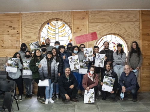
La comuna de Cochamó históricamente ha estado en un contexto de aislamiento geográfico, lo que ha forjado una comunidad con un interesante patrimonio histórico-cultural y natural. En este contexto, surge el proyecto “Patrimonio de Cochamó a un Click: cultura al alcance de todos”, que a través de un proceso de participación comunitaria y de la ...
eha.cl
SisGeo

UNIFAL-MG Lança Sistema Para Compartilhamento De Dados Geoespaciais Produzidos Nos Cursos De Graduação E Pós-graduação Em Geografia; Plataforma Gratuita, De Fácil Acesso, Beneficia Comunidade Acadêmica E Sociedade Sul-mineira

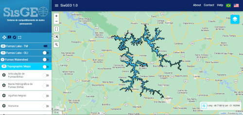
A divulgação de dados geoespaciais é uma ferramenta que contribui para ações de planejamento e gestão de territórios, assim como para a geração de conhecimentos. A fim de de atuar nesse sentido, equipe interdisciplinar da UNIFAL-MG, em parceria com o Instituto Nacional de Pesquisas Espaciais (INPE), lança plataforma web que disponibiliza dados de pesquisas de ...
jornaltribuna.com.br
카카오맵, 부산시내버스 위치 실시간으로 보여준다

카카오맵, 부산시내버스 위치 실시간으로 보여준다

부산 시내버스의 실시간 이동 모습을 카카오맵에서 확인할 수 있게 됐다. 카카오는 10일 지도 앱 서비스 카카오맵에서 부산 지역 초정밀 버스 위치 정보를 제공한다고 밝혔다. 제주, 울산, 춘천, 목포에 이어 부산지역에 5번째로 실현됐다. 카카오맵 초정밀 버스 위치 정보는 위성항법시스템(GNSS)을 활용해 지도상에 실시간 버스 위치를 나타나며 10cm 단위의 버스 위치 정보를 초 단위로 갱신해 보여준다. 신호 대기 ...
smartcitytoday.co.kr
Ukrainians Using New Smartphone App To Make Precious 3D Records Of War-threatened Historic Buildings And Monuments

Ukrainians Using New Smartphone App To Make Precious 3D Records Of War-threatened Historic Buildings And Monuments

A new smartphone app is offering hope to people trying to preserve Ukraine’s war-threatened historic buildings. The “Backup Ukraine” project now lets ordinary people become archivists by using an app to digitally capture buildings and monuments as 3D models. Already, the app has recorded more than 6,000 downloads, and has between 30 and 50 active ...
abc.net.au
Calif. Launches Mapping Tool For Groundwater Sustainability Projects

Calif. Launches Mapping Tool For Groundwater Sustainability Projects

A new web-based tool developed by the California Department of Water Resources (DWR) will allow the public to explore thousands of groundwater projects across California to get a better understanding of one of the state’s most critical water supply resources. The California Groundwater Projects Tool is an interactive mapping tool that allows users to explore ...
waterworld.com
Geoportal Now Available In 3D

Geoportal Now Available In 3D

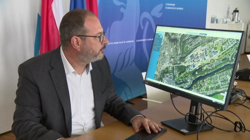
Around 5,000 people per day use the Geoportal mapping service. Be it individuals checking if their house is in a flooding zone, administrations needing information about the solar cadaster or an architect working on a project – with around 800 different layers to choose from, the portal offers a vast panoply of geographic information about ...
today.rtl.lu
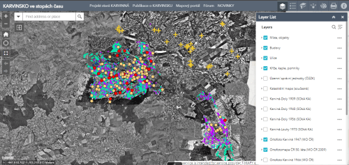
Interaktywna Mapa Karwiny Rozszerzona O Kolejną Część. Teraz Możemy Odkrywać Historię Łąk

Interaktywna Mapa Karwiny Rozszerzona O Kolejną Część. Teraz Możemy Odkrywać Historię Łąk

Ponad rok temu miasto Karwina we współpracy z Państwowym Archiwum w Karwinie uruchomiło specjalną aplikacje z mapami starej Karwiny. Teraz można w niej znaleźć nowe lokalizacje. Mieszkańcy mają okazję do obejrzenia historycznych zdjęć, dokumentów i ortofotomap dzielnicy Karwina-Łąki. Aplikacja bazuje na tematycznej stronie internetowej Powiatowego Archiwum w Karwinie pod nazwą “Projekt stara Karwina”. Strony zostały ...
glos.live
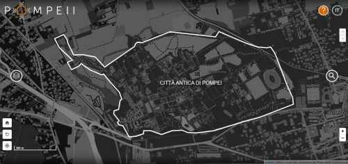
Pompei Apre I Suoi Archivi Digitali Alla Libera Consultazione – Attraverso Il Sistema Open Pompeii Una Rivoluzione Nell’accesso Ai Dati

Pompei Apre I Suoi Archivi Digitali Alla Libera Consultazione – Attraverso Il Sistema Open Pompeii Una Rivoluzione Nell’accesso Ai Dati

Un immenso patrimonio di dati del Parco archeologico di Pompei, raccolti in decenni e aumentato significativamente in tempi recenti grazie al Grande Progetto Pompei sotto la direzione di Massimo Osanna, da oggi sarà alla portata di tutti con un click, per consultazione, studio e approfondimento. Un archivio di vetro trasparente, disponibile e accessibile a tutti, ...
pompeiisites.org

Base De Dados Do CEM Traz Divisões Climáticas Do Brasil Em Escala Municipal

O Centro de Estudos da Metrópole (CEM-Cepid/Fapesp) disponibiliza para a comunidade científica, gratuitamente, uma base de dados georreferenciada em que faz um cruzamento entre dados demográficos e econômicos dos municípios do Brasil com a divisão em zonas climáticas, conforme a classificação Köppen. Desenvolvida pelo climatologista russo Wladimir Köppen, esta é a classificação mais utilizada por ...
mundogeo.com
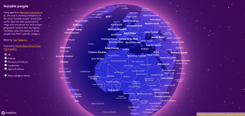
This Interactive Map Highlights The Most Notable Person From Your Hometown

This Interactive Map Highlights The Most Notable Person From Your Hometown

This interactive world map visualizes “a cross-verified database of notable people” to show you the most notable person in your hometown — or anywhere else you might want to look. Topi Tjukanov, a geographer and senior map designer at Mapbox, put the visualization together, which features different influential people from fields including culture, science, leadership, ...
theverge.com

Turystyka Tematyczna Na Dolnośląskim Geoportalu

Interesuje Cię astroturystyka, slow travel, a może turystyka pszczelarska… Teraz te wszystkie atrakcje turystyczne zebrano na jednaj mapie udostępnionej na Geoportalu Dolny Śląsk. A ponieważ są wakacje, może warto z niej skorzystać i ciekawie, niesztampowo je zaplanować. Mapa łączy wszystkie udostępniane wcześniej sukcesywnie na geoportalu warstwy prezentujące zagadnienia związane ze: slow turystyką, astroturystyką, czyli miejscami ...
geoforum.pl
Lifegate – Neue Interaktive Karte Zeigt Die Ganze Vielfalt Des Lebens

Lifegate – Neue Interaktive Karte Zeigt Die Ganze Vielfalt Des Lebens

Wissenschaftler aus Leipzig haben eine riesige, digitale Karte veröffentlicht, welche die ganze Vielfalt des Lebens in Tausenden Fotos zeigt. Das sogenannte LifeGate umfasst alle 2,6 Millionen bekannten Arten des Planeten und sortiert diese nach ihrer Verwandtschaft. Die Online-Plattform LifeGate zeigt die ganze Vielfalt des Lebens in einer einzigen interaktiven Karte. Diese bildet bereits 420.000 Fotos ...
idw-online.de
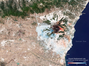
ESA Makes Ground Motion Data Freely Accessible

ESA Makes Ground Motion Data Freely Accessible

thanks to Europe’s environmental Copernicus program and the Sentinel-1 radar satellite mission, the first Europe-wide subsidence and soil movement analysis service is available to the public. The new European Ground Motion Service, the latest offering of the Copernicus Land Monitoring Service and implemented by the European Environment Agency, provides free and accessible ground motion data ...
phys.org