Geomaticians

Tool | Resource

Government To Present Application To Help Farmers Protect Crops Against Freezing Conditions

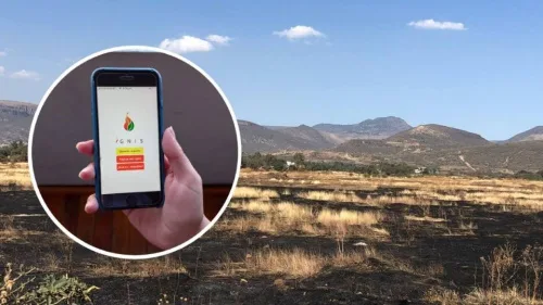
A new application developed by the rural development and foods ministry to give farmers early warning of oncoming frost is to be unveiled next week. Its aim is to restrict crop losses due to frost each year, as well as the amounts paid in compensation, which have reached an estimated 1.25 billion euros in the ...
hellenicnews.com
SkyFi Launches Satellite Imagery App

SkyFi Launches Satellite Imagery App

SkyFi believes that satellite imagery should be easily accessible and affordable for anyone to access. Today, the Austin, TX startup took a major step toward democratizing that data with the public launch of its mobile and web apps. The story so far: SkyFi built an entirely new app and interface for individuals to task satellites ...
payloadspace.com
Lidar Survey Of New Zealand’s Taranaki Regio

Lidar Survey Of New Zealand’s Taranaki Region

A ground-breaking aerial LiDAR survey of Taranaki’s land surface has just been completed, opening up a wealth of valuable land-surface and elevation data for a wide range of uses. The dataset — collected in 2021 and two years in the making — will be used to generate high-definition 3D maps and models for environmental management ...
spatialsource.com.au

Crean Un Mapa Para Que Los Ganaderos Registren Los Ataques De Lobos Al Ganado Sin Censuras Ni Filtros Ecologistas

Los ataques al ganado por parte de depredadores como en lobo son un problema que va en aumento en toda Europa. Hartos de sufrir el hostigamiento de estos animales y la censura de los medios que se niegan a hacerse eco de la problemática, un grupo de ganaderos franceses de la zona de los Vosgos, ...
revistajaraysedal.es
La NASA Se Interesa Por Una App Diseñada En Zaragoza Para Predecir Los Incendio

La NASA Se Interesa Por Una App Diseñada En Zaragoza Para Predecir Los Incendios

Un simulador de incendios forestales diseñado en Zaragoza por un grupo de jóvenes ingenieros e informáticos, se ha convertido en finalista en un concurso de ideas convocado por la NASA. Con esta aplicación han conseguido ser uno de los 35 equipos de todo el mundo que han llegado a la final del ‘NASA Space Apps ...
cope.es
Andalucía Cuenta Con 35.000 Solares Disponibles Para Empresas E Industrias

Andalucía Cuenta Con 35.000 Solares Disponibles Para Empresas E Industrias

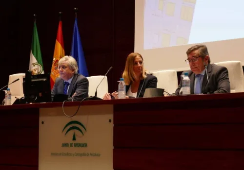
Una empresa interesada en invertir en Andalucía puede consultar online toda la información pública sobre los espacios productivos disponibles en la región, entre ellos polígonos industriales. En pocos minutos tiene a golpe de clic todos los datos públicos sobre los 35.000 solares disponibles que suman 9.000 hectáreas, infraestructuras energéticas (suministro eléctrico y gas) y telecomunicaciones ...
sevilla.abc.es
Amazonas Ganha Plataforma Georreferenciada Com Mapas E Dados Sobre Educação E Trabalho

Amazonas Ganha Plataforma Georreferenciada Com Mapas E Dados Sobre Educação E Trabalho

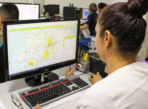
O Amazonas passa a contar, pela primeira vez, com o Geoportal Amazonas em Mapas, uma plataforma on-line georreferenciada com dados públicos em formato de mapas que serão úteis para a formulação de políticas públicas no estado. A ferramenta faz parte da parceria entre o Governo do Amazonas, por meio da Secretaria de Desenvolvimento Econômico, Ciência, ...
agenciaamazonas.am.gov.br
Interactive ​​​​​​​NYC Tree Map Aims To Help Residents Care For Urban Forest

Interactive ​​​​​​​NYC Tree Map Aims To Help Residents Care For Urban Forest

New York City launched a comprehensive map showing the location, species, maintenance status and other information of about 800,000 trees located in city parks and along its streets, the city’s Department of Parks and Recreation announced last week. The tool builds on a previous map that listed 650,000 street trees. In addition to helping users ...
smartcitiesdive.com
Mapa De Calor En España

Mapa De Calor En España

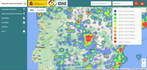
El Instituto para la Diversificación y el Ahorro de la Energía (IDAE), entidad adscrita al Ministerio para la Transición Ecológica y el Reto Demográfico (MITECO), ha publicado el mapa de calor de España. El mapa impulsará los proyectos de calefacción y refrigeración eficientes, desde el momento en que permite identificar las demandas térmicas de todos ...
tiempo.com
세종시, 모바일‘세종엔’으로 똑똑한 세종생활 누려요

세종시, 모바일‘세종엔’으로 똑똑한 세종생활 누려요

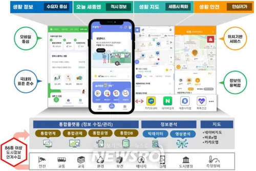
세종특별자치시(시장 최민호)가 위치기반 스마트포털 ‘세종엔’ 앱 서비스를 8일부터 정식 출시했다. ‘세종엔’은 교통, 방범, 환경, 문화, 행정 등 86종의 도시 데이터를 수집하고 분석·가공해 시민에게 유익한 정보를 제공하는 앱이다. 세종시는 그동안 행정중심복합도시건설청과 시민이용 편의성과 접근성개선을 위해 지난해 5월부터 1년간 세종엔 고도화 개발에 매진해왔다. 이후 약 5개월간 시범운영을 거쳐 발생 가능한 문제를 미연에 방지하기 위해 연구·개발을 지속하며 앱 ...
newsro.kr
Profesora Y Alumno Idean Aplicación Para Registrar Distintos Tipos De Incendios

Profesora Y Alumno Idean Aplicación Para Registrar Distintos Tipos De Incendios

Una profesora y un estudiante de la Universidad de Guanajuato (UG), del Departamento de Ingeniería Geomática e Hidráulica, crearon una aplicación que realiza el reporte de diferentes tipos de incendios, esta “app” vincula, directamente, los reportes a las distintas instituciones encargadas de controlar y apagar el fuego. La investigadora de la Universidad de Guanajuato explicó ...
lasillarota.com

ISRO To Develop “Spatial Data Infrastructure Geoportal ‘Geo-ladakh’ For Ut-ladakh”

Union Minister of State (Independent Charge) Science & Technology; Minister of State (Independent Charge) Earth Sciences; MoS PMO, Personnel, Public Grievances, Pensions, Atomic Energy and Space, Dr Jitendra Singh today informed that Government of UT – Ladakh has approached the Indian Institute of Remote Sensing (IIRS), a unit of Indian Space Research Organisation (ISRO) for ...
indiaeducationdiary.in
Epic Games 3D Scanning App RealityScan Now Available On The App Store For iPhone And iPad

Epic Games 3D Scanning App RealityScan Now Available On The App Store For iPhone And iPad

Earlier this year, Epic Games announced a new app called RealityScan that lets users scan objects and turn them into high-fidelity 3D models using the iPhone and iPad camera. After months of beta testing, RealityScan is now finally available for everyone on the iOS App Store. The app was built with technologies from Capturing Reality, ...
9to5mac.com
New EWG Research Finds Many North Carolina Factory Farms Are At Risk Of Flooding

New EWG Research Finds Many North Carolina Factory Farms Are At Risk Of Flooding

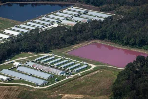
A new Environmental Working Group geospatial analysis finds over 2 percent of North Carolina’s 7,352 swine and poultry factory farms are in or just outside floodplains. When these farms flood, they can contaminate water with bacteria and other health hazards. “The 156 factory farms we found in and near North Carolina’s floodplains are at a ...
ewg.org

Open Maps For Europe Adds Data From Four More Countries For Final Release

Open Maps For Europe has today announced that official geospatial data from four additional countries is included in the project’s third and final release. North Macedonia and Switzerland have contributed multi-themed topographic open data for 1:250 000 scale EuroRegionalMap, with Denmark and Slovenia adding their data to the Cadastral Index Map prototype. North Macedonia has ...
directionsmag.com

Prefeitura Atualiza Imagens Do Mapa Digital Da Cidade

A Prefeitura de São Paulo, por iniciativa da Secretaria Municipal da Fazenda, em parceria com a Secretaria Municipal de Urbanismo e Licenciamento (SMUL), disponibiliza ao público a partir desta quarta-feira, dia 23, no portal GeoSampa, novas imagens ortorretificadas da capital paulista. O novo mapeamento fotográfico do município foi realizado em 2020, com perfilamento laser que ...
prefeitura.sp.gov.br

Model 3D Poznania Światowym Liderem

W opublikowanym niedawno artykule w czasopiśmie „International Journal of Geographical Information Science” model 3D Poznania został uznany za jeden z najlepszych na świecie. Na początku listopada na stronie tego periodyku ukazała się publikacja pt. „Assessing and benchmarking 3D city models”. Trójka naukowców z Singapuru przeanalizowała w nim 40 trójwymiarowych modeli zabudowy miast z całego świata. ...
geoforum.pl
Map Of Italy's Fascist Monuments Goes Online

Map Of Italy’s Fascist Monuments Goes Online

More than 1,400 monuments, street signs and plaques honoring fascism have been put online in the first nationwide attempt to document the symbols of Benito Mussolini’s regime that still dot the urban landscape of Italy. The “places of fascism” website was unveiled on Tuesday by the Istituto Nazionale Parri, a Milan-based historical research institute, following ...
cnn.com

System Informacji Przestrzennej Dla Mieszkańców Przasnysza

Urzędu Miasta uruchomiła portal mapowy dla mieszkańców Miasta Przasnysz. Portal ma usprawnić m.in. wydawanie wypisów i wyrysów z miejscowych planów zagospodarowania przestrzennego. Portal ten jest podstawowym sposobem dostępu do danych przestrzennych dla użytkownika zewnętrznego (bez konieczności instalacji rozszerzeń, pluginów). Polega na udostępnieniu informacji przestrzennej wraz z niezbędną informacją publiczną dostępną dla wszystkich klientów wraz ze ...
infoprzasnysz.com

Wrocławski Geoportal Z Nową Mapą Wypadków I Kolizji Drogowych

W Systemie Informacji Przestrzennej Wrocławia udostępniono nową wersję mapy wypadków i kolizji drogowych. Zmieniono w niej sposób prezentacji danych, który powinien znacząco ułatwić ich przeglądanie i analizowanie. Mapa wypadków i kolizji drogowych jest wizualizacją danych pobieranych, dzięki współpracy z Komendą Wojewódzką Policji we Wrocławiu, z policyjnego Systemu Ewidencji Wypadków i Kolizji Drogowych (SEWIK). Pokazywane na ...
geoforum.pl
This Map Shows Exactly Where 70,000 Of The World’s Biggest Polluters Are Located

This Map Shows Exactly Where 70,000 Of The World’s Biggest Polluters Are Located

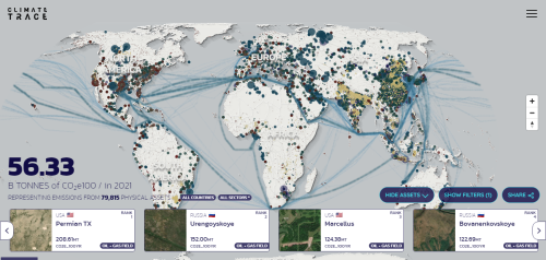
A single steel factory in Jiangsu, China, emits 43 million tons of CO2 every year—more than the entire country of Madagascar or Nicaragua. It’s one of more than 70,000 individual sources of climate pollution listed on a new map made from what is now the largest, most detailed database of greenhouse gas emissions in the ...
fastcompany.com

Zaktualizowane Mapy Powodziowe Już W Geoportalach Geo-systemu

Dzięki aktualizacji serwisów mapowych działających w technologii e-mapa.net stołecznej firmy Geo-System możemy łatwo sprawdzić, jak w ostatnim czasie zmieniło się zagrożenie powodziowe w naszym kraju. Jest to możliwie dzięki udostępnieniu w tych portalach nowych danych dotyczących zagrożenia powodziowego. Znajdziemy je w grupie warstw Hydrografia > Mapy zagrożenia powodziowego. Mapy te bazują na danych, które zostały ...
geoforum.pl

Gazetteer of Australia

The Composite Gazetteer of Australia is a cloud-based system allowing users to easily discover, interrogate and download place names information from Australia and its external territories. It is developed as a partnership between contributing agencies of the Intergovernmental Committee on Surveying and Mapping (ICSM) and is built on modern infrastructure providing automated ingestion and validation, ...
placenames.fsdf.org.au

TGN: The Getty Thesaurus of Geographic Names

TGN is a thesaurus. TGN is not a geographic information system (GIS), although it may be linked to existing major, general-purpose, geographic databases and maps. While most records in TGN include coordinates, these coordinates are approximate and are intended for reference (“finding purposes”) only (as is true of coordinates in most atlases and other resources, ...
getty.edu

GeoNames

The GeoNames geographical database is available for download free of charge under a creative commons attribution license. It contains over 27 million geographical names and consists of over 12 million unique features whereof 4.8 million populated places and 15 million alternate names. All features are categorized into one out of nine feature classes and further ...
geonames.org