Geomaticians

Dataportal

Stadt Bern Stellt Geodaten Der Öffentlichkeit Zur Verfügung

Wo darf mit welcher Parkkarte parkiert werden? Wo ist das Bauen aufgrund von Naturgefahren eingeschränkt? Die Stadt Bern nutzt als Grundlage für ihr Handeln eine Vielzahl von Geodatensätzen. Neu stellt sie diese Daten über das städtische Geoportal www.bern.ch/geoportal auch der Öffentlichkeit zur Verfügung. Die Stadt Bern macht einen weiteren Schritt in Richtung digitale Verwaltung und ...
bern.ch

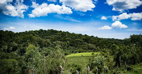
New Online ‘Forest Eye’ Will Daylight Old-Growth Logging In B.C.

An online tracking system developed by an international environmental group goes live today. It will enable the public to monitor where old growth is being logged and is designed to hold the province accountable for promises to reform forestry, said project lead Angeline Robertson, a senior investigative researcher with Stand.earth. Forest Eye — an online ...
nationalobserver.com
New Wave Of Satellite Tech Can Help Protect Against Ocean Overfishing

New Wave Of Satellite Tech Can Help Protect Against Ocean Overfishing

Around one-third of fish stocks worldwide are overfished, while 20 percent of all seafood is obtained through illegal, unreported, and unregulated fishing. Most such fishing, known as IUU, occurs on the high seas, where the governance of marine areas is tricky and their protection is virtually non-existent. IUU fishing vessels pursuing the largest profits often ...
earthisland.org

WSA Announces Launch Of GeoHub Portal

The Water Security Agency of Saskatchewan (WSA) announced the launch of its GeoHub portal, making data used by the agency to monitor and manage the province’s water resources freely available for the public. The new WSA GeoHub brings together 17 Geographic Information System (GIS) layers and four web maps in one place. This open-data portal ...
saskatchewan.ca

Introducing The Digital Atlas: Unlocking The Power Of Location-Based Data

In an exciting step forward in how we access and use location data, the Digital Atlas of Australia beta was released to the public on 30 June 2023. The interactive, secure, and easy-to-use platform brings together, curates and connects trusted data from across government. Anyone, anywhere can explore, analyse and visualise data on Australia’s geography, ...
ga.gov.au

Archeologia Italiana A Portata Di Click: Il Nuovo Geoportale Nazionale Svela I Segreti Del Nostro Patrimonio Storico

Il Geoportale Nazionale per l’Archeologia (GNA) è un punto di raccolta e di condivisione dei dati esito delle indagini archeologiche condotte sul territorio italiano, realizzato grazie alla collaborazione delle soprintendenze e degli archeologi, di altri enti e liberi professionisti. Si tratta di una mappa archeologica dinamica del territorio nazionale, di accesso libero e di facile ...
scintilena.com

L’observatoire Des Forêts Françaises Est Lancé

Le ministre de l’Agriculture Marc Fesneau et le ministre de la Transition écologique Christophe Béchu lancent l’Observatoire des forêts françaises, afin de rassembler et proposer en un lieu unique les informations indispensables au pilotage des forêts. Cet observatoire a « pour vocation de constituer un centre de partage et de production de données indispensables pour ...
lafranceagricole.fr

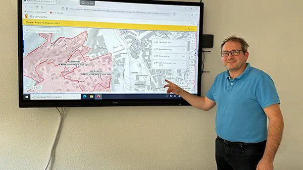
Geoinformationen Für Stadtkreis Baden-baden Öffentlich Zugänglich – Fachbereichsleiter Stefan Hetzel Präsentiert Neues Portal

Die Web-Anwendung wartet jetzt mit einer Reihe neuer Funktionen auf und bietet noch mehr Möglichkeiten, verschiedenste geografische Daten interaktiv zu entdecken. Mit dem neuen Portal bieten wir weitere Möglichkeiten und das nicht nur für Fachleute, sondern auch für die breite Öffentlichkeit», so Hetzel weiter. Das Geoportal wurde 2017 mit dem Ziel ins Leben gerufen, Geoinformationen ...
goodnews4.de

GeoHub: Nueva Aplicación Monitorea Riesgos Ambientales Y Ante Desastres En La Cuenca Del Río Maipo

El objetivo de esta plataforma, desarrollada por el Centro de Investigación para la Gestión Integrada del Riesgo de Desastres (CIGIDEN) y el Observatorio de la Costa, es transferir conocimiento científico relacionado con la gestión de cuencas y áreas litorales. La aplicación incorpora herramientas de captura, catalogación y visualización de datos geoespaciales. El trabajo es liderado ...
uc.cl
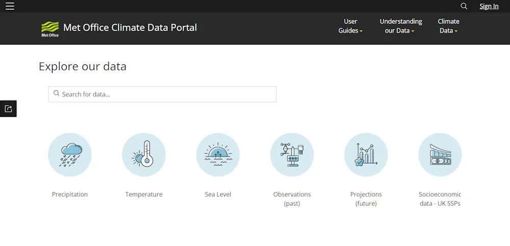
Met Office Launches Climate Data Portal

Met Office Launches Climate Data Portal

The Met Office has launched a new online portal to provide government and business organisations with improved access to climate data. The Climate Data Portal has been built using geospatial technology from Esri UK as part of their strategic partnership, and to help users combine Met Office data with their own to assess the future ...
ukauthority.com
Building A Governance Framework For Forest Data In Eastern And Southern Africa

Building A Governance Framework For Forest Data In Eastern And Southern Africa

The East and Southern Africa Forest Observatory (OFESA) was launched at the Global Landscapes Forum (GLF)’s Nairobi conference in late 2018, with twin goals of supporting improved forest monitoring and reporting practices, and developing a data governance framework for the countries in the region. The Observatory’s geoportal, hosted by the Kenya-based Regional Centre for Mapping ...
forestsnews.cifor.org

El IECA Cuenta Con Una Nueva Base De Datos Espacial De Lugares Donde Se Asienta La Población

La localización, delimitación y asignación de topónimos de los asentamientos en los que el hombre ejerce alguna actividad sobre el territorio es fundamental para lograr un adecuado análisis de la realidad existente en el mismo, que permita planificar correctamente un desarrollo sostenible y sostenido en el tiempo. Con este objetivo, el Instituto de Estadística y ...
europapress.es

The Institute Of Geosciences And Georesources Of The National Resource Council Has Published An Update Of Geothopica

The Institute Of Geosciences And Georesources Of The National Resource Council Has Published An Update Of Geothopica – Italy’s National Geothermal Data Platform. The updated version of GeoThopica, which was originally created in 2007 by CNR-IGG, benefits from the BNDG currently containing about twice the data compared to when it was originally created. The most ...
thinkgeoenergy

Scotland’s Spatial Hub Becomes Open Data

Scotland’s Improvement Service (IS) has launched open access to the Spatial Hub, making it available beyond the public sector to anyone. It said the hub, which is run by the Spatial Information Service and brings together a wide range of data directly from local authorities and partner organisations, has been made more widely available due ...
ukauthority.com

Kolejne Szczyty Górskie Dostępne W Krajowym Geoportalu

Usługa „Wykaz szczytów” dostępna w serwisie www.geoportal.gov.pl została zasilona o kolejne obiekty, tj. ok. 80 szczytów górskich w województwie dolnośląskim (w powiatach lubańskim, bolesławickim i ząbkowickim). Wysokości szczytów pomierzono w ramach prac własnych GUGiK na podstawie chmury punktów z lotniczego skanowania laserowego, dostępnej w centralnym zasobie geodezyjnym i kartograficznym. Usługa dsotęna jest w grupie warstw ...
gisplay.pl

Birmingham Creates Interactive Mapping Portal Using Bluesky Tree Data

Birmingham City Council has launched a first of its kind mapping portal to address the issue of tree equity across the city. With National Tree Map data, created by aerial mapping company Bluesky International, at its core, the interactive tool allows users to identify which parts of the city have lower than average tree canopy ...
directionsmag.com
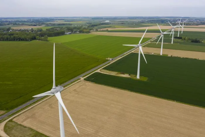
Lancement Du Portail Cartographique Des Énergies Renouvelables

Lancement Du Portail Cartographique Des Énergies Renouvelables

Afin de permettre aux élus de mener à bien cet exercice, et dans l’objectif de rendre accessible au public l’ensemble des informations relatives aux énergies renouvelables, le ministère de la Transition énergétique, le Cerema et l’Institut national de l’information géographique et forestière (IGN) mettent en ligne un portail cartographique. Le portail cartographique a vocation à ...
ecologie.gouv.fr

Aggiornamento Atlante Delle Analisi Del Terreno

E’ online sul Geoportale l’aggiornamento del servizio regionale “Atlante delle analisi del terreno”. L’Atlante è un servizio di consultazione e diffusione online dei dati di analisi dei terreni dove si possono trovare informazioni “puntuali” sullo strato superficiale dei terreni agrari del Piemonte. L’aggiornamento è consistito nell’ampliamento del numero di analisi disponibili grazie alla georeferenziazione di ...
regione.piemonte.it
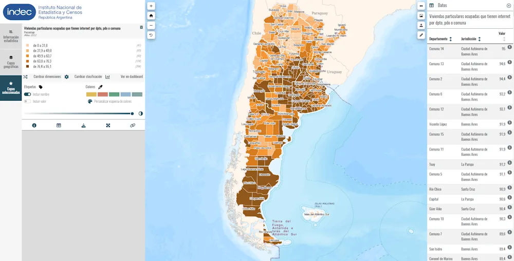
Nuevo Geoportal Estadístico Del INDEC De Argentina

Nuevo Geoportal Estadístico Del INDEC De Argentina

El 18 de mayo del presente año, el Instituto Nacional de Estadística y Censos de Argentina (INDEC) realizó el lanzamiento de su geoportal estadístico, plataforma web que permite la diseminación de datos estadísticos de manera desagregada en el territorio. En esta etapa inicial, el geoportal del INDEC ofrece a los usuarios los datos provisionales del ...
cepal.org
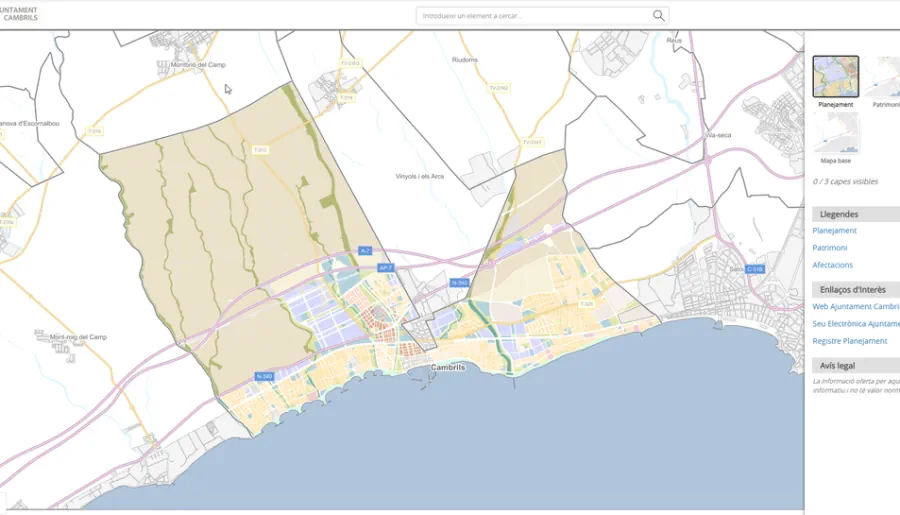
Cambrils Pone En Marcha Un Geoportal De Consulta Urbanística

Cambrils Pone En Marcha Un Geoportal De Consulta Urbanística

El Ayuntamiento de Cambrils ha puesto en marcha un Geoportal que permite a la ciudadanía consultar de manera más intuitiva y rápida los datos disponibles de los emplazamientos del municipio en referencia al planeamiento urbanístico, tanto municipal como supramunicipal. La nueva herramienta pone al alcance de toda la ciudadanía informaciones urbanísticas y cartográficas como la ...
Neue Plattform Für Die Geodaten

Neue Plattform Für Die Geodaten

In neuer Aufmachung präsentiert sich seit Dienstag das Geographische Informationssystem des Landes. Über ein Portal könne künftig auf alle verfügbaren geografischen Daten des Landes zugegriffen werden, erläuterte Landesstatthalterin Barbara Schöbi-Fink (ÖVP) beim Pressefoyer nach der Regierungssitzung. Etwa 600 Datensätze aus zwölf Abteilungen und Dienststellen würden zugänglich gemacht, ergänzte Johannes Kanonier vom Landesamt für Vermessung und ...
vol.at
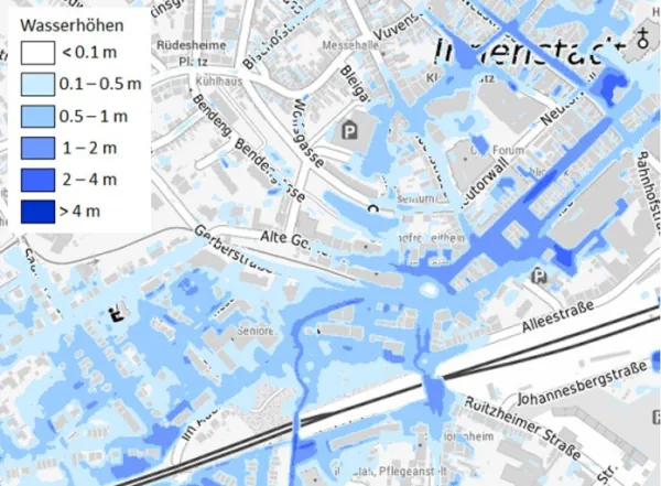
Bundesweite Kartierung Über Die Gefahren Durch Starkregen Gestartet

Bundesweite Kartierung Über Die Gefahren Durch Starkregen Gestartet

Das Bundesamt für Kartographie und Geodäsie (BKG) arbeitet gemeinsam mit Fachbehörden aus Bund und Ländern an einer deutschlandweiten Hinweiskarte zu Starkregengefahren. Zu Jahresbeginn hat das BKG dafür mehrere Projekte auf den Weg gebracht. Nach einer ersten Kartierung des Landes Nordrhein-Westfalen sollen mit den jetzt gestarteten Projekten zehn weitere Bundesländer kartiert werden. Die Arbeiten sollen bis ...
behoerden-spiegel.de
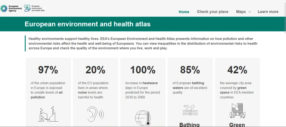
European Environment And Health Atlas Goes Live

European Environment And Health Atlas Goes Live

The interactive online tool, a first on such a scale for all of Europe, allows users to visualise how the environment around them affects their health and well-being via set of detailed maps. It covers topics like air quality, noise and quietness, green and blue spaces and climate change throughout the member and collaborating countries ...
Córdoba Actualizó Los Mapas Digitales De Propiedades De Suelo

Córdoba Actualizó Los Mapas Digitales De Propiedades De Suelo

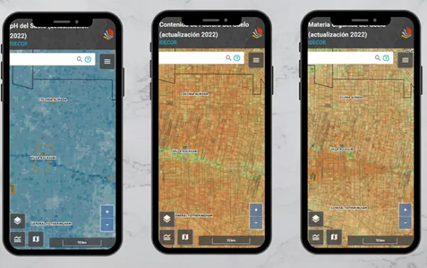
A través de un trabajo interinstitucional, la provincia de Córdoba actualizó los mapas digitales, a escala semi-predial, de materia orgánica (MO), fósforo (P) y Ph. Estas actividades forman parte de la estrategia de Mapeo Digital de Suelos (MDS), en una labor colaborativa iniciada hace más de 3 años entre el Ministerio de Agricultura y Ganadería, ...
agroverdad.com.ar