Geomaticians

Cooperation

AI And Drones Aid Farmers With Identifying Botrytis

AI And Drones Aid Farmers With Identifying Botrytis

Researchers from Unmanned Valley, Greenport DB, and NL Space Campus in the Netherlands have successfully developed an AI model that enables drones to identify the disease botrytis. The model leverages artificial intelligence to analyze vast amounts of drone data, resulting in a detailed map that pinpoints, with millimeter precision, which plants are diseased or at ...
futurefarming.com
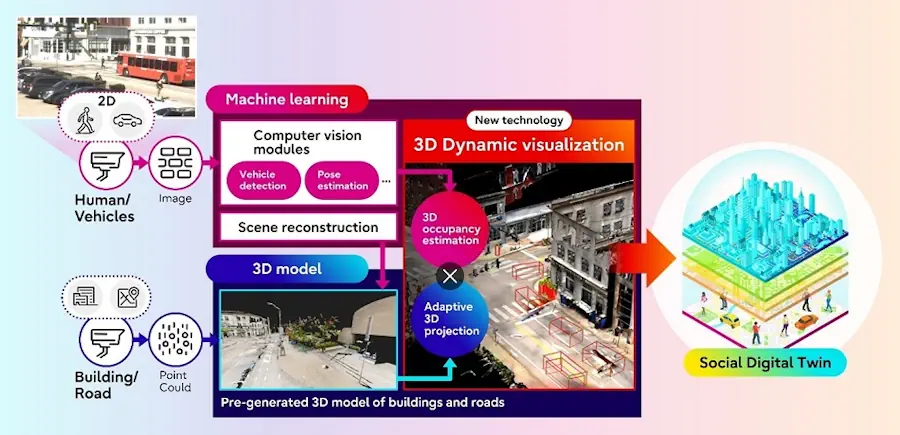
Fujitsu And Carnegie Mellon University Develop AI-Powered Social Digital Twin Technology With Traffic Data From Pittsburgh

Fujitsu And Carnegie Mellon University Develop AI-Powered Social Digital Twin Technology With Traffic Data From Pittsburgh

Fujitsu Limited and Carnegie Mellon University today announced the development of a new technology to visualize traffic situations, including people and vehicles, as part of joint research on Social Digital Twin that began in 2022. The technology transforms a 2D scene image captured by a monocular RGB camera (1) into a digitalized 3D format using ...
fujitsu.com

Philsa, DENR Team Up To Create Mangrove Map Using Satellite Data

The Philippine Space Agency (PhilSA) and the Department of Environment and Natural Resources (DENR) have collaborated to develop a nationwide mangrove map using remote sensing data, a vital tool for conservation efforts. The mangrove mapping initiative is part of the DENR’s development of a national geospatial database for its environment and natural resource accounting program. ...
philstar.com
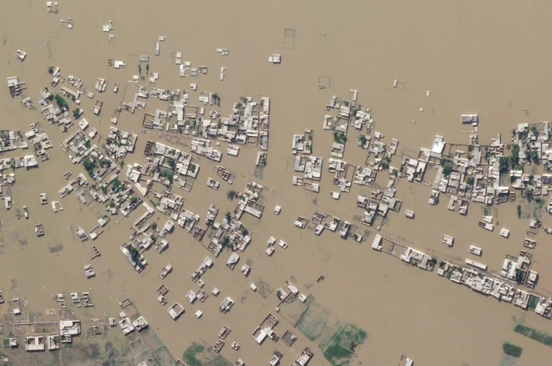
IHME, Microsoft, And Planet Collaborate To Map Climate-Vulnerable Populations In Unprecedented Detail

IHME, Microsoft, And Planet Collaborate To Map Climate-Vulnerable Populations In Unprecedented Detail

Climate change intensifies disasters, which drives displacement. That can, among many impacts, push internally displaced people from rural areas into urban slums. That in turn raises the risks of forced evictions and secondary urban displacement, as well as increased risks of public health crises, and so on, in a dispiriting causal chain. Knowing, in detail, ...
planet.com
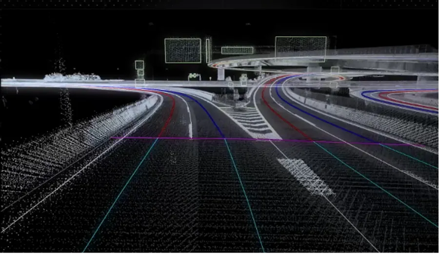
Synspective + Dynamic Map Platform Selected For Enterprise Innovation Promotion Program

Synspective + Dynamic Map Platform Selected For Enterprise Innovation Promotion Program

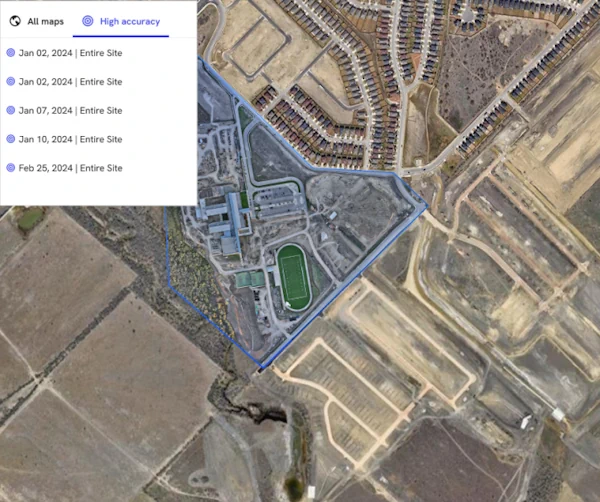
Synspective Inc. (Synspective) and Dynamic Map Platform Co., Ltd. (Dynamic Map Platform) have been selected by the Japanese Ministry of Land, Infrastructure, Transport and Tourism for the Small and Medium Enterprise Innovation Promotion Program. This project leverages SAR satellite technologies and Synspective’s Land Displacement Monitoring (LDM) solution and aims to integrate these technologies with HD ...
news.satnews.com

MoSPI Signs MoU With ISRO On Urban Frame Survey Using Bhuvan

The NSSO (FOD) under Ministry of Statistics and Programme Implementation (MoSPI) has entered into a Memorandum of Understanding (MoU) with the National Remote Sensing Centre (NRSC) under the Indian Space Research Organization (ISRO) to facilitate Urban Frame Survey (UFS) in a digital mode using the state-of-the-art Geo ICT tools and techniques using Bhuvan Platform. The ...
pib.gov.in

GeoComm And Rapidsos Empower Emergency Communications Centers With Enhanced Indoor Maps

GeoComm, provider of Public Safety Location Intelligence, and RapidSOS, creator of the world’s first intelligent safety platform, are excited to announce the integration of GeoComm Indoor Maps into RapidSOS premium. Currently, telecommunicators in the U.S. are typically provided limited building structure information during a 9-1-1 call. An address point on a map with no additional ...
police1.com
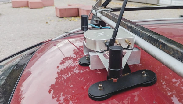
Mosaic, Movella Improve Mobile Mapping And Geospatial Analysis

Mosaic, Movella Improve Mobile Mapping And Geospatial Analysis

Mosaic and Movella have collaborated to combine the Mosaic 51 and Mosaic X camera systems with Movella’s Xsens Vision Navigator (XVN). The collaboration aims to bolster GIS platform integration and allow for extensive and precise 3D reconstruction. It uses inertial measuring unit (IMU) data generated by XVN and directly connects to the OBD port. The ...
gpsworld.com

Mapbox Unveils Digital Twin In Partnership With Snowflake And Maxar

Mapbox, the leading location data platform for mobile and web applications, announced a partnership with Snowflake, the Data Cloud company, and Maxar Intelligence, aimed at delivering a cutting-edge digital twin solution for the telecommunications industry. This collaboration leverages Snowflake’s geospatial capabilities and Maxar’s high-resolution 3D terrain and satellite imagery, combined with Mapbox’s powerful rendering capabilities ...
aithority.com

Inertial Labs And E38 Collaborate For Drone-Lidar Integration

Inertial Labs And E38 Collaborate For Drone-Lidar Integration

In a new strategic partnership, Inertial Labs’ RESEPI Payload Lidar technology will be integrated into E38’s advanced E455 drone platform. This collaboration marks a significant milestone in the utilization of uncrewed aerial systems (UAS) for professional surveying, mapping and inspection services. Inertial Labs is recognized for its innovative essential navigation solutions, and E38 Company is ...
gim-international.com

PlanetScope Now Accessible Via Google Cloud Marketplace

PlanetScope is now accessible on Google Cloud Marketplace. This availability of Planet’s flagship satellite imaging product contributes to the company’s mission to democratize access to near-daily satellite imagery, enabling organizations to visualize and understand the changes occurring on our planet. For Google Cloud customers, leveraging the power of PlanetScope has never been easier. With just ...
gim-international.com
Trimble And DroneDeploy Bring Premier Positioning To UAV Mapping

Trimble And DroneDeploy Bring Premier Positioning To UAV Mapping

Trimble has unveiled the integration of the Trimble Applanix POSPac Cloud post-processed kinematic (PPK) GNSS positioning service, featuring CenterPoint RTX, with the UAV-based mapping and data collection capabilities of DroneDeploy’s reality capture platform. With the Trimble cloud positioning service, DroneDeploy customers can expect centimetre-level accuracy and an automated, streamlined workflow when performing reality capture with ...
gim-international.com

Geographic Information System To Assess And Mitigate Natural Disasters

Southampton University has partnered with three of Egypt’s top institutions in a project aiming to assess and mitigate natural disasters through geographic information system (GIS) mapping technology. The project, ‘Seismic Resilience of Egypt’s Built Environment: A GIS-Based Framework for Assessment and Mitigation’ (Egypt-SeReAM), has received £133.5K from the Engineering and Physical Sciences Research Council (EPSRC) ...
theengineer.co.uk
España Abre Las Puertas A Bruselas De Sus Archivos Secretos De Imágenes Radar

España Abre Las Puertas A Bruselas De Sus Archivos Secretos De Imágenes Radar

El Ministerio de Defensa español ha abierto las puertas de sus archivos secretos de imágenes radar para también puedan ser explotadas, descifradas y convertidas en inteligencia geoespacial por los expertos analistas de la Unión Europea. La ministra Margarita Robles ha autorizado a su departamento para que conceda luz verde al Centro de Satélites de la ...
atalayar.com
ESA’s Cloud Mission In The Limelight

ESA’s Cloud Mission In The Limelight

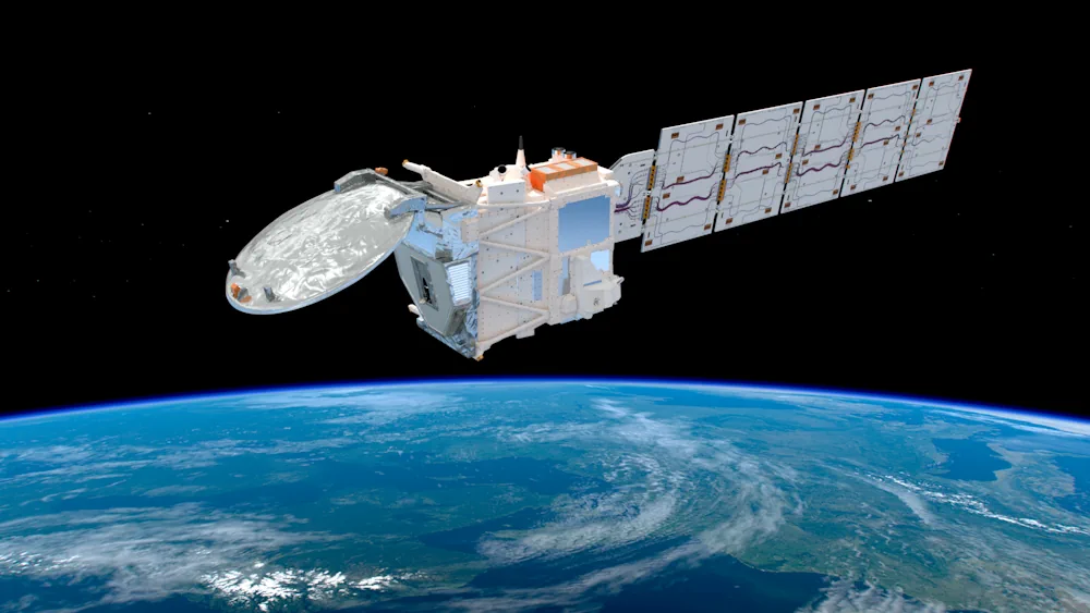
Dedicated to delivering a wealth of new information on exactly how clouds and aerosols affect Earth’s climate, ESA’s EarthCARE satellite has had the chance to show off prior to engineers embarking upon the careful task of packing it up for its journey to the launch site in the US. Carrying four different instruments, this remarkable ...
esa.int

DCU, Bentley Partner For 3D Smart City Research Initiative

Dublin City University (DCU) has partnered with Bentley Systems to create an advanced digital twin of its campus as part of its Smart DCU initiative. The partnership combines artificial intelligence (AI) and immersive digital twin technology. The campus will be used as a testing ground for innovative smart city solutions, with the aim of creating ...
gpsworld.com

Cyfrowy Bliźniak Pomoże Ograniczyć Emisję Dwutlenku Węgla

Naukowcy z Instytutu Geodezji i Geoinformatyki UPWr pracują nad projektem DigiTwins4PEDs, który do modelowania aspektów energetycznych miast wykorzysta cyfrowego bliźniaka miasta. To krok w kierunku miast neutralnych pod względem emisji dwutlenku węgla i zrównoważonej przyszłości energetycznej. Badania finansuje Narodowe Centrum Nauki. Project „Utilisation of urban digital twins to co-create flexible positive energy systems for districts” ...
tuolawa.pl
Baidu And Huawei Forge Strategic Partnership For Advanced Navigation And Smart Cockpit Technologies

Baidu And Huawei Forge Strategic Partnership For Advanced Navigation And Smart Cockpit Technologies

On January 18, 2024, Baidu (Google of China) and Huawei signed an ecological cooperation agreement focusing on navigation, Advanced Driver Assistance Systems (ADAS), and Huawei’s smart cockpit technology. The signing ceremony was attended by Huawei division General Manager Jin Yongfu and Baidu Vice President Shang Guobin. The collaboration aims to improve the navigation and travel ...
carnewschina.com

Danish Geodata Agency And EOMAP Unite To Map Denmark’s Shallows

Through the collaborative implementation of satellite-derived bathymetry (SDB), the Danish Geodata Agency and EOMAP are synergizing efforts to contribute to the European Marine Observation and Data Network (EMODnet) Bathymetry partnership. Their shared goal is to seamlessly integrate SDB data into the Danish Depth Model (DDM). Harnessing cutting-edge satellite technology, this partnership aims to enhance the ...
hydro-international.com
UKHO And XOCEAN Team Up For Uncrewed Seabed Survey

UKHO And XOCEAN Team Up For Uncrewed Seabed Survey

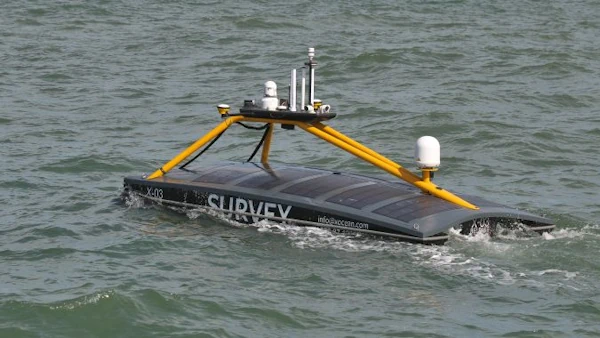
Marine data provider XOCEAN recently deployed five uncrewed surface vessels (USVs) near the Isles of Scilly to collect bathymetric data on behalf of the UK Hydrographic Office (UKHO). The USVs scanned the seabed, identifying features such as depth, habitats, ridges, boulders and shipwrecks. This marked the UKHO’s inaugural use of an external organization for seabed ...
hydro-international.com
Mapbox And Hyundai Autoever Collaborate On 3D Navigation With MapGPT

Mapbox And Hyundai Autoever Collaborate On 3D Navigation With MapGPT

Mapbox, a global company in location technology, announces its collaboration with Hyundai Autoever, an automotive software innovation leader of the Hyundai Motor Group. Together, Mapbox and Hyundai Autoever are set to redefine the driving experience by developing an AI-powered digital ecosystem centred around Mapbox MapGPT, a location-intelligent AI voice assistant capable of natural and actionable ...
geospatialworld.net

Trimble To Provide Advanced Positioning Systems To Sabanto For Enhanced Autonomous Tractor Performance

Trimble and Sabanto have announced the integration of Trimble BX992 Dual Antenna GNSS receivers with Trimble CenterPoint® RTX into Sabanto’s autonomy solutions. Trimble will act as Sabanto’s key autonomous technology provider, delivering high-accuracy positioning to its fleet. Farmers need the highest level of uptime and reliability to avoid service disruption. Leveraging Trimble’s BX992 GNSS receiver ...
insidegnss.com

Abu Dhabi’s Bayanat And Yahsat Merge To Create $4 Billion Space Tech Company

Bayanat, a provider of geospatial data products and services, and Al Yah Satellite Communications, known as Yahsat, are set to merge in a deal that will establish one of the world’s most valuable listed space companies. The combined entity, with a market capitalisation of Dh15 billion ($4.08 billion) based on closing share prices as of ...
edgemiddleeast.com

Rwanda And UAE Sign MoU On Civil Space Activities

UAE and the Rwanda Space Agency have signed a memorandum of understanding with the UAE Space Agency to establish collaboration frameworks in civil space activities, fostering research and development, space technologies, geospatial data sharing, and initiating joint space sector projects. The agreement also offers opportunities for capacity building in space science and technology. This agreement ...
geospatialworld.net

COP28: NICFI And Bezos Earth Fund To Provide Free Satellite Images

Norway’s International Climate and Forest Initiative (NICFI) and the Bezos Earth Fund announce a new partnership to continue providing the world with free access to high-resolution satellite data to support efforts to stop the destruction of the world’s rainforests. The partnership adds to the USD 43 million previously granted by NICFI to establish the NICFI ...
geospatialworld.net
China Launches Remote-Sensing Satellite For Egypt

China Launches Remote-Sensing Satellite For Egypt

China launched a remote-sensing satellite for Egypt late on Sunday (Dec. 3) as space cooperation between the two countries deepens. A Long March 2C rocket lifted off from Jiuquan Satellite Launch Center in the Gobi Desert at 11:10 p.m. EST on Sunday (0410 GMT, or 12:10 p.m. Beijing time on Dec. 4), with insulation tiles ...
space.com

Trimble Supports Indian Institute Of Technology With Inertial Navigation Solutions For UAV Industry Leadership

Trimble announced today a collaboration with the Indian Institute of Technology in Kanpur (IIT Kanpur) to support a new program in uncrewed aerial vehicles (UAV) to be offered by the Department of Aerospace Engineering. A signing ceremony to officially launch the program was held on October 26 and attended by Professor Tarun Gupta, dean of ...
uasweekly.com

IBM Advances Geospatial AI To Address Climate Challenges

IBM today announced new efforts that apply its geospatial AI technologies, including IBM’s geospatial foundation model developed in collaboration with NASA, to climate efforts including analysis of urban heat islands in the United Arab Emirates (UAE); reforestation across Kenya; and climate resiliency in the United Kingdom (UK). IBM continues to advance its AI model strategy ...
newsroom.ibm.com

Sino-Kenyan Forum Opens In Kenya To Boost Use Of Geospatial Technologies

A Sino-Kenyan forum started in the Kenyan capital, Nairobi, Wednesday to seek ways of promoting the use of geospatial technologies in agriculture, urban planning and natural resource management. The 2023 Supermap GIS software innovation conference that was jointly organized by Kenya’s Directorate of Resource Surveys and Remote Sensing and Chinese firm Supermap gathered government officials, ...
china.org.cn

UAE Launches Development Phase Of Sirb Satellite Programme

The project will enable partnerships with global institutions and offer incentives, as an extension of the Space Economic Zones project. The Sirb programme will enable the commercialisation of satellites and the data they generate on both national and international fronts. This milestone project will include three synthetic aperture radar (SAR) satellites that use advanced imaging ...
gulfbusiness.com