Geomaticians

Conference

Conferenza Nazionale Di Geomatica E Informazione Geografica #ASITA2024 Primo Annuncio E Call For Abstract

ASITA è il luogo dove professionisti, docenti, ricercatori, tecnici e professionisti, soggetti istituzionali e territoriali, società commerciali e più in generale tutti coloro che operano nei diversi campi della Geomatica possono confrontarsi su temi specifici, promuovendo una visione multidisciplinare e integrata del settore della Geomatica nel tentativo di delineare le cosiddette “best practices” utili ad ...
rivistageomedia.it

I Dati Satellitari Per Il Controllo Del Microclima Urbano. All’oar Il Convegno Con L’agenzia Spaziale Italiana E Il Politecnico Di Milano

Arrivano dai dati satellitari gli strumenti per mappare il fenomeno dell’isola di calore urbana e capire come la struttura fisica della città e l’uso del suolo influiscano sul microclima urbano. Se ne parla al convegno che si terrà venerdì 23 febbraio presso il complesso monumentale dell’Acquario Romano, sede dell’Ordine degli Architetti di Roma e Provincia. ...
architettiroma.it

Registrations Open For Geo Connect Asia 2024

Regional geospatial, positioning and remote sensing conference, Geo Connect Asia, will return to Singapore on the 6th and 7th of March, 2024. The theme, ‘Geospatial driven impacts: underground, ground and sea to sky,’ will address key challenges facing the Asian region, from public health and critical infrastructure to AI and the monitoring of utility operations. ...
spatialsource.com.au
El Proyecto DATAPASS Elabora El Primer Mapa Interactivo Sobre Vivienda Que Integra Las Bases De Organismos Públicos Transfronterizos

El proyecto DATAPASS de cooperación transfronteriza, en el que participa el Gobierno de Navarra y Nasuvinsa-Lursarea, ha elaborado un mapa interactivo que integra las bases de datos de los organismos implicados en el diseño de políticas públicas en ordenación del territorio y urbanismo, en el marco de un estudio sobre vivienda y territorio en el ...
pamplonaactual.com

Esri España Celebra Su Conferencia Geoespacial Con El Agua Como Temática De Análisis

La Conferencia Esri España, el mayor evento sobre tecnología geoespacial de Europa, organizado anualmente por Esri España, reúne el 4 y 5 de octubre en Ifema (Madrid) algunos de los proyectos más innovadores en la aplicación de tecnología geoespacial en España, entre ellos sobre agua. Bajo el lema ´Creando el mundo que queremos ver´, el ...
tecnoaqua.es

Cuba Se Apresta A Celebrar La X Convención De Agrimensura 2023

El citadino Hotel Tryp Habana Libre, acoge la X Convención de Agrimensura 2023, cuyas sesiones de debates y feria expositiva se extenderán desde este 25 al 30 de septiembre próximos, informó el Comité Organizador. Antonio Guerrero Rodríguez, presidente de la Unión Nacional de Arquitectos e Ingenieros de la Construcción de Cuba (UNAICC), organizador del encuentro, ...
excelenciascuba.com
PCSDS Upgrades Coastal Mapping Through Google Earth Engine

PCSDS Upgrades Coastal Mapping Through Google Earth Engine

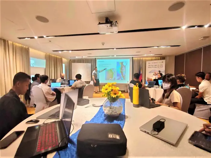
The Palawan Council for Sustainable Development, along with representatives of different government and public organizations dedicated to environmental conservation in Palawan, attended a training-workshop organized by the United States Agency for International Development (USAID) Fish Right program on August 21-23. The workshop consisted of using the features of Google Earth Engine, integrating it with the ...
palawan-news.com
Hacia La Democratización De La Información Geográfica

Hacia La Democratización De La Información Geográfica

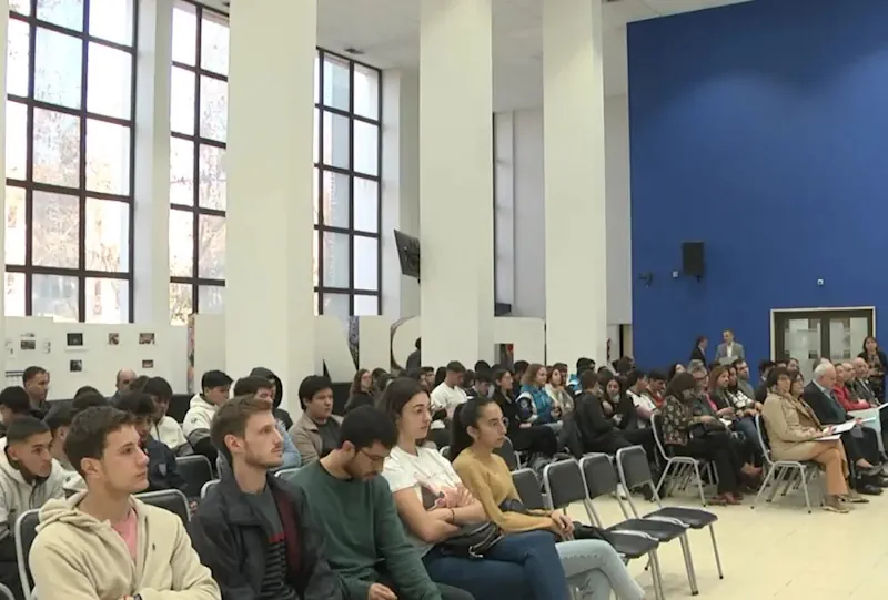
El Centro de Fotogrametría, Cartografía y Catastro (CEFOCCA) de la Facultad de Ingeniería de la UNSJ ha preparado, en el marco de su 50 aniversario, una serie de actividades de extensión y difusión. Este martes 15 de agosto hubo en el Edificio Central de la UNSJ una conexión interactiva con el Dr. Ever Castillo Osorio, ...
unsj.edu.ar

Scientists To Converge In Nairobi For Earth Observation Conference

Top Scientists from across the world are set to put their heads together in Nairobi next week to find solutions to challenges facing the earth through the use of earth observation technologies. Regional Centre for Mapping of Resources for Development Director General Dr Emmanuel Nkurunziza told journalists that over 1,000 delegates are expected. “The conference ...
the-star.co.ke
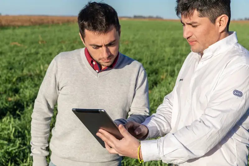
Experta Tecnología AGD Presenta En AAPRESID Su Nueva Plataforma Digital

Experta “Tecnología AGD” Presenta En AAPRESID Su Nueva Plataforma Digital

La importancia de la gestión del conocimiento en las empresas agropecuarias cada vez tiene más relevancia al momento de tomar decisiones. La evolución de la agricultura en los últimos años, el aumento de la información y las nuevas tecnologías generan una oportunidad para hacer más eficiente la producción agropecuaria, pero sistematizar y ordenar todos los ...
agritotal.com

I Kongres Geoinformacyjny: Zmiana Terminu Zgłaszania Referatów

Do 23 września został wydłużony termin, w którym można zgłaszać referaty na I Kongres Geoinformacyjny. Wydarzenie odbędzie się w dniach 25–27 października w Krakowie. Jak zapewniają organizatorzy, spotkanie pozwoli na pełną integrację środowisk związanych z geoinformacją w kraju, ale nie tylko. Kongres Geoinformacyjny będzie wydarzeniem naukowym, które umożliwi prezentację najnowszych polskich i zagranicznych osiągnięć badawczych ...
geoforum.pl

Ruszyły Zapisy Na VIII Forum Biogis

Można już zapisywać się na VIII Forum BioGIS – System Informacji Przestrzennej w badaniach różnorodności biologicznej, które odbędzie się w dniach 29 – 30 listopada 2023 r. w Poznaniu. Forum BioGIS jest cykliczną imprezą o charakterze konferencji i warsztatów, której głównym celem jest wymiana doświadczeń między nauką i praktyką, a także popularyzacja wiedzy na temat ...
gisplay.pl

Le Symposium De Mi-parcours Sera Organisé À Belém, Du 4 Au 8 Novembre 2024

Dans le cadre de la présidence franco-brésilienne 2022-2026 de la Commission III « Remote Sensing » de la Société Internationale de Photogrammétrie et de Télédétection (ISPRS), le symposium de mi-parcours, en partenariat avec le SFPT (France), sera organisé à Belém, du 4 au 8 novembre 2024, ainsi que le symposium latino-américain sur la télédétection SELPER. ...
ird.fr
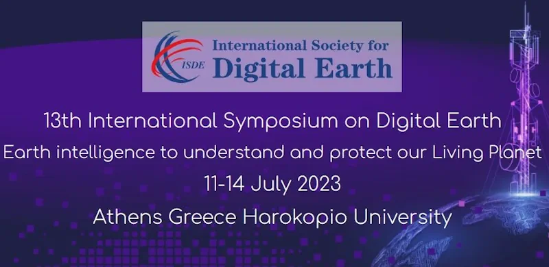
ISDE 23 Στην Αθήνα Το 13ο Διεθνές Συμπόσιο Για Την Ψηφιακή Γη

ISDE 23: Στην Αθήνα Το 13ο Διεθνές Συμπόσιο Για Την Ψηφιακή Γη

Στην Αθήνα θα πραγματοποιηθεί από τις 11 έως τις 14 Ιουλίου 2023 και συγκεκριμένα στο Χαροκόπειο Πανεπιστήμιο το 13ο Διεθνές Συμπόσιο για την Ψηφιακή Γη – ISDE 2023. Το ISDE είναι το ετήσιο συνέδριο της Διεθνούς Εταιρείας για την Ψηφιακή Γη, στο οποίο διερευνάται το ερώτημα πώς η ψηφιακή τεχνολογία μπορεί να συμβάλει στην προστασία ...
powergame.gr

Final Call For Abstracts For Fourth International Workshop On Spatial Data Quality

Submissions covering a wide range of topics, including ways in which data providers can ensure that their data continues to be trusted, ways of bringing together data from multiple sources to ensure seamless, high-quality datasets, and ways to communicate the quality, relevance and content to users, are invited by 17 July. The event, to be ...
directionsmag.com
Universidad Participa En El 'VI Congreso Nacional De Estudiantes De Geomática, Geodesia Y Geoinformática'

Universidad Participa En El ‘VI Congreso Nacional De Estudiantes De Geomática, Geodesia Y Geoinformática’

La jefa de posgrado de la Facultad de Ciencias Forestales y Ambientales de la Universidad Juárez del Estado de Durango, Emily García Montiel, compartió detalles sobre el “Sexto Congreso nacional de estudiantes de geomática, geodesia y geoinformática”, que tuvo lugar del 17 al 20 de mayo. En este evento, estudiantes e investigadores del núcleo básico ...
elsiglodedurango.com.mx

2ème Édition De “Tunisia Drone Day” Se Tiendra Le 10 Juin 2023 À La Cité Des Sciences

L’Association Africaine pour la Promotion du Géospatial (AGEOS) organise en collaboration avec le cercle Aéronautique, comprenant la Fédération Tunisienne des Pilotes de Ligne (FTPL), l’Association Tunisienne de l’Aéronautique (ATA) et l’Association Tunisienne des Contrôleurs de la Circulation Aérienne (ATCCA), la deuxième édition de la conférence internationale “Tunisia Drone Day “. Cette conférence se tiendra le ...
tekiano.com
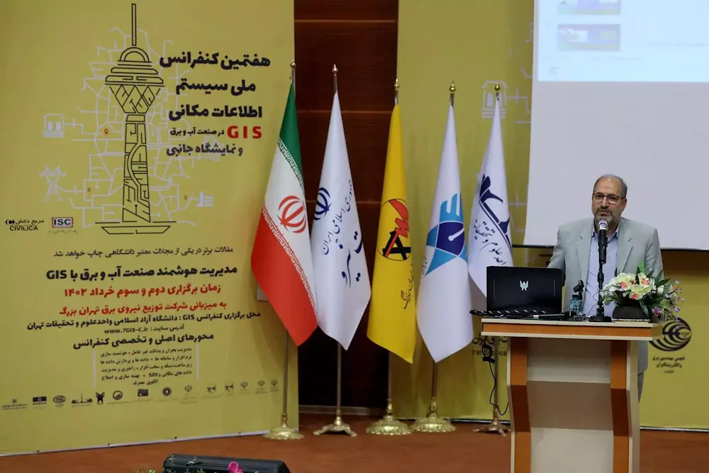
کنفرانس ملی سیستم اطلاعات مکانی در صنعت آب و برق در واحد علوم و تحقیقات برگزار شد

کنفرانس ملی سیستم اطلاعات مکانی در صنعت آب و برق در واحد علوم و تحقیقات برگزار شد

هفتمین کنفرانس ملی سیستم اطلاعات مکانی (GIS)، به همت معاونت پژوهشی واحد علوم و تحقیقات، با همکاری وزارت نیرو و شرکت توزیع نیروی برق تهران بزرگ با هدف دستیابی به آخرین یافته‌های علمی و پژوهشیGIS در ایران و جهان و تبادل تجربیات حاصله در صنعت آب و برق کشور و با حضور جمعی از پژوهشگران، ...
iau.ir

Geovet 2023 – Expanding Boundaries: Interdisciplinary Geospatial Research For The One Health Era

Since 2001, the GeoVet conference, held every 3 years, brings together a diverse group of international experts in spatial epidemiology, spatial statistics and Geographical Information Systems applied to animal health, public health and food safety. From September 19ᵗʰ to 21ˢᵗ 2023, in Silvi Marina, Teramo – Italy, experts from different disciplines will share their knowledge ...
eurekalert.org

Scientists From Country’s Top Space Research Institutes Join Climate Change Deliberations At Kashmir University

Distinguished scientists from the country’s top research organisations involved in satellite earth observation including ISRO and other institutions of national importance joined deliberations on the use of satellite earth observation for climate services during a national-level workshop on ‘Earth Observations for Climate Services’ at the University of Kashmir on Thursday. Vice-Chancellor Prof Nilofer Khan inaugurated ...
greaterkashmir.com
Cold Atoms For New Physics

Cold Atoms For New Physics

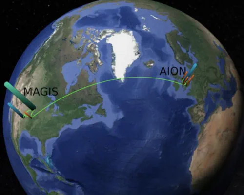
On 13 and 14 March CERN hosted an international workshop on atom interferometry and the prospects for future large-scale experiments employing this quantum-sensing technique. This quantum sensing technology holds great promise for making ultra-sensitive measurements in fundamental physics. Like light interferometry, atom interferometry involves measuring interference patterns, but between atomic wave packets rather than light ...
cerncourier.com
Geospatial World Forum 2023 To Be Held In Rotterdam In May

Geospatial World Forum 2023 To Be Held In Rotterdam In May

The Geospatial World Forum (GWF) is gearing up for its 14th edition, and it promises to be a must-attend event for professionals in the geospatial industry. With expected participation of 800+ attendees from more than 75 countries, the GWF is set to be a global gathering of industry leaders, innovators, and experts. More than 300 ...
geospatialworld.net

NORTH51 Heads To Banff For The 5th Annual Geospatial Ideas Conference

NORTH51 Conference, a boutique event dedicated to geospatial ideas is set to take place on May 10-12, 2023 at the Rimrock Resort in Banff. The conference will bring together industry leaders, experts, professionals, and enthusiasts from around the world to exchange ideas, share knowledge, and discuss the latest trends and advancements in the world of ...
amerisurv.com

Locana Showcases Leading Mobile Geospatial Capabilities To Energy, Utilities And Infrastructure Markets At European Shows

Locana, an international leader in spatial technology, announced that its Lemur mobile GIS solution will be showcased at the International SAP Conference for Utilities in Basel, Switzerland and the ESRI International Infrastructure Management & GIS Conference in Frankfurt, Germany. Both events will address how mobile field work requirements across Europe are rapidly shifting — and ...
directionsmag.com

Developers Invited To The 2023 OGC Tiling Interfaces Code Sprint

The Open Geospatial Consortium (OGC) invites software developers to the OGC Tiling Interfaces Code Sprint, to be held online and in-person from June 12-14, 2023, at the Moonshot Labs of the National Geospatial-Intelligence Agency (NGA) in St Louis, Missouri, USA. Participation in the code sprint is free. Registration for in-person participation closes at 5pm EDT ...
directionsmag.com
Hexagon US Federal Announces The Digital Defense Summit At HxGN Live Global 2023

Hexagon US Federal Announces The Digital Defense Summit At HxGN Live Global 2023

Hexagon US Federal is involved in shaping a first-of-its kind Digital Defense Summit for U.S. Government and global attendees from federal civilian, defense, intelligence organizations, and industry partners and customers. The four-day event will take place during the HxGN Live Global 2023 digital reality conference, from June 12 – 15, 2023 in Las Vegas, NV.
businesswire.com
Locate23 From Lands To Seas To Stars

Locate23: From Lands To Seas To Stars

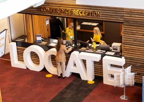
The Australian geospatial industry’s most important annual event, Locate, is on once again, this time in Adelaide from 10-12 May 2023 and with a distinctly spacey feel. With the city now recognised as the nation’s ‘space capital’ — home of the Australian Space Agency, the SmartSat CRC and numerous space-related companies — and with the ...
spatialsource.com.au
국토지리정보원, 국가기본도 고도화 추진…‘디지털 대한민국’ 앞당긴다

국토지리정보원, 국가기본도 고도화 추진…‘디지털 대한민국’ 앞당긴다

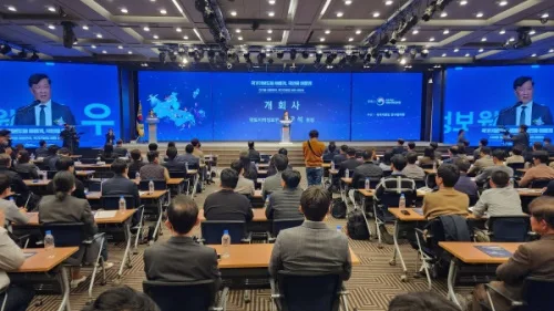
국가기본도가 다양한 공공·민간 데이터를 활용으로 최신성이 강화되고, 일관성 있는 데이터베이스로써 보다 폭넓은 분야와의 연계·활용이 가능해질 전망이다. 국토교통부 국토지리정보원은 29일 서울 영등포구 중소기업중앙회 K-Biz홀에서 ‘국가기본도 비전 선포식’을 개최했다고 밝혔다. 국토지리정보원에 따르면, 디지털 트윈 기술의 발전을 위해 지도의 최신성과 정확성이 강화되고 호환성이 향상돼야 한다는 요구가 커지고 있는 상황에서 자율주행이 가능하고 휠체어와 로봇이 자유롭게 이동할 수 있도록 현실 ...
cenews.kr

Seminarium: ISO W Specyfikacjach KIIP

19 maja w Warszawie w centrum konferencyjnym West Gate odbędzie się seminarium naukowo-techniczne „Zastosowanie norm ISO w specyfikacjach Krajowej Infrastruktury Informacji Przestrzennej”. Seminarium kierowane jest m.in. do osób tworzących specyfikacje danych przestrzennych na wszystkich szczeblach administracji publicznej, producentów danych geodezyjno-kartograficznych, analityków biznesowych z obszaru aplikacji geoprzestrzennych, kartografów, geoinformatyków oraz do osób pracujących przy kontroli danych ...
geoforum.pl
SEI Lança Novos Aplicativos De Geoinformação Em Evento On-line

SEI Lança Novos Aplicativos De Geoinformação Em Evento On-line

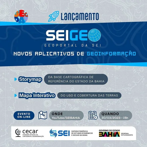
A plataforma SEIGEO, portal oficial de geoinformação da Superintendência de Estudos Econômicos e Sociais da Bahia (SEI), disponibiliza para os usuários dois novos aplicativos: o Storymap da Base Cartográfica de Referência do Estado da Bahia e o Mapa Interativo do Uso e Cobertura das Terras. As ferramentas serão lançadas em evento on-line, a ser realizado ...
correio24horas.com.br