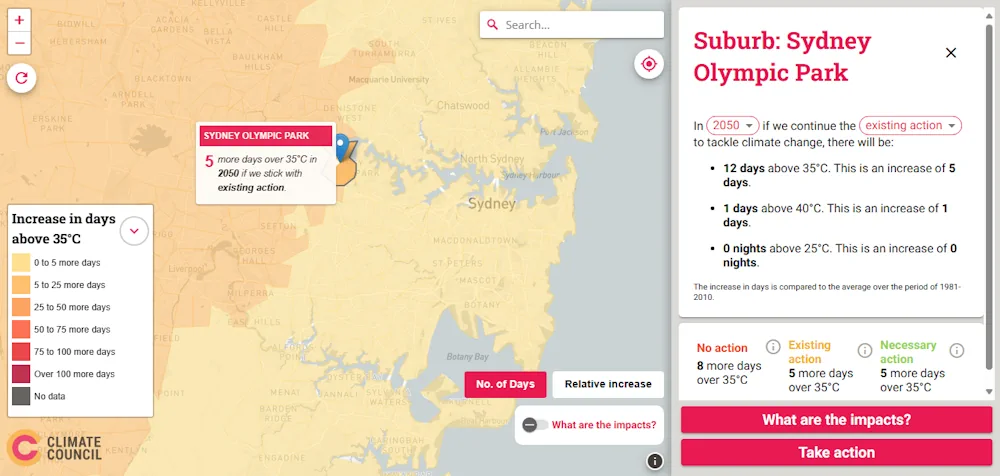
The Climate Council’s Heat Map of Australia is an interactive tool that shows how cutting climate pollution will limit extreme heat in our neighbourhoods. It projects the average number of hot and very hot days, as well as very hot nights, for each suburb by 2050 and 2090, and across three scenarios: no action, continuing with existing action, and taking necessary action in line with Climate Council’s recommendations.