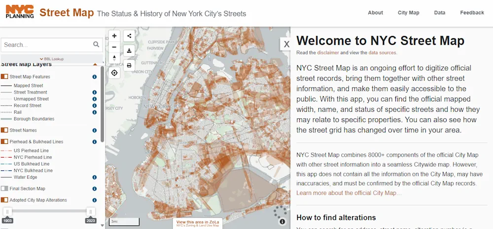
On October 12, 2023, Department of City Planning Director Dan Garodnick announced that the NYC Street Map will now include access to the original street mapping of the City. Users can see the width, angles, and other dimensions of the City’s over 32,000 streets when utilizing the interactive map for requests to change their street, personal property interests, and to explore the history of the City. By clicking on the street square grid, users can view the layout of any street in the City from its original mapping through all alterations to present day. The oldest street map dates back to the start of the 20th century and the paper maps accessible are over a combined total of 8,000 documents.