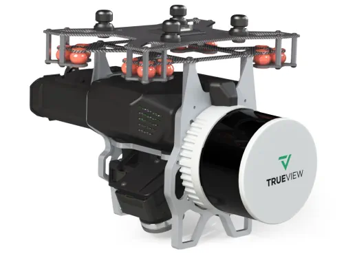
Cansel, a technology solutions provider for industries including engineering, surveying, construction, and utilities, announced a partnership with GeoCue, a global provider of 3D LiDAR imaging sensors and geospatial software. Now as a distributor of GeoCue, Cansel will offer the full product line of TrueView LiDAR 3D imaging sensors and LP360 processing software throughout Canada. TrueView is an innovative drone LiDAR and photogrammetry solution integrated into lightweight payloads, allowing for fast, easily automated generation of true 3D colourized point clouds, oblique imagery, and orthophotos from a single drone flight. LP360 is an advanced desktop LIDAR software package that makes easy work of extracting information and generating deliverables in an intuitive GIS environment.