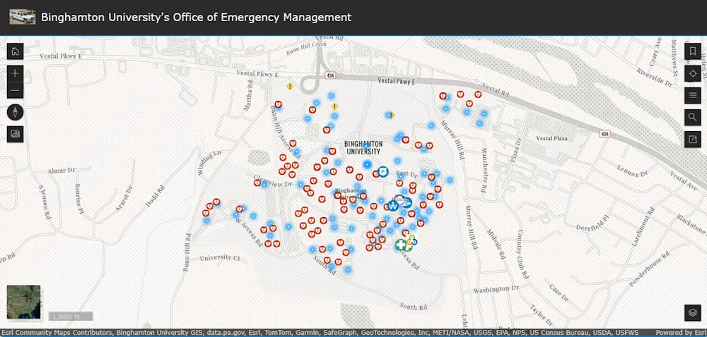
In dire situations, it is important to know where safety resources like blue lights, police stations and automated external defibrillators (AEDs) are located across Binghamton University’s multiple campuses. Thanks to the work of Ryan Kinsella, this kind of information is easier to access than ever before.
A graduate student in the Geography Department, Kinsella has developed a series of interactive public safety maps to provide easily accessible information to limit confusion during crises.
Kinsella began an internship program with the Office of Emergency Management (OEM) in fall 2023. Prior to his internship, in an interview with executive director Dave Hubeny, the concept of these geographic information systems (GIS) maps was brought up.
The process of creating these maps begins with mobile apps that capture geolocation points. For example, someone helping to create these maps would walk up to a blue light and have their precise whereabouts pinged.
“In simple terms, that essentially gets uploaded to a web map that automatically populates. We use different tools to symbolize each point, add on additional information, and then, ultimately, put it all together and deliver that instant map that people see,” Kinsella said.