The U.S. Geological Survey (USGS) has released a compilation of national-scale geological, geophysical and mineral resource datasets from Australia, Canada and the US through a collaboration between the three countries’ federal geological surveys. “Geology doesn’t stop at the border and neither does our data,” said USGS scientist Anne McCafferty, who led the effort. “Scientists will now be able to look at geological and geophysical data seamlessly across both Canada and the United States, as well as make direct comparisons to Australia.”
“These standardised datasets, spanning the continents of Australia and North America, enable unique investigations into the controls on critical mineral distribution which were simply not possible beforehand,” said Geoscience Australia scientist Karol Czarnota. “I’m sure they will be a foundation for ongoing research and innovation for many years to come.”
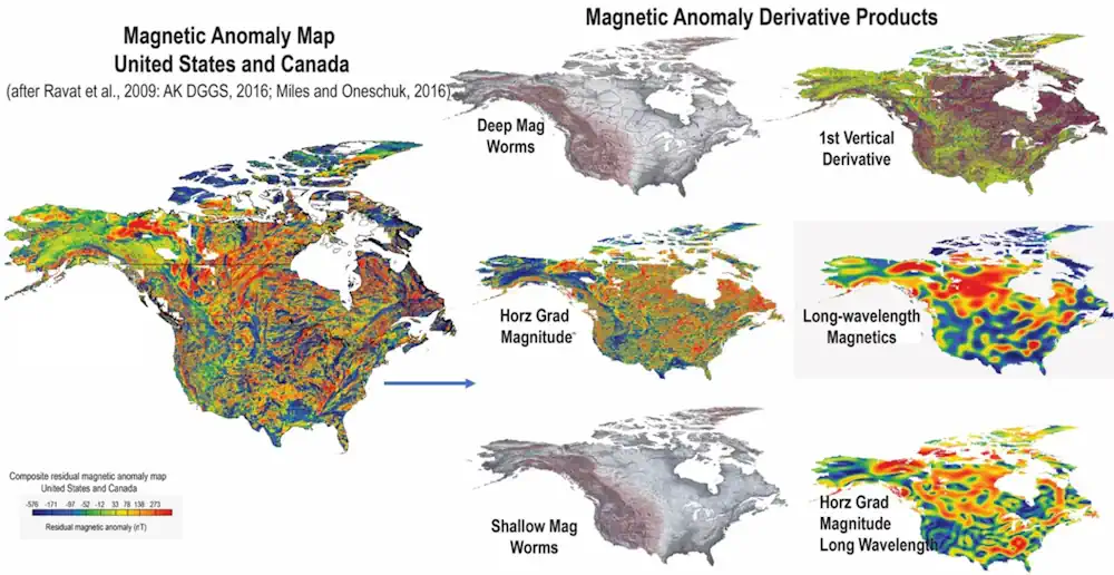
The data release includes more than 40 earth science data layers, including a new map of variations in the Earth’s natural magnetic field for the entirety of Canada and the United States that scientists can use to develop three-dimensional representations of geology underground. The data layers are in widely accepted geographic information system formats.