It’s been one month since deadly tornadoes tore through Tennessee counties and left serious devastation. Since then, many have jumped in to help. One team — part of a data center at Austin Peay State University — used a special computer system to get assistance to victims faster.
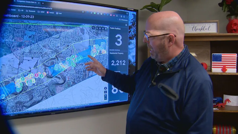
Mike Wilson, the director of the APSU GIS Center, said this unique technology, short for geographic information systems, helped find the areas hardest hit by the tornado. “I’m not a first responder, but what we can do is use this technology to assist,” he said.
While his partner Doug flew the drone, Mike tracked 911 calls, road closures, and later, property assessments, to pinpoint who needed help most. All the data, shared with Montgomery County Emergency Management, quickly sent help to damaged neighborhoods, pointed volunteers clearing debris in the right direction, and even showed who would be most in need of food donations. “The sooner we collect this data, the sooner we can get help to the people that need it most,” said Wilson. He said the advanced nature of GIS allowed them to do the work in hours, compared to what would’ve taken weeks in prior years.
The team added four or five APSU students to help with the mapping during the disaster. The center has assisted in natural disasters before, including prior tornadoes and floods in Montgomery County.