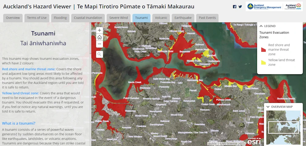
Fewer Auckland residents would be at risk in the event of a tsunami than the council previously thought. Auckland Emergency Management (AEM) has updated the region’s tsunami map in the wake of new data which it says showed less of the city’s coastline would be at threat.
AEM head of operations John Cranfield said the data used more accurate modelling of tsunamis which replicated earthquakes, and the movement of water, onto the region’s shores.
It showed fewer residents living on Auckland shoreline, Hauraki Gulf Islands, and Aotea Great Barrier Island would need to evacuate. But Cranfield said, while there was a lower risk, much of Auckland’s shoreline was still in the red.