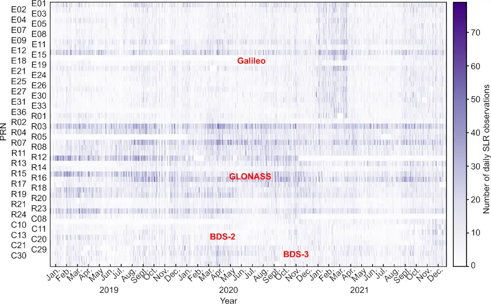
Aerial System Obtains Glacier Data
The Chinese Academy of Sciences and Wuhan University are conducting a sky-ground scientific experiment to test the condition of glaciers in the Haibei Tibetan autonomous prefecture in Northwest Qinghai province. The experiment has applied radars in three bands — P-band, L-band and Very High Frequency — and undertaken 11 flights, among which seven carried out ...
chinadaily.com.cn