Geomaticians

Washington University in St. Louis

Artificial Intelligence Meets Cartography

Artificial Intelligence Meets Cartography

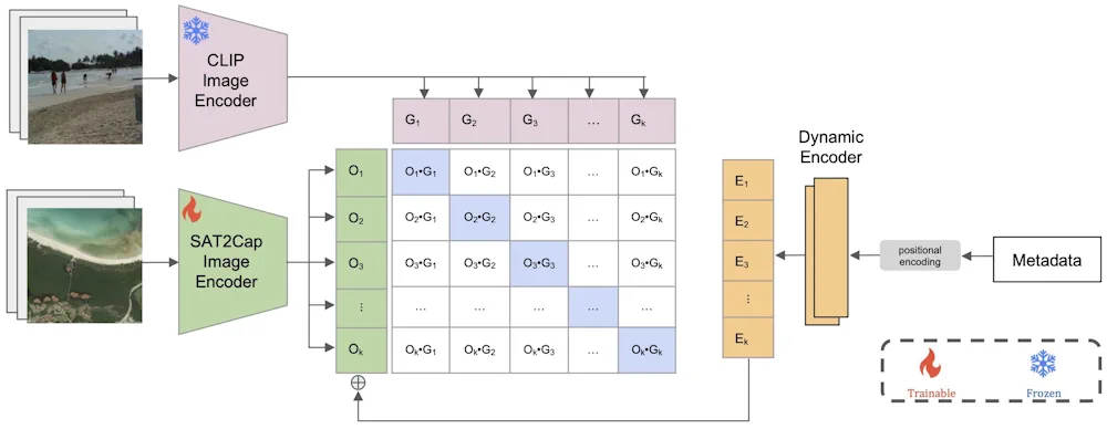
Most people interact with maps regularly, for example, when they’re trying to get from point A to point B, track the weather or plan a trip. But, beyond those daily activities, maps are also increasingly being combined with artificial intelligence to create powerful tools for urban modeling, navigation systems, natural hazard forecasting and response, climate ...
engineering.wustl.edu
Interactive Approach To Geospatial Search Combines Aerial Imagery, Reinforcement Learning

Interactive Approach To Geospatial Search Combines Aerial Imagery, Reinforcement Learning

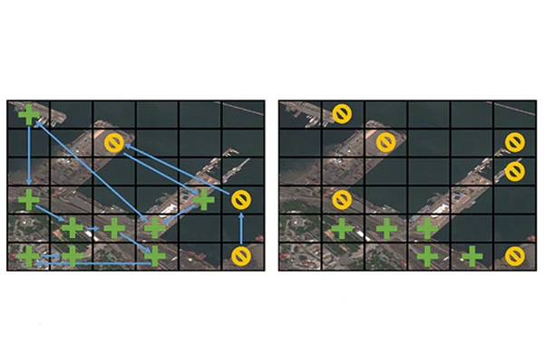
When combatting complex problems like illegal poaching and human trafficking, efficient yet broad geospatial search tools can provide critical assistance in finding and stopping the activity. A visual active search (VAS) framework for geospatial exploration developed by researchers in the McKelvey School of Engineering at Washington University in St. Louis uses a novel visual reasoning ...
engineering.wustl.edu