Geomaticians

Wageningen University and Research

Mapping How Deforested Land In Africa Is Used

Mapping How Deforested Land In Africa Is Used

Africa’s forested areas—an estimated 14 % of the global forest area—are continuing to decline at an increasing rate—mostly because of human activities to convert forest land for economic purposes. As natural forests are important CO2 and biodiversity reservoirs, this development has a significant impact on climate change and affects the integrity of nature. To intervene ...
phys.org
Study Brings Satellite Data Down To Earth For Biomass Tracking

Study Brings Satellite Data Down To Earth For Biomass Tracking

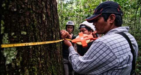
Each data-gathering method has advantages and limitations. National forest inventories (NFIs), which include biomass estimates and are conducted in most of the world’s countries, are based on field plots. But monitoring those field plots is costly, so the number is limited, and results must be averaged out over the country, resulting in less-precise calculations. Satellites ...
forestsnews.cifor.org