Geomaticians

University of Twente

An Open-Source Tool To Assist In Multi-Hazard Risk Assessment

An Open-Source Tool To Assist In Multi-Hazard Risk Assessment

RiskChanges is an open-source cloud-based spatial decision support tool using a dynamic and comprehensive approach to multi-hazard risk assessment. It is designed to support orgaizations in assessing and managing risks associated with multiple hazards at the local level to select optimal risk reduction alternatives. RiskChanges was developed by the University of Twente in collaboration with ...
reliefweb.int
Measuring Nutrition In Crops From Space

Measuring Nutrition In Crops From Space

With many people around the world suffering from various forms of malnutrition it’s important that the absolute basics such as rice, soya and wheat are as nourishing as possible. ESA-funded research shows that the Copernicus Sentinel-2 mission and the Italian Prisma mission could be used to monitor the nutritional content of staple crops. This could, ...
esa.int
Using AI To Push The Boundaries Of Wildlife Survey Technologies

Using AI To Push The Boundaries Of Wildlife Survey Technologies

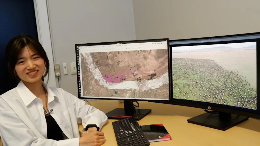
In their research, associate professor from the NRS Department Tiejun Wang and his master’s student Zijing Wu developed an AI-model to automatically locate and count large herds of migratory ungulates (wildebeest and zebra). They used their method in the Serengeti-Mara ecosystem using fine-resolution (38–50 cm) satellite imagery. They achieved accurate detection of nearly 500,000 individuals across ...
phys.org