Geomaticians

University of Connecticut

Mapping Connecticut's Understory From Outer Space

Mapping Connecticut’s Understory From Outer Space

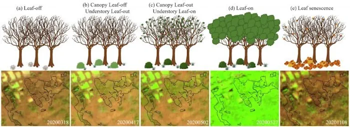
Distinguishing separate plant species from one another is hard even for human eyes; however, a team of UConn researchers was able to use data from a satellite nearly 500 miles (786km) above Earth’s surface to map Connecticut’s forest understory plant communities. The results of this study are published in Remote Sensing of Environment. The understory, ...
phys.org
Uconn Researchers Take A More Innovative Approach To Investigating Inequity In Parks

Uconn Researchers Take A More Innovative Approach To Investigating Inequity In Parks

‘While many studies looked at these topics at the city level, I was able to explore the local patterns within the city, not just talk about the fact that there is unequal access to parks, but I was able to identify neighborhoods that should be improved’. Not everyone has equal access to green spaces, and ...
today.uconn.edu