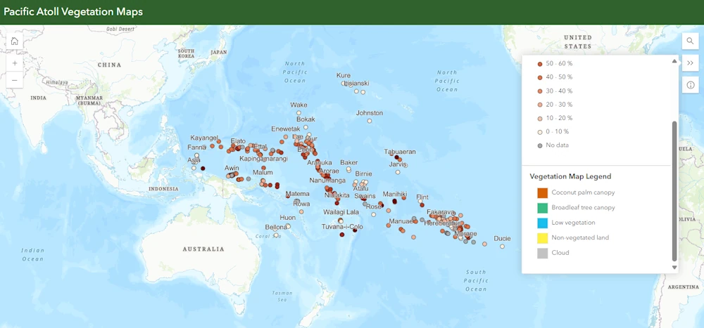
New Mapping Shows 80% Of Pacific Atolls Deforested By Coconut Palms
The Nature Conservancy and UC Santa Barbara release the first comprehensive maps of coconut agriculture, and the subsequent loss of native forests, on atolls throughout the tropical Pacific. Over the last 200 years, this pervasive land cover change has profoundly altered ecosystems and hydrologic resources, potentially affecting atoll communities’ resilience to climate change and other environmental ...
scoop.co.nz