Geomaticians

JPL

Satellites Help Scientists Track Dramatic Wetlands Loss In Louisiana

Satellites Help Scientists Track Dramatic Wetlands Loss In Louisiana

From Lake Pontchartrain to the Texas border, Louisiana has lost enough wetlands since the mid-1950s to cover the entire state of Rhode Island. Using a first-of-its kind model, NASA-funded researchers quantified those wetlands losses at nearly 21 square miles (54 square kilometers) per year since the early 1980s. In the new study, scientists used the ...
jpl.nasa.gov
City Heat Extremes Captured By Instrument On The ISS

City Heat Extremes Captured By Instrument On The ISS

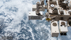
An instrument, carried on the International Space Station, has captured the recent land-surface temperature extremes for some European cities, including Milan, Paris and Prague. For ESA, this particular instrument, which is called ECOSTRESS and owned by NASA’s Jet Propulsion Laboratory (JPL), is important because it is helping in the development of a new Copernicus Sentinel ...
phys.org