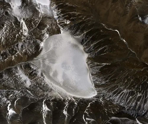
The Chinese Academy of Sciences and Wuhan University are conducting a sky-ground scientific experiment to test the condition of glaciers in the Haibei Tibetan autonomous prefecture in Northwest Qinghai province. The experiment has applied radars in three bands — P-band, L-band and Very High Frequency — and undertaken 11 flights, among which seven carried out tomography and interferometric imaging and four conducted perspective imaging. A total of 4.6 terabytes of data have been obtained. The experiment also involved visible light and lidar flight observation of the ice surface, the calibration of instruments used to analyze the surface of the ice, the measurement of glacier thickness using ground-penetrating radar, and extra-long visual distance three-dimensional cloud imaging.