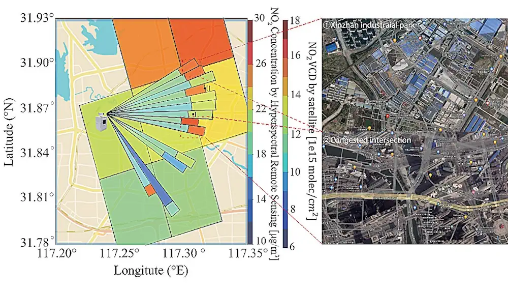
A groundbreaking study by researchers from a number of institutions in China introduces a novel hyperspectral remote sensing technique capable of hour-hectometer level horizontal distribution of trace gases, offering an advanced tool to accurately identify emission sources. The study was published in the Journal of Remote Sensing on 14 November 2023. The research introduces a groundbreaking hyperspectral remote sensing method that delivers highly accurate, hour-hectometer-level insights into the horizontal distribution of atmospheric trace gases. This advanced technique utilizes effective optical paths (EOPs) within the ultraviolet (UV) and visible (VIS) spectral bands to measure average trace gas concentrations across various distances.
A novel aspect of the study is the application of the onion-peeling method, which further refines the data to reveal concentrations at specific distances, offering unprecedented detail and accuracy. The method represents a significant improvement over traditional satellite and in-situ monitoring techniques, often constrained by spatial and temporal resolution. In practical applications, this technique successfully pinpointed small yet critical high-value emission areas in Hefei, China, demonstrating its potential for detailed environmental monitoring and urban planning. It also highlighted the limitations in satellite data’s ability to represent daily average concentrations, indicating the need for a reevaluation of current emission inventories.