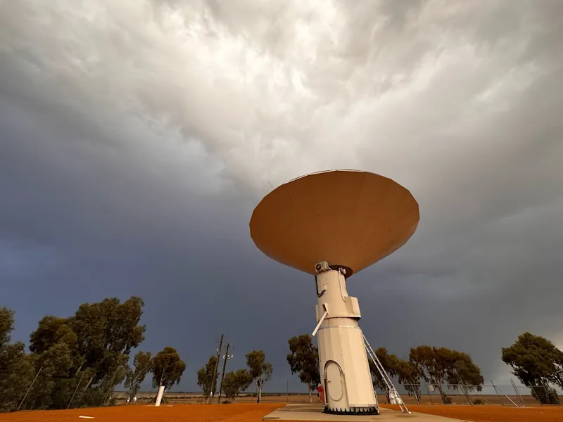
“We need to use an external frame of reference when making measurements of the Earth’s position, tilt and speed of rotation, and that these supermassive black holes are our best indicator as they don’t really move.” These measurements, called Earth Orientation Parameters, are used by Global Navigation Satellite System (GNSS) satellites to help geodesists understand the location-based relationship between the Earth’s position in space and the GNSS satellites that are in orbit. Geoscience Australia, AuScope and The University of Tasmania work together to operate three separate VLBI stations at geodetic observatories across Australia. These observatories are located around the country at Yarragadee, Western Australia; Katherine, Northern Territory; and Hobart, Tasmania.
VLBI is a fundamental geodetic observation method that observes and records measurements of the Earth’s position, tilt and speed of rotation. It is the only method that does this, underlining its importance to the toolkit of geodetic techniques. It is also the only method that measures the difference between time measured by atomic clocks onboard satellites, and mean solar time, which is important for providing synchronised time. By using a network of radio telescopes from around the world, VLBI observes the time it takes for signals emitted from the plasma surrounding nearby supermassive black holes to reach different radio telescopes that are in different locations. This time difference is then used to calculate the distance between these telescopes and determine how they have moved since their last reading, informing geodesists of the Earth’s measurements at that point in time.
Together, Geoscience Australia and the University of Tasmania operate the Australian VLBI Correlation Centre at the National Computational Infrastructure at the Australian National University. Staff at the centre collaborate with partners from the International Association of Geodesy to convert VLBI data into the information needed by GNSS operators. Currently, for global VLBI experiments, Australia is required to freight hard drives storing between 10 and 100 terabytes of raw VLBI data from geodetic observatories in remote parts of Australia to data centres in Washington, USA or Bonn, Germany. This current method means one 24-hr session of VLBI observation data needs at least 14 days of lead time until the results are released. This significant delay is viewed as a bottleneck for VLBI correlation and means Australia is not as efficient as other global centres. The impact of this is that geodesists are not able to monitor changes in the Earth as effectively, limiting the improvement of the resilience and accuracy of PNT services.
“The time difference information provided by VLBI should be delivered to the GNSS operation centres as soon as possible to help monitor and improve the orbits of their satellites … Not only that, but all space agencies also need VLBI to track orbits of all lunar and deep space missions, and numerous military applications require this information for their operations … Any delay with the VLBI information will affect satellite orbit predictions, causing a loss of precision to the navigation data that is distributed to PNT customers, including farmers, financial institutions, and weather observations.” Having an improved processing capability here in Australia is vital, as a loss of GNSS services would greatly impact the navigation, tracking and precision timing needed to allow these applications to work. Not only that, but a global loss of GNSS services could cause both the UK and US economies to lose approximately US$1 billion per day.