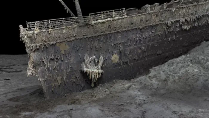
The RMS Titanic sank to the bottom of the North Atlantic in 1912, but the fate of the ship and its passengers has fascinated the popular imagination for more than a century. Now we have the first full-size 3D digital scan of the complete wreckage—a "digital twin" that captures Titanic in unprecedented detail. Magellan Ltd, a deep-sea mapping company, and Atlantic Productions conducted the scans over a six-week expedition last summer. The joint mission by Magellan and Atlantic Productions deployed two submersibles nicknamed Romeo and Juliet to map every millimeter of the wreck, including the debris field spanning some three miles. The result was a whopping 16 terabytes of data, along with over 715,000 still images and 4K video footage. That raw data was then processed to create the 3D digital twin. The resolution is so good, one can make out part of the serial number on one of the propellers. "This model is the first one based on a pure data cloud, that stitches all that imagery together with data points created by a digital scan, and with the help from a little artificial intelligence, we are seeing the first unbiased view of the wreck," historian and Titanic expert Parks Stephenson told BBC News.